Download

1 / 24
240 likes | 260 Vues
This study investigates the convection patterns in extra-tropical cyclones using GFDL AM4 model. It analyzes cloud fraction, precipitation, temperature tendencies, and cloud distribution.

E N D
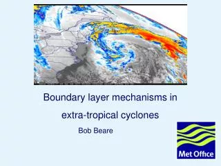
Diagnosing Convection in Extra-Tropical Cyclones in GFDL AM4 Leo Donner GFDL/NOAA, Princeton University Catherine Naud GISS/NASA, Columbia University James F. Booth City University of New York Charles Seman, Ming Zhao, Huan Gou, Yi Ming GFDL/NOAA, Princeton University Paracon, UK Met Office, 19 July 2019
Total Cloud Fraction 5-year mean total cloud cover for (a) MODIS, (b) devAM4-2PM and (c) devAM4-MPM over the southern hemisphere midlatitudes 2008-2012, all months
Figure 2: 5-year mean cloud radiative effect (CRE) for (a) CERES shortwave (SW) and (b) CERES longwave (LW), (c) devAM4-2PM SW and (d) devAM4-2PM LW, and (e) devAM4-MPM SW and (f) devAM4-MP LW over the southern hemisphere midlatitudes 2008-2012, all months. Difference between devAM4-MPM and devAM4-2PM (g) SW CRE and (h) LW CRE
Total Cloud Fraction Figure 3: Cyclone-centered composites of (a,b,c) total cloud cover, (d,e,f) PW and (g,h,i) 500 hPa vertical velocities from (a) MODIS, (d, g) MERRA-2, (b, e, h) 2PM and (c, f, i) MPM, for SH cyclones in November-March Precipitable Water 500 hPa Vertical (pressure) Velocity
Cloud Fraction Figure 4: Difference in cyclone-centered composites of cloud cover (a-b), PW (c-d) and 500 hPa vertical velocities (e-f) between (a, c, e) 2PM and (b, d, f) MPM and MODIS/MERRA2, for SH cyclones in November-March Precipitable Water 500 hPa Vertical (pressure) Velocity
Precipitation Figure 9: Cold front centered composite of (a) mean precipitation for 2PM (solid) and MPM (dashed) for total (black), convective (red) and large-scale (blue) precipitation and difference between MPM and 2PM in (b) mean precipitation, (c) frequency of precipitation and (d) precipitation rate when precipitating . The vertical dashed line indicates the location of the surface front: the post-cold frontal or cold side of the front is to the left of this line, while the pre-cold frontal or warm side of the front is to the right. These are southern hemisphere cold fronts during November-March
Cloud Frequency of Occurrence/Cloud Fraction Figure 5: Cold front centered composites of vertical cloud distribution from (a) CloudSat-CALIPSO averaged over 2006-2016, (b) as modeled with devAM4 2PM and (c) as modeled with devAM4-MPM. The vertical dashed line indicates the location of the surface front: the post-cold frontal or cold side of the front is to the left of this line, while the pre-cold frontal or warm side of the front is to the right. These are southern hemisphere cold fronts during November-March
Convective Temperature Tendencies Figure 7: Cold front centered composites of temperature tendencies for convection from (a) 2PM, (b) MPM and (c) the difference between MPM and 2PM. The vertical dashed line indicates the location of the surface front: the post-cold frontal or cold side of the front is to the left of this line, while the pre-cold frontal or warm side of the front is to the right. These are southern hemisphere cold fronts during November-March
Distribution of Maximum Heights of Convective Columns Figure 8: Cold front transect vertical distribution of the maximum height of the convective column in (a) 2PM, (b) MPM and (c) difference in height between MPM and 2PM. The vertical dashed line indicates the location of the surface front: the post-cold frontal or cold side of the front is to the left of this line, while the pre-cold frontal or warm side of the front is to the right. These are southern hemisphere cold fronts during November-March
Key Differences in Extra-tropical Cyclone Cloudiness, MPM vs. 2PM
Most of the cloud changes are stratiform, not convective. Convective detrainment builds stratiform clouds. Changes in clouds and RH are broadly consistent in the warm sector but not the cold sector. MPM and 2PM have been separately tuned to optimize TOA radiation, cloud radiative effects, aerosol-cloud interactions, precipitation…
Without re-tuning, the convective clouds, stratiform clouds, and RH change consistently between MPM and 2PM. With MPM, more high clouds with increased RH in the warm sector; mostly reduced low clouds in all sectors.
Tuning differences between MPM and 2PM produce large increases in low clouds in all sectors and explain the discrepancy between RH and cloud changes there. MPM tunings favor stratiform clouds by requiring larger drop sizes for precipitation and using slower ice fall speeds and smaller stratiform erosion rates.
Multi- vs two- plume: MPM tuning parameters Multi- vs two- plume: 2PM tuning parameters Convective cloud cover differenceRH difference Convective cloud cover differenceRH difference Humidity tendencies for convection Humidity tendencies for convection Tnqc difference Tnqc difference - MPM tendencies larger than 2PM tendencies below 2 km, but lower above - However, at front location, tuning matters: with 2PM-tuning, MPM has lower tendencies than 2PM compared to when MPM-tuning is applied
Multi- vs two- plume: MPM tuning parameters Multi- vs two- plume: 2PM tuning parameters Convective cloud cover differenceRH difference Convective cloud cover differenceRH difference Temperature tendencies for convection Temperature tendencies for convection Tntc difference Tntc difference Above 10 km: regardless of tuning, MPM cloud, rh and tendency greater than 2PM Below 10km: with MPM-tuning, MPM-2PM convective cloud cover and temperature tendencies in agreement But not with 2PM-tuning: MPM < 2PM convective cloud cover & RH below 5 km but in PCF temperature tendency larger
Specific humidity tendencies Impact of tuning on MPM MPM-tuning tends to suppress tendencies above 2 km but enhance below 2km for both models However, magnitude of impact differs between models Impact of tuning on 2PM
Temperature tendencies MPM-tuning: works against MPM convection? Impact of tuning on MPM But MPM-tuning works with 2PM convection above 2 km at the front Impact of tuning on 2PM
Figure 6: Cold-front centered composites of the 2PM (a) large-scale and (b) convective cloud cover, and (c) RH, and difference in large-scale cloud cover, convective cloud cover and RH between: MPM and 2PM (d, e, f); MPM and 2PM (MPM Tune) (g, h, i); 2PM (MPM Tune) and 2PM (j, k, l); MPM and MPM (2PM Tune) (m, n, o); MPM (2PM Tune) and 2PM in (p, q, r). The vertical dashed line indicates the location of the surface front: the post-cold frontal or cold side of the front is to the left of this line, while the pre-cold frontal or warm side of the front is to the right. These are southern hemisphere cold fronts during November-March.