Large River Flood Pulse
Large River Flood Pulse. Where Are We?. Ponchartrain. Atchafalaya. N. Barataria. Terrebonne. Habitat Types of the Barataria-Terrebonne Basins. The Floodplain Extends to the Coast. All flowing Louisiana waterways eventually drain to the Gulf of Mexico
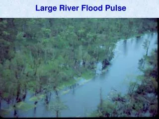

Large River Flood Pulse
E N D
Presentation Transcript
Where Are We? Ponchartrain Atchafalaya N Barataria Terrebonne
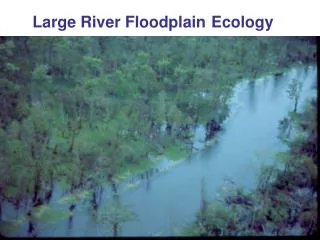
The Floodplain Extends to the Coast • All flowing Louisiana waterways eventually drain to the Gulf of Mexico • How much are energy and nutrients transferred throughout the estuary? • Is the coast is ultimately supported by floodplain ecosystem processes
Estuary Continuum? How Connected are the Swamps to the Coast?
Estuaries Swamps and marshes Tropical rain forest Temperate forest Northern coniferous forest (taiga) Savanna Agricultural land Woodland and shrubland Temperate grassland Lakes and streams Continental shelf Open ocean Tundra (arctic and alpine) Desert scrub Extreme desert 800 1,600 2,400 3,200 4,000 4,800 5,600 6,400 7,200 8,000 8,800 9,600 Average net primary productivity (kcal/m2/yr) Net Primary Production (measure of available energy and nutrients) (Miller, G.T. 2002. Living in the Environment: Principles, Connections, and Solutions)
1 1 1 1 2 2 1 2 3 Stream Order – Strahler Method Stream Order Used to classify a stream in relation to tributaries, drainage area, total length, and age of water. 1 1 = 2 1 2 = 2 2 2 = 3 1 3 = 3 2 3 = 3 3 3 = 4 Mississippi River is classified as a 10th or 12th order stream. Headwater stream classification matters
Rivers and Streams • Generally represent the excess of precipitation on land areas over evaporation from them. • Precipitation that falls is either evaporated, transpirated, enters the ground water supply, or flows down rivers • Flow is down-hill and varies seasonally • Related to rainfall and ice/snow melt • Beginning of a river = the source and the end of a river = the mouth • Discharge - volume of water passing a given point during a period of time • Channel Width X Depth X Velocity
Rivers and Streams • Materials are transported by running water in three principal states • Dissolved matter • Suspended solids • Bed load • Allochthonous – organic material brought in from outside the system • Autochthounous – organic material produced within the system (primary production)
Maringouin: 6,000 – 7,000 years ago Teche: 5,700 – 3,900 years ago St. Bernard Delta: 4,600 – 1,800 years ago Lafourche Delta: 3,400 - 400
Construction of levees along the Mississippi River and many of its tributaries has severed the river from over 90% of its floodplain, denying fish and other aquatic species access to millions of acres of foraging, spawning and nursery habitat. Miss. Dept. of Archives and History Miss. Dept. of Archives and History http://www.lmrcc.org/ARMP%20folio.pdf
= Average Stage = 2005 Stage The Flood Pulse 1959-2005 Atchafalaya River Stage at Butte La Rose USACE Gage ID = 03120
April February December September
April June August September
I II III IV V VI Floodplain Upland Transition Active Floodplain Aquatic Ecosystem Terrestrial Or Upland Ecosystem Bottomland Hardwood Ecosystem Floodplain System Floodplain Zones From Larson et al. 1981; Hall and Lambou 1990
Atchafalaya River Basin Distributary – A smaller channel that takes water away from the main stem river. Flow Mississippi River (Main Stem) Atchafalaya River (Distributary)
ARB Cross Section Protection Levees Natural Levees Floodplain Floodplain Atchafalaya River Back Water Area Back Water Area
Floodplain Deer Lake Billy Littles Lake
Staff Gage Water Level Floodplain Bank Full Level = 66 ± 9.5 cm AR = 218 cm (7.15 ft) Lake
Three General Types of Water • Brown • High flow, lots of sediment, fairly high oxygen levels, riverine • Green • Low flow, stratification, very high surface oxygen levels, highly productive, lacustrine • Black • Low flow, very low surface oxygen levels, not productive, swamp
Backwater Interior Lakes Mainstem December June August
What is Hypoxia • Dissolved Oxygen less than 2.0 mg/L • Normoxic = DO > 2.0 mg/L • Generally, most fish can not tolerate hypoxic conditions for long periods. • Gar, bowfin (choupique), bullheads can
When and Where Is Hypoxia? • Generally found during high water times when temperatures are warm. • Backwater areas (away from the mainstem river). • Low flow
Oxygen Level Controls Photosynthesis produces oxygen: Solar Energy + CO2 + H20 C6H12O6 + O2 Respiration consumes oxygen: C6H12O6 + O2 CO2 + H20 + chemical energy(ATP)
Aquatic/Terrestrial Transition Zone (ATTZ) • Alternates between aquatic and terrestrial habitats (active floodplain). • Important for fish feeding and reproduction. • Facilitates transfer of energy and nutrients between aquatic and terrestrial habitats.
Terrestrial Vegetation Growth During Low Water Nutrients Released During High Water
= Happy Cajuns!! Simply put: More Nutrients = More Plants = More Animals Inundation of the floodplain is the mechanism of energy and nutrient transfer from terrestrial vegetation to the aquatic community.
Eventually the swamp drains and backwater areas become very productive.
8 9 7 6
How Do ‘Unproductive’ Areas Support Living Populations? • Detritus-Based Production • Decomposers (e.g., bacteria) transfer energy stored in old organic matter to consumers • Insects, crawfish • Low-oxygen tolerant organisms • Gar, bowfin (choupique), bullheads
Energy flow through an aquatic ecosystem. From Cole 1988, Waveland Press
Detritus based energy flow through an aquatic ecosystem. From Cole 1988, Waveland Press
What If There is no Flood Pulse? • Barataria-Terrebonne National Estuary has been cut-off from the Mississippi River • Hydrology is strictly related to local precipitation • What are the possible implications in light of the Flood Pulse Concept?
No More Flood Pulse Ponchartrain Atchafalaya Barataria Terrebonne