Download
1 / 18
180 likes | 328 Vues
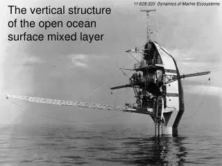
Seasonal evolution of the surface mixed layer. Meri Korhonen. Deployed by e.g. WHOI from 2004 onwards Polar Ocean Profiling System (POPS) Real-time monitoring of the water column 2 to 4 profiles per day Operates between 7-760 m Vertical resolution <1 m (0.25 m?)

E N D
Seasonal evolution of the surface mixed layer Meri Korhonen
Deployed by e.g. WHOI from 2004 onwards • Polar Ocean Profiling System (POPS) • Real-time monitoring of the water column • 2 to 4 profiles per day • Operates between 7-760 m • Vertical resolution <1 m (0.25 m?) • Horizontal resolution <2.5 km (compare to 40 km of CTD sections)
Year-round observations of temperature and salinity (sometimes also oxygen) make ITPs Perfect for studying seasonal changes! Also suitable for studying small scale features and processes such as eddies.
Data coverage is highest in the Canada Basin, where the buoys circulate in the Beaufort Gyre Transpolar Drift exports ice and ITPs out of the Eurasian Basin much faster.
Winter Mixed Layer WML depth • Cooling begins in mid/late September • Ice formation increases surface salinity, which triggers haline convection • In the strongly stratified Canada Basin convection depth is ~30…40 m • In the more weakly stratified Nansen Basin convection can reach 120 m • Haline convection homogenises temperature and salinity down to the convection depth; hence the name mixed layer
Temperature decrease Salinity increase
Definitions of surface mixed layer • Because a sharp pycnocline is located below the homogenous surface layer, mixed layer can be defined with the depth where the change in density/temperature/ salinity or their vertical gradient first exceeds a prescribed threshold value. • Brunt-Väisälä frequency can also be used as a stability indicator • More complex algorithms (e.g. Holte and Talley, 2009) • For winter mixed layer in the Arctic Ocean the simple temperature gradient threshold method was found to best represent the depth of winter convection • Depending on year and location of the ITP, the threshold was adjusted between 0.005 and 0.02 °C/m
Observed changes between 1975 and 2007 • Increase in summer temperature of the mixed layer • Increase in temperature of the Bering Sea Summer Water/ Alaskan Coastal Water • Pronounced near surface temperature maximum • Decrease in surface salinity • Increased stability (stratification)
Case study: winter mixed layer from ITP10 • Threshold of 0.005 °C/m is used to define the winter mixed layer • Depth of winter convection ~35 m (generally 20 to 45 m) • Salinity ~30 ppt • Temperature ~ -1.65 °C
Summer halocline Summer Mixed Layer NSTM • Warming of surface waters begins in mid-June • Late summer is characterised by a shallow, <12 m, mechanically mixed surface layer Base of WML Tmin Sub-surface temperature minimum Tminfound in late summer/ early autumn can be used to find the depth of previous winter convection. Temperature and salinity at this depth can be used to approximate the properties of the winter mixed layer.
Temperature increase Salinity decrease
Summer observations: temperature minimum • Criteria for Tmin : p>30 dbar and S<31 • Depth of temperature minimum ~55 m (generally 30 – 55 m) • Temperature ~ -1.6 °C • Salinity ~30.5 ppt
Comparison: WML and Tmin properties Deepening by 5-20 m compared to depth of winter convection is likely caused by Ekman convergence Warming by ~0.2 degrees Salinification by ~1 ppt
Separating seasonal ice melt from permanent freshwater content in the Polar (Winter) Mixed Layer • Temperature minimum from the summer profile is used to detect the depth of previous winter convection • Salinity at this depth is assumed to equal the salinity of the homogenised mixed layer during winter • Thus all salinities lower than the salinity at the temperature minimum derive directly from ice melt
Seasonal ice melt estimatesfrom CTD casts in late summer / early autumn • ~2 m in the Southern Canada Basin (Beaufort Sea) • ~0.5 m in the Nansen Basin • Results compare well with potential ice melt induced by atmospheric heat fluxes elsewhere except in the Nansen Basin
Outlook • Winter Mixed Layer vs Tmin properties in the Eurasian Basin • Diffusion coefficient for salinity • Chemical oceanography: nutrients and dissolved argon