Download
1 / 25
250 likes | 408 Vues
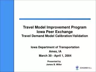
MTMUG Presentation. Iowa Statewide Travel Demand Model A Status Report. Paul Hershkowitz Wilbur Smith Associates Dane Ismart The Louis Berger Group Mary Lupa Wilbur Smith Associates Phil Mescher Iowa DOT, Office of Systems Planning February 20, 2008 .

E N D
MTMUG Presentation Iowa Statewide Travel Demand Model A Status Report Paul Hershkowitz Wilbur Smith Associates Dane Ismart The Louis Berger Group Mary Lupa Wilbur Smith Associates Phil Mescher Iowa DOT, Office of Systems Planning February 20, 2008
Purpose of Today’s Presentation • Review the two phases of the Iowa STM • Discuss the key purposes of the Iowa STM • Outline the findings of the architecture step • Provide a status report on key model elements (see next slide) • Obtain your feedback
Iowa STM Model Elements • Traffic Analysis Zones (Internal) geography • Buffer Zones (External) geography • Network • Socioeconomic Forecasts • Trucks
Phases I and II Work Flow • Phase I developed the • Iowa Statewide Model Framework for Phase II • Think “blueprint” • Phase II is building the Iowa Statewide Model
Phase II WorkFlow • Two parts of Phase II: • Part 1 – Construction of Iowa STM using the Architecture “blueprint” (began October 15, 2007) • Part 2 – Commodity Flow Model Component (TBD)
Iowa DOT’s Actions supported the STM • Assembled a team of internal and external transportation specialists • Established a technical steering team – the EPSC – Executive Planning Steering Committee, which includes MPO representatives • Set up a cooperative hands-on workshop program for TAZ, network, and centroid tasks with both DOT and consultant members • Launched the effort formally in October 2007
Iowa STM Model Elements Approach & Status • Traffic Analysis Zones (Internal) geography • Buffer Zones (External) geography • Network • Socioeconomic Forecasts • Trucks
A “telescoping” size approach to the zone systems is being used. Zone System Scales
Traffic Analysis Zones (Internal) After TAZ Aggregation
Network congruence is desired with the Iowa Road database - GIMS (Geographic Information Management System) The Iowa DOT is reviewing the GIMS for connectivity, and assignability prior to formal network development There is an opportunity to interface with the Iowa DOT LRS road file product under development in 2008. Much work ahead of us. Iowa Highway Network(Internal)
Begin with National Highway Network or FAF2.2 Highway network Adjust to the buffer TAZ system with telescoping scale Collect traffic counts at Iowa portals, both land and bridges. Highway Network(External)
Population - from 2000 Census with growth trends from REMI or Woods & Poole Employment - from Iowa Workforce Development with growth trends from REMI or Woods & Poole MPOs will assist the Iowa DOT on obtaining congruency of forecast totals in their areas TAZs within Iowa will be scaled towards the micro size (small). Data SourcesInternal TAZ
Population - from 2000 Census with growth trends from Woods & Poole Employment - from Woods and Poole with growth trends from Woods & Poole MPOs will provide SE data for the portions of MPOs outside of Iowa. TAZs outside Iowa will be scaled larger than those within the state. Data SourcesExternal TAZ
REMI in Iowa • Used statewide since 1991 • Custom developed by REMI on fixed Iowa districts • Contains population & total employment • 1990 to 2050 by one-year increments • Run by the Office of Program Management in • the Planning, Programming and Modal Division • Used by Iowa DOT for two highway corridor studies: • US 63 from Waterloo to the Twin Cities • US 20 from Fort Dodge to Sioux City
Current REMI Districts • Five Des Moines counties • individually (yellow) • Eight MPO counties as a • unit (green) • Remainder of Iowa (gray)
SE Challenge • REMI estimates are locally derived providing the best • overall fit to Iowa conditions • How to solve the “eight in one” city/county problem? • Sioux City, Council Bluffs, Ames, Waterloo, Cedar Rapids, • Iowa City, Dubuque and Davenport are forecast as a group.
Iowa Truck Flows Estimated Iowa Daily Truck Traffic Source: FHWA Iowa Total Domestic Truck Flows Source: FHWA
Iowa DOT wanted the most recent national and state data The new Freight Analysis Framework (FAF2) freight data will be used for national truck flow information to/from and through Iowa. Trucks
Comments and Questions?