GPS with Farm Site Mate
260 likes | 933 Vues
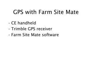
GPS with Farm Site Mate. CE handheld Trimble GPS receiver Farm Site Mate software. GPS in the field. GPS antenna. Paper Map with targets. GPS receiver and batteries. Sample Location.

GPS with Farm Site Mate
E N D
Presentation Transcript
GPS with Farm Site Mate • CE handheld • Trimble GPS receiver • Farm Site Mate software
GPS in the field. GPS antenna Paper Map with targets GPS receiver and batteries Sample Location Matt Evans of Abe591a and Aaron Pierce of the Biology Department; mapping the Purdue University Ross Reserve. Windows CE handheld computer
Trimble AgGPS 132 Turn on GPS by attaching batteries. Nothing else is needed.
CASIO pocketPC Attach the cable to the bottom of the Casio. Then turn it on by depressing the small “power” button on the left side.
Farm SiteMate Click under the windows icon to start SiteMate. Click once on the splash screen. Then click “open scouting” and say “new”
Scouting Log Create a new log file. This will be the record of your session today Enter your initials as a file name. Brief, no spaces; Select “Blank template” and click the small round “OK” button.
Add an attribute. The new scouting log file opens and asks if you want to add an attribute. You do. It asks if the attribute will be text or numerical. I suggest text but its not really important today. Click “OK” again to return to the map view.
Taking points or lines Select boundry or points. You will use both at some point. Then click on “go” to begin.
Our aerial photos were taken when the building next door was under construction. We need to find the area now planted in grass in front of the new building. North
Red line is Nick following the sidewalk. The big jump towards AGAD never really happened. That is caused by bounce from nearby buildings and trees. This software gives you no warning. grass New building Use points for the 3 hydrants and the callbox and boundary for the grass area.
Here Nick is walking around the fireplug, his path is drawn in blue. At the same time Monica, using another GPS is standing next to the fireplug (drawn as purple dot.) Notice the discrepancy. Nick’s blue line should circle the purple dot. Why are the units not agreeing? Fire Plug
These represent locations collected by a differential GPS antenna on our roof. In 24 hours the points scatter around a 4.0 meter circle. In Tippecanoe county a second of a degree is about 30 meters.
After mapping, to download… • When you are done, click “file=>export log” and select shapefile output. This translates your data into 2 shapefiles. • Exit SiteMate from File=>exit. • Plug the pocketPC into a cradle, and when the ActiveSynch window appears, use explore to move your shapefiles.
Plugged in If you get this window, click “no” to partnership.
ActiveSynch When ActiveSynch appears, click on explore to see your stored files. Look in Personal.
Assignment: Rectify • Download themes • Upload GPS and project (State Plane IN west feet) • Rectify image to the state plane layers • Create map and index as usual.
This photo has been scanned, with no coordinate system.
Locate the grass circle And the fireplugs