Transpo 2012
210 likes | 344 Vues
This paper explores the integration of Intelligent Transportation Systems (ITS) data with traffic analysis, simulation modeling, data mining, and other techniques to evaluate transportation system performance both in real-time and through off-line assessments. Key topics discussed include decision support systems, predictive travel time, data fusion from various sources, and the measurement of performance attributes such as mobility, reliability, safety, and environmental impacts. By leveraging ITS data, we aim to improve operational efficiency and support informed decision-making in transportation planning.

Transpo 2012
E N D
Presentation Transcript
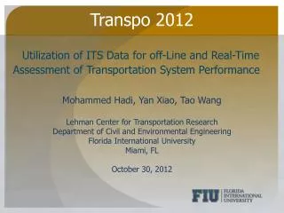
Transpo 2012 Utilization of ITS Data for off-Line and Real-Time Assessment of Transportation System Performance Mohammed Hadi, Yan Xiao, Tao Wang Lehman Center for Transportation Research Department of Civil and Environmental Engineering Florida International University Miami, FL October 30, 2012
Background ITS data can be used in combination with traffic analysis, simulation modeling, data fusion/data mining and optimization for planning and operation Real-time and Off-line Performance measurements of transportation system Transportation system modeling Benefits and costs assessment of ITS applications Associations of attributes utilizing data mining and visualization methods Decision support systems Predictive travel time and impacts
ITSDCAP Components ITS Data Capture and Analysis of Performance (ITSDCAP) Capture and fusion of data from multiple sources Data mining Performance measurements and visualization ITS evaluation/benefit-cost analysis Modeling and analysis support Decision support systems to be incorporated
Data from Multiple Sources SunGuide data (TSS, TVT data, incident, DMS, etc.) Inrix Statistics office data Central data warehouse Weather data Managed lane dynamic congestion pricing rates Work zones Crash data/CARS 511 data FHP data
Data Grouping Data grouping allow the extraction and archiving of data based on different conditions Time-of-day, working days/holidays, day of the week Specific segments Similarity in traffic patterns Incidents Weather conditions Work zones
Selection based on Traffic Patterns Progress Meeting
Performance Measurements Mobility measures Reliability measures Environmental measures Safety measures
Mobility and Reliability Mobility measures: speed, density, queue length/location, travel time, delay, vehicle-mile traveled (VMT), and vehicle-hour traveled (VHT) Alternative methods are incorporated to calculate different measures based on point detector data and INRIX data. AVI data being incorporated and studied Reliability measures: standard deviation/variance, Buffer Index, Failure/On-time performance, Planning Time Index based on the 95th or 80th percentile, Skew Statistics, and Misery Index New measures will potentially be incorporated At least one year of data
Safety and Environmental Impacts Safety: Estimate a number of safety measures including crash frequency by crash type, crash frequency by severity, total crash frequency, crash rate by type, crash rate by severity, and total crash rate Energy and Emission: Currently based on Mobile 6. When emission rates based on MOVES are calculated for Florida they will be incorporated
Travel Time Comparison I-95 NB from South of NW 62nd St. to Golden Glades Interchange (Exit 12A) 9/1/2011 9/22/2011
IRISDS Web-based real-time information sharing and decision support system Integrated Regional Information Sharing and Decision Support system (IRISDS) Proof of concept of two main components Information sharing (SunGuide C2C, transit AVL, INRIX) Decision support systems
Decision Support System Incident impacts, impact index, and dashboard Real-time simulation of incidents Utilizing bus travel time to estimate corridor travel time Estimate diversion during incidents and potential impacts on alternative routes
Prediction of Incident Impacts The prediction of impacts based on measured incident attributes include: Predict lane blockage duration Predict potential for secondary incidents Predict delays and queue lengths Assigns a severity Index to each incident based on the impacts and user assessment of impact weights