Download
1 / 17
380 likes | 1.2k Vues
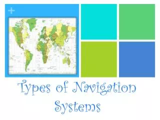
NAVIGATION TRAINING Section 1- Types of Navigation. Table of Contents. • Section 1 Types of Navigation • Section 2 Terrestial Coordinates • Section 3 Charts • Section 4 Compass • Section 5 Nautical Publications • Section 6 Navigational Aids • Section 7 Buoyage

E N D
Table of Contents • • Section 1 Types of Navigation • • Section 2 Terrestial Coordinates • • Section 3 Charts • • Section 4 Compass • • Section 5 Nautical Publications • • Section 6 Navigational Aids • • Section 7 Buoyage • • Section 8 Position Lines and Fixes • • Section 9 Tides • • Section 10 Currents • • Section 11 Weather
Types of Navigation Navigation The process of safely and efficiently directing the movements of a vessel from one place to another.
Types of Navigation 1. Piloting (Coastal) Navigation 2. Dead Reckoning 3. Celestial Navigation 4. Radio Navigation 5. Electronic Navigation
Types of Navigation • Piloting (Coastal) Navigation • This is the process by which the ship’s position is found usually at a set interval, by taking 3 compass bearings of fixed, prominent and identifiable charted objects. • These bearings, when corrected for deviation and variation are plotted on the chart, and the vessel’s position at that time is found. • A sextant can be used on coastal navigation as well.
Types of Navigation Piloting (Coastal) Navigation
Types of Navigation 2. Dead Reckoning This type of navigation is used, working from a last known position fix. The vessel’s steady course and speed over a known period of time is used to calculate the True Course and Distance traveled over that period of time. This True Course and Distance is plotted from the last known position fix, and a Dead Reckoning Position obtained.
Types of Navigation Dead Reckoning
Types of Navigation 3. Celestial Navigation This form of navigation is using a sextant to measure the vertical angle of sun, moon, planets or stars above the horizon, combined with exact GMT time taken from a chronometer. A calculation based on a dead reckoning position, will yield the distance towards or away the celestial object from that position, and a single position line is found.
Types of Navigation Celestial Navigation (Continued) If a number of stars altitudes are taken at around the same time, normally at twilight, a fix can be made. Similarly if a planet and the sun are about 60 degrees or more in azimuth, can be measured at about the same time an reasonably accurate fix can be obtained.
Types of Navigation Celestial Navigation (Continued) Otherwise the most common method is to use a running fix with two sights of the sun taken over about three hours, of which one may be when the sun is due north or south.
Types of Navigation 4. Radio Navigation Radio Navigation is generally defined as using a direction finder to take radio bearings of known Marine Radio Beacons ashore, and plotting those position lines on a chart. Generally used when well off shore.
Types of Navigation • 5. Electronic Navigation • This form of navigation is any navigation undertaken using electronic navigational aids. • These include: • LORAN C • Radar • Transit Satellite Navigator • Global Positioning System
Types of Navigation Electronic Navigation (Continued) It is important that the navigator understands the limitations and error that these systems are prone to. Only then can a true appreciation of the fix accuracy be made, and the accuracy of the position of the vessel be made.
Types of Navigation • The primary systems Royal Canadian Marine Search and Rescue will be concerned with are: • 1. Pilotage (Coastal) Navigation • 2. Electronic Navigation