Enhancing Coastal Fisheries Management in the Pacific Islands through Advanced GIS Training
150 likes | 258 Vues
The SciCOFish project, funded by the European Union, aims to support the management of coastal and oceanic fisheries in the Pacific Islands. Utilizing Quantum GIS (QGIS) 1.8, fisheries officers are trained to effectively use GIS for planning field surveys, establishing sampling stations, and visualizing data with thematic maps. The training addresses common GIS challenges such as on-the-fly reprojection and geometry errors, equipping participants with practical solutions. This initiative enhances scientific capabilities for better fisheries management in the region.

Enhancing Coastal Fisheries Management in the Pacific Islands through Advanced GIS Training
E N D
Presentation Transcript
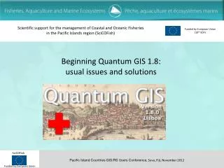
Scientific support for the management of Coastal and Oceanic Fisheries in the Pacific Islands region (SciCOFish) Funded by European Union (10th EDF) Beginning Quantum GIS 1.8: usual issues and solutions
GIS use in coastalfisheries • GIS is often used by coastal fisheries officers to • plan field surveys and determine coordinates of new sample stations using satellite imagery and additional vector layers (MPA boundaries, habitat maps etc) • display sampling stations / habitat maps by category (thematic maps) • display data associated with sampling stations (bubble maps and pie charts) • determine area of delineated zones (MPA area, habitat area etc...) • measure distances along a path
GIS use in coastalfisheries • The GIS data generally consists in • GeoTIFF and ECW satellite images • a mixture of legacy shapefile and MapInfo vector layers • CSV or tab delimited text files • GPX files (waypoints) • QGIS can handle all these kinds of layers and is sufficient for most fisheries users. • QGIS complements nicely commercial software whose installation is often restricted to a few machines because of licence costs.
QGIS for coastalfisheries • QGIS 1.7 & 1.8 were used to train coastal fisheries officers in 2012 • Vanuatu (4 days) • Marshall Is (2 days) • Samoa (2 days) • Timor-Leste (introduction to GIS) • SPC coastal fisheries scientists (1 day) • Some trainees had some previous experience on MapInfo and/or ArcGIS while others were totally new to GIS • We observed that most QGIS beginners are facing the same blocking issues (i.e. issues for which they don’t find themselves workarounds)
On-the-flyreprojection • Issue: by default ‘on the fly’ reprojection is disabled. • Most projects include a mix of UTM rasters (satellite images) and Long Lat Geographic Coordinates. As by default the reprojection is not enabled, only the raster or the vector layers is displayed. • On the fly reprojection can easily be enabled by default for all new projects from Settings/Options/CRS • (and restarting QGIS)
On-the-flyreprojection Issue: error when displaying a raster that overlaps date line
$area unit is the layer CRS unit • Issue: for a longlat GCS layer, polygon areas are calculated in square degrees and distances in degrees. For UTM projection, the area unit is square meter and distances are in meters. • When calculating areas for polygons, it is disturbing to get areas close to zero. But that’s because the unit is square degrees for a longlat GCS layer. • The solution is to use UTM instead (the unit is meter) or to use Vector/Geometry tools/Add geometry columns to create AREA and PERIMETER fields (by default the area is calculated using ellipsoid)
Scale bar unit Issue: in the print composer, the scale bar unit comes from the project CRS. The project CRS must be set to UTM to get a scale bar in meters. In addition, it is necessary to adapt map units per bar unit and segment size to transform meters into kilometres Project CRS is UTM => Scale bar in meters 0 10’ 20’ 30’ Project CRS is Longlat GCS => Scale bar in degrees
Geometryerrors • Issue: geometry errors are easily created when digitizing a polygon and cause problems in geoprocessing tools (clipping, etc.). • Because polygons are closed by a double click in MapInfo and a right click in QGIS, former MapInfo users tend to create duplicated nodes and knots when closing the polygon (double click followed by right click) • Geometry must be checked from Vector/Geometry tools/Check geometry validity knot duplicated node
Geometryerrors Issue: geometry errors are often not visible at the default zoom level. Zooming to see the duplicated node or knot is necessary before fixing the polygon It is possible to automatically fix these errors by importing and re-exporting from a GRASS project (the snap tolerance eliminates the spurious nodes) but it doesn’t always work for large knots.
Calculatedfields Issue: when adding a calculated field in a shapefile with a field name >= 10 characters, the field name is truncated and the calculated field is not evaluated (filled with NULL value) Field names must be 10 characters long at max. Issue: by default the data type for calculated fields is whole number and precision is 0. When switching to decimal number, the user must remember to increase the precision
Size scalefield Issue: for a bubble map (Layer properties/Style/Advanced/Size scale field), the radius of the disk is proportional to the value, while in other software the value is proportional to the area of the disk (and radius proportional to square root of value) The solution is to create a calculated field which contains the sqrt(value) and use it as size scale field. (Remember, be careful to not use a field name >10 characters long...) 10 20 30 Size scale field = a*value Size scale field = b*sqrt(value)
Scaling a pie Tip: for a pie (overlay), the square root of the sum of values can be used to scale the pie, while the raw values are used to segment the pie.
Conclusion • During trainings QGIS was quickly adopted by users, whether they were former users of MapInfo/ArcGIS or not • Once explained, the projection issues were understood and UTM adopted as default projection for polygons, while longlat GCS was used for sample stations (points) • Scaling bubble maps and pies with the square root of value was applied by users as a recipe but the reason not always well understood. • Geometry errors still cause problems to users, mainly because the error message is not always explicit and users have trouble to correct the errors because they are not visible at normal zoom level.