Download
1 / 22
220 likes | 365 Vues
Space Weather Studies with EISCAT_3D: Developing the Science Case. Ian McCrea on behalf of the EISCAT_3D Project Team. EISCAT_3D Key Capabilities. Five key capabilities: Volumetric imaging ( enabled by digital beam forming ) Aperture Synthesis imaging => sub- beamwidth structures

E N D
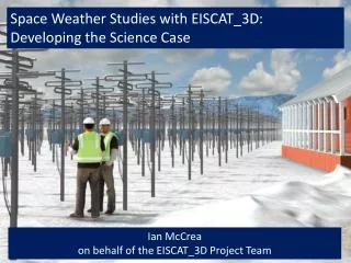
Space Weather Studies with EISCAT_3D: Developing the Science Case Ian McCrea on behalf of the EISCAT_3D Project Team
EISCAT_3D Key Capabilities Five key capabilities: Volumetric imaging (enabledby digital beam forming) Aperture Synthesis imaging => sub-beamwidth structures Multistatic configuration => 3D vector velocities Greatly improved sensitivity (e.g. 32 000 antenna elements in transmitter, 16 000 in receivers) Transmitter flexibility (e.g. coding, beam-forming) These abilities have never before been combined in a single radar!
EISCAT_3D Design Principles • Distributed phased array with multiple sites • At least one active site • Multiple receive sites, with optimised geometry • Support for co-located instruments • Highly flexible transmitter • High VHF frequencies (e.g. 233 MHz) • Narrow bandwidth on transmit • Wider bandwidth on receive • Possibly different arrays for Tx and Rx • Rx array distributed for imaging • Low-elevation capability • Capable of continuous operations • Unattended operations at remote sites • Possibility to adapt experiments in real-time • Significant data processing at central site
EISCAT_3D will be located within the auroral oval and on the equatorward edge of the polar vortex: key regions for global atmosphere-ionosphere system! Location of EISCAT_3D Statistical auroral oval (depends on UT and Kp index). Schematic figure of winter polar vortex (courtesy of M. Clilverd).
One possible site orientation 69.4 N 30.0 E 69.58 N 19.22 E 68.2 N 14.3 E Final site selection still undecided Site surveys in progress
EISCAT_3D Transmitters Centre frequency 220-250 MHz Peak output power > 2 MW -1 dB power bandwidth > 5 MHz Pulse length 0.5 to 2000 us Pulse repetition frequency 0 to 3000 Hz Arbitrary waveform generation Must be rugged and mass-producible at low cost
EISCAT_3D Antennas • The “RenkwitzYagi” • Centre frequency 235 MHz • Bandwidth 12 MHz (>20 dB) • Opening angle 40o (core array), 30o (receiver arrays) • Arbitrary polarisation • Good sidelobesupression • 7dB gain over 10% relative bandwidth • Need to be mechanically robust (e.g. due to snow loading) • Bandwidth should not be affected by icing • Mutual coupling needs to be acceptable
LOFAR HBA Test Array at Kilpisjärvi • HBA Array – summer 2011 • LBA Array – summer 2012
EISCAT_3D Signal Processing Design study did not specify a chosen system due to speed of evolution in DSP technology Preparatory phase will evaluate the use of multi-channel samplers and high performance computing for DSP and beam-forming EISCAT_3D technology can be prototyped on a range of different systems, e.g. the MST radar at Sodankyla.
EISCAT_3D Work Packages • WP1: Management and reporting • WP2: Legal and logistical issues • WP3: Science planning and user engagement • WP4: Outreach activities • WP5: Consortium building • WP6: Performance specification • WP7: Signal processing • WP8: Antenna, front end and timing • WP9: Transmitter development • WP10: Aperture synthesis imaging • WP11: Software theory & implementation • WP12: System control • WP13: Data handling & distribution • WP14: Mass-production & reliability
WP3: Science Planning and User Engagement Science Working Group (SWG) • Typically 2+5 members • Membership rotated on a yearly basis • Works to keep the Science Case up-to-date and bring new ideas from the existing and new EISCAT user groups. • Helps to compile a list of contact persons/groups for potential new EISCAT_3D user communities Science Working Group after a day’s work with the EISCAT_3D Science Case
A. Atmospheric physics and global change B. Space and plasma physics C. Solar system research D. Space weather and service applications E. Radar techniques, coding and analysis Appendix A: Table of EISCAT_3D radar performance requirements by science topics The Science Case Document:
High-Latitude Electron Density:Large-Scale Structure • Targets: • TEC structure and variability (for GPS) • Density peak and profile variations (for communications) • Wide view field for position of oval, trough etc. • Quasi-simultaneous imaging gives real-time maps • Continuous operation for effects of geomagnetic disturbance on density • Independent TEC information from multi-path Faraday rotation Image Credit: LucillaAlfonsi, INGV
High-Latitude Electron Density:Small-Scale Structure Targets: • Small scale irregularities (scintillation) • Flow/gradient regions (irregularity generation) • Large-scale imaging allows potential scintillation regions to be identified • Aperture synthesis imaging allows investigation of small structures • Continuous operation allows monitoring capability and climatology determination • Obvious synergy with satellite measurements and models Phase scintillation signatures on disturbed and active days Image Credit: LucillaAlfonsi, INGV
Electrodynamics Targets: • Real-time E-fields • Conductivity, current and heating rate maps • Relationship to irregularity and structure • Continuous monitoring provides possibility to separate solar wind, auroral, diurnal effects • Long-period data provide climaotology of electrodynamic effects • Interaction between monitoring and modelling can improve understanding of hazards e.g. GICs in northern Europe. Image Credit: LucillaAlfonsi, INGV
Modellling Observation Targets: • Comparison/validation for models • Data input/assimilation techniques • Semi-empirical models from data • Broad coverage and long-period data provide a huge resources for modelling community • Lots of interesting science from data/model comparisons in IPY • Need more engagement with the modelling community on critical parameters to measure; timing and frequency of observations Simulation Image Credit: Frederic Pitout, Toulouse
Thermosphere Targets: • Short-term thermospheric change during disturbances • Identification of long-term trends (thermosphere contraction) • Long-term data allows monitoring role • Continuous operations ensure effects of short-term disturbances are measured. • Complement to international modelling community • Combination of ion velocity and airglow measurements gives neutral density measurements via momentum equation. • Satellite tracking and ranging capabilities provide additional thermosphere moniitoring capabilities.
Space Debris • Space debris is integral part of EISCAT data (otherwise thrown away) • ESA buys EISCAT time for space debris studies • Regular monitoring allows identification of “space debris” events (e.g. Cosmos/Iridium) • Potential for individual object tracking/ranging using adaptive beams • Observation compares and drives modelling (e.g. debris cloud evolution) • Obvious synergy with thermosphere measurements Image Credit: JuhaVierinen, SGO
Solar Wind Studies • Solar wind monitoring via scintillation of radio stars • Multi-site observations yield solar wind velocity • Single site observations give irregularity content and variability • Solar wind acceleration processes • Identification of fast/slow streams • Irregularity content of solar wind • Solar wind tomography and CMEs • Solar wind magnetic structure (?) Image Credits: Steve Crothers (STFC-RAL) and Mario Bisi (Aberystwyth)
Conclusions • EISCAT_3D has clear potential as a space weather instrument • Capabilities go beyond anything available to the radar community • Realising this potential needs: • Well thought-out plan of operations • Good connection to other instrument programs • Better connection to/support for models • To do this, we need to involve space weather community at a higher level within EISCAT
In the new EISCAT Scientific Association, new members (at different commitment levels) are welcomed! • Welcome also to the 4th EISCAT_3D User meeting in Uppsala 23–25 May 2012! 1st day will be dedicated to Space Weather issues. • Science case document: • http://www.eiscat3d.se • Contact: • anita.aikio@oulu.fi • ian.mccrea@stfc.ac.uk • esa.turunen@eiscat.se Get involved!