WATERS Status Update
WATERS Status Update. www.epa.gov/waters. Available WATERS Data. National Hydrography Dataset (NHD) NHDPlus Catchments Watershed Boundary Dataset (WBD) Water Program Features indexed to the NHD:. Assessed Waters Impaired Waters Beaches Combined Sewer Overflows

WATERS Status Update
E N D
Presentation Transcript
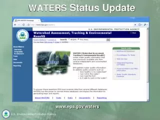
WATERS Status Update www.epa.gov/waters
Available WATERS Data • National Hydrography Dataset (NHD) • NHDPlus Catchments • Watershed Boundary Dataset (WBD) • Water Program Features indexed to the NHD: • Assessed Waters • Impaired Waters • Beaches • Combined Sewer Overflows • Clean Watersheds Needs Survey • Fish Consumption Advisories • Clean Water State Revolving Fund Projects • No Discharge Zones • Permitted Dischargers • Total Maximum Daily Loads • Water Quality Standards Additional Information: http://www.epa.gov/waters/data/prog.html http://www.epa.gov/waters/doc/auxiliary/index.html
WATERS Data Web Pages • Contains detailed information about the Reach Address Database, NHD, NHDPlus, and other supplemental tables.
WATERS Data Web Pages • Web page contains hyperlinks to Auxiliary Dataset information. • Watershed Boundary Dataset • Tiger 2008 (subset) • NHDPlus Smoothed • Regional layers • National Atlas (subset)
Available WATERS Services • Web and Database Services • Identify Service • Total Waters by State, HUC, FCODE, and Bounding Box • Name Service • Upstream/Downstream Service • Navigation Service * • Validate and Convert Lat/Long Service • Get Entities by Lat/Long, HUC, and Radius Service • Get Program Waters Entities • NHD Event Indexing Service * • NHD Point Indexing Service * * Currently database only service Additional Information: http://www.epa.gov/waters/geoservices/index.html
WATERS Services Web Page • Services web page contains high-level overview information about available services. • Indicates if service is available as web and/or database service. • Provides link to SOAP Service Endpoint and WSDL. • Provides information about underlying database location and name.
WATERS Services Web Page • Services web pages contain detailed level information about individual services. • Description of the service • Input parameters • Example call to the database service • Sample SOAP Request • UML object diagram • Output object • Sample SOAP Response
WATERS Services Web Page • Services web pages contain detailed level information about individual services. • Description of the service • Input parameters • Example call to the database service • Sample SOAP Request • UML object diagram • Output object • Sample SOAP Response
WATERS Services Web Page • Services web pages contain detailed level information about individual services. • Description of the service • Input parameters • Example call to the database service • Sample SOAP Request • UML object diagram • Output object • Sample SOAP Response
WATERS Services Web Page • Services web pages contain detailed level information about individual services. • Description of the service • Input parameters • Example call to the database service • Sample SOAP Request • UML object diagram • Output object • Sample SOAP Response
Future Direction • GIS services • Rollout ArcGIS 9.3 (9.3.1) • Enable ArcGIS based KML and WFS services • Enable ArcGIS REST interface • Configure caching for popular projections • Update RAD Download service functionality • Reorganization of available services • Reevaluation of WATERS Metadata • Other • Release Google Earth based KML files, ArcMap Template, and ArcGIS Explorer map document • Develop ArcGIS Explorer custom tasks that leverage OW Services • Migrate to Oracle11g to overcome Oracle Spatial issues
Future Direction • Continued focus on web services • Basin delineation service • Deployment of SOAP based versions of existing NHD Event Indexing Service, NHD Point Indexing Service, and Navigation Service • New lightweight HTTP gateway service endpoints • KML, JSON, GeoJSON and user provided style sheet output options • WATERS JavaScript Wrapper API • Similar to ERSI’s JavaScript API for Google Maps and Virtual Earth • Avoids cross-site browser scripting limitations when accessing services from different domains
What it means to users • Users can develop light weight mapping clients that easily consume OW services. • The example screenshot shows a light weight client making a call to the OW Navigation Service requesting navigation results 25 miles upstream of a point location.
What it means to users • Users can develop light weight mapping clients that easily consume OW services. • The example screenshot shows a light weight client making a call to the NHD Point Indexing Service. • 1) Shows the results of a snap operation. • 2) Shows the results of a raindrop operation.
What it means to users • Users can develop light weight mapping clients that easily consume OW services. • The example screenshot shows a light weight client making a call to a prototype basin delineation service that dissolves smoothed catchments into a resulting basin of interest.
What it means to users • Users can display web service results using customizable style sheets.
Demonstration • Access to framework geospatial datasets stored in the WATERS Database and to general purpose interactive service panels. • Dialog boxes providing access to tools, services, and information, such as NHD feature name query, total waters, up/downstream navigation, watershed reports, ATTAINS reports, etc. • Access to indexed water program features, with hyperlinks to additional attributes, and context sensitive analysis services, such as up/downstream navigation and watershed reports.
Future Direction • Interface • OW is currently evaluating interface options being used by EPA, other agencies and industry. • OW plans to develop a light weight interface that demonstrates available services and data sets. • Outreach • WATERS web site restructuring • Notification service (RSS, e-mail, etc) • Webinars • Presentations • Training sessions • White papers
Future Direction • Outreach (Code) • Cut & paste ready code samples that illustrate how to use OW based services. Similar to Google AJAX Playground, Virtual Earth SDK, ESRI’s JavaScript API samples.
Additional Information • Pravin Rana (OW IM PMO) • Phone: (202) 564-1909 • E-mail: rana.pravin@epa.gov • Brad Cooper • Phone: (703) 852-3586 • E-mail: bcooper@induscorp.com • Waters Support • E-mail: waters_support@epa.gov