Download
1 / 29
290 likes | 439 Vues
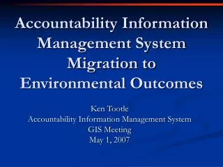
Accountability Information Management System Migration to Environmental Outcomes. Ken Tootle Accountability Information Management System GIS Meeting May 1, 2007. Activity Based cost data, Workforce & Performance Data. Resource Inventory & Assessment. Locally Led Input & Consultations.

E N D
Accountability Information Management System Migration toEnvironmental Outcomes Ken Tootle Accountability Information Management System GIS Meeting May 1, 2007
Activity Based cost data, Workforce & Performance Data Resource Inventory & Assessment Locally Led Input & Consultations Customer Service Feedback Performance Measures Annual Performance Plan National Business Plan Annual Budget State Performance Plans State Business Plans State Budget Accountability System NRCS Strategic Plan Performance Report Accountability Tools Activity Based Cost (ABC) WEBTCAS – Total Cost Accounting System) Workforce Planning (WFP) Performance Measurement Workload Management Analysis (WLMA) Performance Results System ( PRS) Oversight & Evaluation Budget Allocation Process
Outputs to Outcomes OUTCOMES • Healthy Watersheds • Clean Water • Sediment Reduced • Tons of Soil Saved • Number of Acres Treated • Number of People Served INTERMEDIATE OUTCOMES OUTPUTS
NRCS is Conservation Leader • Farm bill added new responsibilities • Budget increased by $half billion 2002-03 • Projected increase of $300 from 2003-04 • Increased expectations • Increased workload • Increased questions and need for transparency
FY 2003 Paradigm Shift • Harvest performance data • (Enter data once) • Use field office business tools • Performance and cost by program • Need vs. nice to know (actionable) • Geo Enable data so that it can easily be drilled through various GIS layers (accountability geo data viewer)
Paradigm Shift • Focus on interaction between field employee and customer • Loose integration using data warehouses • Clear linkage between outputs and outcomes
Corporate Commitment • Employee focuses on doing the work • System focuses on reporting the work • Up-front investment on new framework • Standardizing parameters • Uniform adoption of common business processes
Strategic Plan 2005-2010 • Strategic plan goals—baselines, targets, accomplishments • Environmental outcomes—productive lands and Healthy Environment (soils, water, air, plant and animal communities, adequate energy • Fiscal stewardship—value for the dollar • Contracts, obligations, activities, and plans are means—not the end.
Field Operations to Performance Outcomes Customer Contact Technical Assistance Provided Customer Relations Management, Toolkit, Protracts, PRS WebTCAS PHYSICAL EFFECT exported from CRA, EFOTG, Conservation Guide Sheets NRI-CEAP utilizes information to refine outcome models OUTPUTS (Ex. Tons of sediment Planned to be reduced) PERFORMANCE MEASURES (Ex. Reduced soil erosion on ___ acres of working lands) OUTCOMES (Ex. By 2007, reduce sedimentation to avoid $___ of on-site and off-site damages.)
E-Government Investments • Conservation Planning (Toolkit) • Field office technical guide (e-FOTG/SmarTech) • Conservation contract management (ProTracts, Lean Six Sigma Grants) • Progress reporting (PRS) • Time reporting (TCAS) • Activity Based Cost (ABC)
Resource Assessments • National Resources Inventory — provides baseline data and trends • Conservation Effects Assessment Project (CEAP) — refines impact of practices for modeling purposes
Customer contact • Client data stored in SCIMS is accessible to CRM for all customer related actions.
Plan or Contract is Developed • Practices and plans are developed in Conservation Toolkit and ProTracts
Progress Reporting • When practices are planned or completed, they are uploaded to PRS.
Impacts Determined Practices effects are harvested from Section 3 of eFOTG and impacts are calculated and reported to PRS.
Effects Data Refined • Impacts data are refined through CEAP and models are verified and enhanced.
Conditions and Trends • Baseline, conditions, and trends monitored through National Resources Inventory
I want to work on… • Conservation Operations • Conservation Programs • Contracting • Financial • Monitoring • Performance Enterprise Data Access, Analysis and Reporting web Portal - Under development
System Benefits • Improved quality and speed of planning and contract administration • Less paper work and data entry • Better estimates of workload • Better estimates of conservation effects of conservation practices and programs • Improved information for priority setting • Increased time for providing conservation technical assistance
GIS Challenges • Need consistent interpretation and use of the standard GIS layers (states develop and use them different) • Need all data Geo-enabled (currently tabular toolkit plans have no land unit or practice lat longs. • Need smaller watershed designations (move from 8 digit to 11, 12 and or 14) • Need to make the geo enabled operations source data/information easily available for various uses • Ned to make all data easily viewable through appropriate GIS layer maps • Length of time to get a state developed layer into production in FT Collins
NRCS Area & Team Boundaries Legend: Red Areas Black Teams
Oklahoma Areas & TeamsAreas in Red, Teams in BlackCounties & Service Center Boundaries are the same
Pennsylvania Service Centers & TeamsService Centers in Black & Red, Teams in RedTeams may be smaller than service center or they may be the same size Service Center 1 has 3 Teams 1 2 3 Service Center 2 has 1 Team and is aligned with Service Center 1
Recommended Location Hierarchy State Area Team County or Service Center