Download
1 / 42
420 likes | 621 Vues
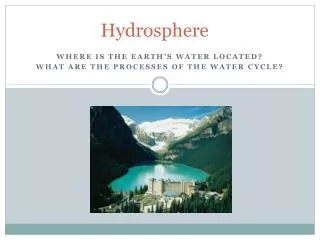
THE EARTH’S HYDROSPHERE. The Earth’s liquid water constitutes the hydrosphere . The vast majority of Earth’s water is in the oceans (salt water), with smaller, but geologically important, quantities of fresh water in lakes, rivers, and ground water.

E N D
THE EARTH’S HYDROSPHERE • The Earth’s liquid water constitutes the hydrosphere. • The vast majority of Earth’s water is in the oceans (salt water), with smaller, but geologically important, quantities of fresh water in lakes, rivers, and ground water. • The components of the hydrosphere, as well as the cryosphere (frozen water), the atmosphere, and the biosphere, participate in the global hydrologic cycle. • Earth’s water supply has had, since Earth was created, major influences on Earth’s climate, its landscape and mineralogy, the composition of its atmosphere, and on the origin and evolution of life. • The total mass of Earth’s water is about 300 times the mass of the atmosphere. • Without water, which facilitates the formation of carbonate rock, the atmospheric content of CO2 would be far higher than it is.
THE EARTH’S HYDROSPHERE:Distribution of Water on Earth Volume Percent of Total OCEANS 1,350 x 1015 m3 97.3 CRYOSPHERE 29 x 1015 m3 2.1 (Glaciers & Polar Ice) UNDERGROUND 8.4 x 10¹⁵ m3 0.6 (Aquifers) LAKES & RIVERS 0.2 x 10¹⁵ m3 0.01 ATMOSPHERE 0.013 x 10¹⁵ m3 0.001 BIOSPHERE 0.0006 x 10¹⁵ m3 4 x 10⁻⁵
Major Topographic Divisions and Profile of the North Atlantic Ocean Basin
THE EARTH’S HYDROSPHERE • The hydrosphere, along with the atmosphere and cryosphere, are primarily responsible for weathering and erosion of land surfaces. • Rain water, in combination with atmospheric CO2, is primarily responsible for chemical weathering by carbonic acid, H2CO3. • The amount of CO2 dissolved in the oceans is much larger than that currently in the atmosphere. Since the solubility of CO2 in water decreases with temperature, global warming could produce a positive feedback effect by releasing oceanic CO2. • Man-made and volcanic pollution can increase weathering by providing much stronger acids (“acid rain”; e.g. H2SO4), and by increasing atmospheric CO2. • Rain, plus the river and stream components of the hydrosphere, also provide mechanical erosion of rocks and convert them to soils and sediments.
December 26, 2004 Earthquake-Generated Tsunami (Red = Wave Heights Measured by Jason 1 Satellite)
“Black Smoker” Under-Sea Volcanic Activity • Under-sea volcanic activity gives rise to high-temperature plumes of water, containing particles of igneous rock that give rise to the appearance of black smoke. • The boiling point of water under the high pressures on the ocean floor can be considerably higher than at the surface; hence the temperatures of the volcanic plumes can be much higher as well. • It has been discovered that some species of animal life thrive on the environment of these “black smokers”, including their very high temperatures.
THE EARTH’S TIDES • Tides in Earth’s oceans are due to the differential of gravitational attraction on different parts of Earth (relative to its center); primarily by the Moon, and secondarily by the Sun. • The part of the oceans on the side of the Earth facing the Moon (or Sun) feels stronger gravity, and the part of the oceans on the side of the Earth facing away from the Moon (or Sun) feels weaker gravity, than does the center of the solid Earth. • The maximum effective forces on Earth’s ocean waters are those in the horizontal direction (which causes horizontal motion), and occur at angles of 45 and 135 to the Moon or Sun direction. • This causes rises in sea level on opposite sides of the Earth (in line with the Moon or Sun direction).
THE EARTH’S TIDES • When the Sun and Moon are in line with the Earth, tides are stronger than average (spring tides), and when the Sun and Moon are at right angles to each other, tides are weaker than average (neap tides). • There are also variations in tide strength due to differences in the Earth-Moon and Earth-Sun distances, and the orientations of the orbit planes of the Earth and Moon with each other, and with the Earth’s equatorial plane. • Tide heights are also affected by the local sea level and coastal topography.
View of the directions and magnitudes of gravitational forces exerted by the Moon on the solid Earth and oceans (G), resultant effect on the solid Earth (C), and net effects on ocean waters (residual difference vectors). Net effective translational force on Earth’s surface water. Note it is zero at 90 to the Earth-Moon direction, as well as at the zenith (Z) and nadir (N) directions.
LIFE IN THE OCEANS • Throughout Earth’s history, the oceans have had major influences on the evolution and propagation of life, and vice versa. • Early in Earth’s history, before the advent of photosynthesis on a large scale, there was no atmospheric ozone layer to protect life forms on the surface from damaging solar ultraviolet radiation. • Therefore, the oceans (and other large bodies of water) provided the only UV-protected (but visible light illuminated) habitats for the original procaryotic life forms, as well as essential nutrients. • Life forms have also had significant influences on the oceans and ocean beds, because of their capabilities to convert carbon dioxide and soluble calcium compounds into limestone (calcium carbonate, CaCO3).
THE EARTH’S CRYOSPHERE • Earth’s supply of frozen water, the cryosphere, is second only to the oceans in water content. • The cryosphere consists mainly of the permanent ice caps of Antarctica and Greenland, with much smaller amounts in Arctic and mountain glaciers. • Major changes in sea level can occur during times of global climate change (ice ages and global warming), due to associated changes in the water content of the cryosphere. • During ice ages, glaciers can cover major parts of Earth’s land area year-round for hundreds or thousands of years. • The advance and retreat of glaciers can also produce major erosion and re-configuration of the landscape. • Ice ages and global warming can have major effects on the biosphere as well.
Permafrost in Land Areas • Land areas in polar regions, such as Antarctica and Greenland, and the north slopes of Alaska and Siberia, have zones below their surfaces in which ground water remains frozen year-round. • Regions in which soil water is permanently frozen constitute what is known as permafrost.
ICE AGES AND GLOBAL WARMING • The most recent “ice age” ended about 12,000 years ago, which was prior to the advent of civilized human history. • It is still unknown as to what causes the advent of ice ages, and the extent that they occur in cycles independent of human activities. • At the current time, we are experiencing a slow global warming, but it is not known to what extent this is part of a natural cycle as distinct from human-induced (by increasing the amount of carbon dioxide and other “greenhouse gases”, due to combustion of fossil fuels and other human activities). • There is concern that the increasing use of fossil fuels might induce a “runaway greenhouse” effect, because heating of the atmosphere could, by heating of the oceans and other water bodies, result in increasing water vapor in the atmosphere (which is also a “greenhouse gas”)! • Global warming would also result in melting of the polar ice caps, which would raise the water level of the oceans and cause flooding of coastal areas of the continents.
Space-Based Remote Sensing of the Hydrosphere and Cryosphere • As is also the case for studies of Earth’s land surfaces, observations of the Earth’s water surfaces from space provide important information that would be difficult or impractical to obtain using only in-situ measurements (such as from surface and submarine vessels) or by aircraft-based remote sensing. • Using spacecraft in the appropriate orbits, nearly all regions of the hydrosphere and cryosphere can be observed at regular intervals (and, in some cases, continuously) with remote-sensing instruments such as imagers and spectrographs, operating in all wavelengths that can penetrate the atmosphere to/from the surface (and, in some cases, below the liquid water or ice surface). • The most recent of these is the Aqua spacecraft, which along with Terra (primarily land measurements) and Aura (primarily atmospheric measurements) constitute the major instruments of NASA’s Earth Observing System (EOS).
NASA’s Aqua Earth Observing Satellite • Aqua, the second of NASA’s Earth Observing System (EOS) family of satellite missions to be launched, has a broad range of scientific objectives and corresponding scientific instrumentation. • The Aqua scientific objectives are focused on the study of a wide range of interrelated Earth system processes (involving the atmosphere, oceans, and land surface) and their involvement in both near- and long-term changes in the Earth system. • Global change research efforts include studies of, and instrumentation to measure, atmospheric temperature and humidity profiles, clouds, precipitation and radiative balance, terrestrial snow and sea ice; sea surface temperature and ocean productivity; soil moisture; and the improvement of numerical weather prediction. • Aqua is also contributing to the monitoring of marine and terrestrial ecosystem dynamics.
NASA’s Aqua Earth Observing Satellite • Aqua is in a near-polar, low Earth orbit. • Aqua has six primary scientific instruments: • Atmospheric Infrared Sounder (AIRS) • Advanced Microwave Sounding Unit (AMSU-A) • Humidity Sounder for Brazil (HSB) • Advanced Microwave Scanning Radiometer for • EOS (AMSR-E) • Moderate Resolution Imaging Spectroradiometer (MODIS) • Clouds and the Earth’s Radiant Energy System (CERES) • The simultaneous observations of this suite of instruments, each having its own unique characteristics and capabilities, contributes greatly to the total scientific capability of this space mission.