Download

1 / 12
120 likes | 268 Vues
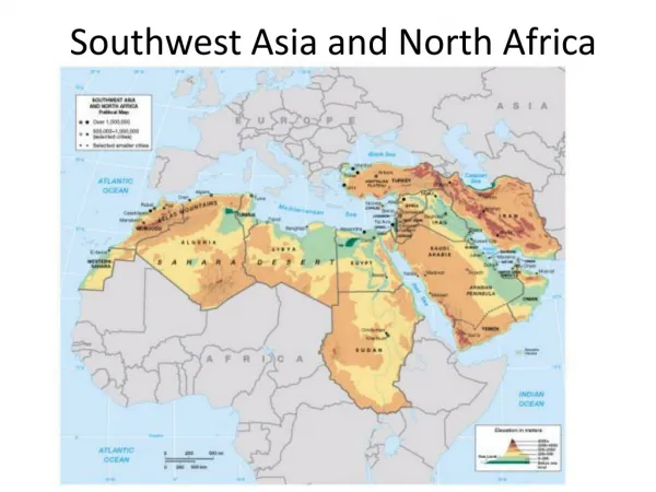
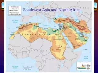
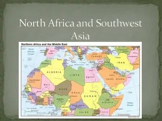
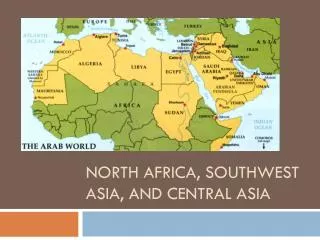
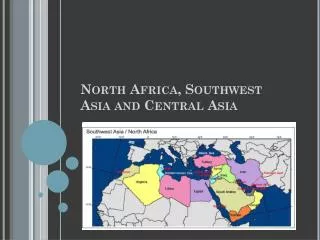
North Africa and Southwest Asia. Physical Geography Facts. The dominant landforms of the Arabian Peninsula are hills and low tablelands. Most of the Arabian Peninsula is a rocky plateau with mountains along the west coast.

E N D
Physical Geography Facts • The dominant landforms of the Arabian Peninsula are hills and low tablelands. • Most of the Arabian Peninsula is a rocky plateau with mountains along the west coast. • The Dead Sea lies 1.312 feet below sea level and is the lowest point on earth not covered by ocean waters. It is the saltiest body of water in the world. The Jordan River flows into the Dead Sea.
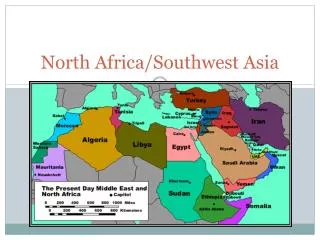
Istanbul was the ancient city of Constantinople. • Turkey sits in an area known as Asia Minor. • The Euphrates River is 1.700 miles long and is the longest river in Southwest Asia. • The Tigris is 1,180 miles long. The river system rises out of the mountains of eastern Turkey and flow southeast. • The two rivers join together in southeastern Iraq before emptying into the Persian Gulf. • The region’s soil is very porous, water is quickly absorbed (sandy). • Southwest Asia contains about 60% of the world’s known oil reserves. • Rainfall averages 10 inches or less each year in most of the area, so desert climate zones are the most common climate. • The Empty Quarter, Rub al-Kahli, is an uninhabited desert on the Arabian Peninsula. It has almost no vegetation.
A Mediterranean climate is found along the coastal plains of the Mediterranean, Black and Caspian Seas and in the Tigris-Euphrates river valley. • Coastal areas receive more rainfall. • Civilizations began to grow in this region 6,000 years ago. • The “land between two rivers” is the meaning of the ancient name given to the area between the Tigris and Euphrates---Mesopotamia.
Culture • The region has a population of Arabs and non-Arabs. About 58% of the population speak Arabic (280 million). The Arab origin started on the Arabian peninsula and spread during history all the way to Morocco and Spain. • The region is also the homeland of the Jews. Hebrew is spoken by the majority of the 5 million Jewish inhabitants of Israel. • Other languages include Turkish, Persian, and Kurdish.
Religion • Islam is the Arabic word for “the act of submitting oneself to Allah, or God” • Muslims introduced the Arabic numerical system and made large contributions in natural sciences, medicine, and astronomy. • Muslims pray in mosques. • Christianity is based on the teachings of Jesus Christ, a Jew. • The apostle Paul spread the news of Christianity outside of Palestine after Christ’s execution. • Judaism is the oldest monotheistic religion. • Judaism taught that Jews were the chosen people of God and that they would be favored if they obeyed God’s laws. • Religion is both a unifying factor and a dividing factor in this area. • Read religion section in textbook. • “Inside Mecca” video
Two Most Valuable Resources: • Oil…OPEC PowerPoint • Water • Read section in book • Iraq…Geopolitical issues http://www.msnbc.msn.com/id/17722026 • Dubai…growth of area b/c of oil http://www.youtube.com/watch?v=1bOd_v7Ukgw&feature=related
Taliban Video • What are differences and similarities between the Taliban and Al-Qaida? • Eastern Mediterranean Map: • Place the terms below on the map provided to you. Countries/Territories: Physical Features: • Israel (Color Yellow) -Dead Sea • Jordan - Jordan River • Lebanon -Sea of Galilee • West Bank (Color Blue) -Sinai Peninsula • Gaza Strip (Color Red) - Mount Hermon • Golan Heights (Color Purple) - Mediterranean Sea • City: Jerusalem
Arab-Israeli conflict (9.1) • Read 9.1 in full until you reach the Jordan section. • Define the terms below, provide detail so if you refer back you understand the importance of the term to topic, and answer the questions during the reading. • Terms: • two-state solution • Right of return • 1967 war (Six Day War) • Camp David Accords • Questions: • Explain why the United Nations thought Jerusalem should be an international city when it created the country of Israel. • Explain the claims of Palestinians and Israeli Jews to the lands of Israel and the Occupied Territories. How might both groups be peacefully accommodated? What faults, if any, existed in the failed Camp David plan of 2000? • How has the United States been involved in the Arab-Israeli regional conflict? • Law of Return • Intifada • PLO • Oslo I Accord • Wye Agreement
Arab-Israeli Conflict • Read from textbook to have a better understanding of the topic. • Answer questions based on reading. • Watch “Bridge over the Wadi” • Wadi: “A gully or streambed in northern Africa and southwest Asia that remains dry except during the rainy season.” • After the video write a one page reflection on the video. • Do you feel the school is a good idea? • Do you feel the school could help resolve the issues among Israeli and Arabs (Palestinians) within this region? • What else do you think could be done to help the next generation? • What did you learn and any other thoughts about the documentary? • Needs to be about a page in length. If typed double space.
“Arab Awakening” Project • Go over instructions • Also mention in presentation…your solution. How can this conflict be solved? (opinion)