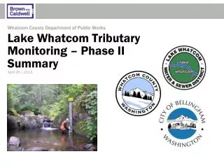
Linked Watershed-Lake Models for the Lake Whatcom Phosphorus TMDL
Linked Watershed-Lake Models for the Lake Whatcom Phosphorus TMDL. Paul Pickett and Steve Hood Washington Department of Ecology. Where?. What?. Monomictic lake Over 100 meters at deepest Twenty kilometers long Glacial sills -> Three Basins

Linked Watershed-Lake Models for the Lake Whatcom Phosphorus TMDL
E N D
Presentation Transcript
Linked Watershed-Lake Models for the Lake Whatcom Phosphorus TMDL Paul Pickett and Steve Hood Washington Department of Ecology
Where? 2009 Puget Sound Georgia Basin Conference
What? • Monomictic lake • Over 100 meters at deepest • Twenty kilometers long • Glacial sills -> Three Basins • Largest basin (96% of volume) average depth over 50 meters • Other basins about 10 meter average depth • Most development around two smallest basins 2009 Puget Sound Georgia Basin Conference
Problem • Lake Whatcom fails to meet oxygen criteria • Trend: anoxic hypolimnion sets up earlier • Criterion: within 0.2 mg/l of natural conditions • Phosphorus loading causing oxygen decline • Just over 10% of watershed developed • Developed tributaries have highest nutrient levels 2009 Puget Sound Georgia Basin Conference
Obligatory Flow Chart Loading Tributary Load HSPF Response CE QUAL W2 Fixed Loads Fixed Parameters N Meets Criteria ? Dissolved Oxygen Results Revise Rollback Y Done 2009 Puget Sound Georgia Basin Conference
HSPF input • Base Scenario: 1992 National Land Cover Dataset, with photo update to 2002-2003 • Full Buildout Scenario: development to allowable zoning • Full Rollback Scenario:all watershed Mixed Forest or wetlands • Partial Rollback: Change land cover from developed to forest until standards are met 2009 Puget Sound Georgia Basin Conference
Model View of Rollback • Developed area • pink/brown • Approx 3600 ac • Changed to Mixed Forest • light green 2009 Puget Sound Georgia Basin Conference
Developed Acres vs. Tributary Loading 2009 Puget Sound Georgia Basin Conference
The Rollback View 86% Rollback 94% Rollback 2009 Puget Sound Georgia Basin Conference
CE QUAL W2 • 2 Dimensional • Laterally averaged segments • Variable depth layers • Dynamic • Time-step selected based on transit times • Hydrodynamic • Simultaneous equations to balance, water, temperature, chemistry, growth, death 2009 Puget Sound Georgia Basin Conference
CE QUAL W2 • Lake Whatcom enhancements • 3 algal groups • Sediment variable stoichiometry and decay • Sediment stoichiometry linked to water column • Both 0th order and 1st order sediment decay w/ different nutrient release rates • Looping methodology • Rerun model using end conditions of one loop for beginning conditions of next loop • Allows model to reach equilibrium from loading changes (15 year retention in Basin 1) 2009 Puget Sound Georgia Basin Conference
CE QUAL Plan 2009 Puget Sound Georgia Basin Conference
CE QUAL Cross Section 2009 Puget Sound Georgia Basin Conference
CE QUAL results: spring 2009 Puget Sound Georgia Basin Conference
CE QUAL results: fall 2009 Puget Sound Georgia Basin Conference
Cumulative Volume 2009 Puget Sound Georgia Basin Conference
Bottom Line • Developed area needs to generate phosphorus loading like pre-development • Partial Rollback from Base Scenario • 86% reduction • Partial Rollback from Full Buildout Scenario • 94% reduction • Stormwater storage and infiltration are key • Better land use practices reduce nutrients before they are released • Fertilizer, erosion, human and pet waste 2009 Puget Sound Georgia Basin Conference
Lake Whatcom TMDL Thanks to: • WWU – Institute of Watershed Studies • City of Bellingham • Whatcom County • Lake Whatcom Water and Sewer District • EPA • Portland State University • CDM • Tetra Tech Backgrounds courtesy of Gordon Tweit and Anne Kreft 2009 Puget Sound Georgia Basin Conference