Download
1 / 12
120 likes | 289 Vues
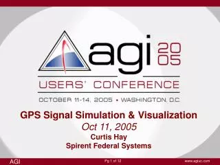
GPS Signal Simulation & Visualization Oct 11, 2005 Curtis Hay Spirent Federal Systems. About Spirent Federal Systems…. GSS6560 GPS Simulator. North America’s leading supplier of high performance broadband, network and GPS RF test equipment Headquarters: Yorba Linda, CA

E N D
GPS Signal Simulation & VisualizationOct 11, 2005Curtis HaySpirent Federal Systems
About Spirent Federal Systems… GSS6560 GPS Simulator • North America’s leading supplier of high performance • broadband, network and GPS RF test equipment • Headquarters: Yorba Linda, CA • Core expertise: Satisfying customers’ unique needs • for wireless, network and GPS • receiver test and evaluation!
What is GPS? • The Global Positioning System is owned and operated by the US government • Constellation of orbiting satellites (~26,560 km altitude) and ground facilities • First Block 1 developmental satellite launched 1978 • GPS provides 24-hour, all-weather navigation and timing capability • to terrestrial, airborne and spaceborne users • Funded purely through US federal taxes– signals available “free of charge” • Enormous public value: • Recreation Surveying • Aviation Agriculture • Defense Financial • Electric utilities Precise Timing • Internet timing Scientific Research
Factors affecting GPS performance • Satellite factors • Broadcast ephemeris • Clock errors • Constellation geometry • SV anomalies and periodic maintenance • Atmospheric factors • Ionosphere effects • Troposphere (weather) • User factors • Sky visibility • User motion • User environment (urban, heavy foliage, etc.) • Signal reflections (multipath) • Interference (unintentional or otherwise) • Receiver design • (noise figure, sensitivity, software bugs, design limitations, etc.)
Why simulate GPS signals? • Controllable Specific tests are created for unique conditions • Flexible Enormous variability of GPS signal conditions can be modeled • Precise Every aspect of the GPS signal and environment is specified by user • Repeatable GPS receiver responses to various stimuli are observed repetitively • Inexpensive Platform motion is simulated, reducing need for expensive field testing • Safe Tests are conducted in a lab Get from here to here… Quickly & with confidence! Spirent GPS Simulation Lab GPS-Guided Munition Test
Spirent’s GPS Signal Simulator SimGEN GUI (for real-time scenario monitoring & control) GSS7700 PC with scenario definition application (SimGEN) Dual frequency (L1/L2) signal generator “Constellation in a Box” (also available for L5) RF Outputs (to GPS receiver under test)
Special GPS simulation applications • High platform dynamics • Spinning antennas • High delta-V/delta-A trajectories • GPS reception under jamming • Combined GPS/INS navigation • “Urban canyon” navigation • Heavy multipath & obscura • Spaceborne navigation • Orbit & attitude determination • Marine navigation • Indoor navigation (AGPS) • Space Based Augmentation • (WAAS, LAAS, EGNOS, MSAS) • Classified signal simulation • (SAASM, M-Code) • Authorized users only • Spirent supports all of these applications… and many more!
Who are Spirent’s GPS simulator customers? • Government • Defense • Army • Air Force • Navy • Universities • Automotive Industry • Wireless Industry • GPS Receiver Manufacturers and OEMs • Commercial & Government
GPS changes on the horizon… • First modernized “IIR-M” satellite launched 25 Sep • M-Code (improved military code on L1 & L2 frequencies) • L2C (new civil signal on L2 frequency) • Modernized GPS payloads to be launched over next several years • Third civil frequency (L5) planned for GPS “Block IIF” satellites • Further reduces GPS range measurement error • Centered at 1176.45 MHz • Projected 2007 first launch • European Galileo system • EU effort to develop navigation satellite system similar to GPS • First launch TBD • Spirent has developed simulation capabilities for ALL of these signals. • These test systems are available to authorized users today.
AGI & Spirent Collaboration • AGI offers wealth of experience with spatial visualization • and graphical analysis • Spirent GPS RF simulations can be enhanced by adding • real-time (and post processing) visualization capabilities • STK translates simulated trajectories into • viewable motion • Eliminates level of abstraction • Useful attributes of SimGEN-STK interface include: • Signal vectors to orbiting satellites • Jammer location visualization • 3D rendering of platform motion • Illustration of signal reception vs. antenna orientation
SimGEN2STKX Application SimGEN GUI (for real-time scenario monitoring & control) STK GUI (for real-time visualization & analysis)