Chapter 9
Chapter 9. Surface Water. Chapter - 9. Section – 9.1 Surface Water Movement (Water Cycle) Section – 9.1 Stream Development Section – 9.1 Lakes & Freshwater Wetlands. SECTION 9.1 Surface Water Movement. Objectives

Chapter 9
E N D
Presentation Transcript
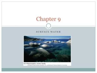
Chapter 9 Surface Water
Chapter - 9 • Section – 9.1 Surface Water Movement (Water Cycle) • Section – 9.1 Stream Development • Section – 9.1 Lakes & Freshwater Wetlands
SECTION 9.1Surface Water Movement Objectives Describe how surface water can move surface materials. Explain how a stream carries its load. Describe how a floodplain develops.
Section 8.1 Running water is an agent of erosion, carrying sediments in streams and rivers and depositing them downstream. Review Vocabulary solution: A homogeneous mixture in which the component particles can not be distinguished.
New Vocabulary • runoff • watershed • divide • suspension • bed load • Discharge • Flood • floodplain
The Hydrologic Cycle The water cycle also referred to as the hydrologic cycle, is a never – ending, natural circulation of water through Earth’s systems.
Runoff • Water flowing downslope along Earth’s surface is called runoff. Runoff might reach a stream, river, or lake. It might evaporate, or accumulate as puddles in small depressions and infiltrate the ground. • Factors that determine how much precipitation becomes runoff • Soil composition • Rate of precipitation • Vegetation • Slope
Runoff: Soil Composition • If the porosity of a soil is greater, then more precipitation will soak into the ground instead of becoming runoff. • Coarse grained soils (sands and gravels) have high porosity - allowing more water to soak in. • Fine grained soils (silt and clay) have low porosity and cause more water to become runoff.
Runoff: Rate of Precipitation • There is a limit to how fast water can soak into the ground – called the rate of infiltration. • If precipitation falls at a faster rate than it can soak into the ground, it will generate more runoff.
Runoff: Vegetation & Slope • Vegetation will slow down the rate of runoff. • Water flowing through grass will move at a slower rate than water flowing across a parking lot. • If the slope is steeper, then the runoff will be faster.
Streams • Runoff generally begins as water flowing across the ground in thin sheets. • Eventually it finds its way to a channel • Channel can be a rill, gully, curbside gutter, or other low spot • Water flowing in a channel is a stream. • Streams organize themselves into systems
Stream Systems • A stream system is a network of streams that takes water out of an area. • Streams usually begin small and gradually merge with other streams as they flow down hill. • A stream that flows into another stream is called a tributary. • The further downhill a stream goes, the more tributaries it collects and the larger it gets. • Eventually the stream ends when it empties into a large lake or the ocean.
Stream Systems • Watershed – The land area drained by a stream system • Divide – The high land area that separates one watershed from another • Streams start - headwaters • Discharge point - mouth
Watersheds • Your local watershed is the Blackstone River • There are also “sub watersheds” in the Blackstone River Valley • West River • Mill River • Mumford River
Watersheds The watershed of the Mississippi River includes many stream systems. Approximately one third of the continental United States eventually drains into the Mississippi River.
Stream Load • Sediment carried by streams is called the stream load. • Stream load can be carried in one of 3 ways: • Suspension – smaller particles “float” along because of turbulent water • Bed Load – heavier particles (sand, gravel, cobbles, boulders) that “roll” along the stream’s bed • Solution – materials with soluble minerals dissolved in the stream’s water
Stream Carrying Capacity • The ability to transport the sediments by stream depends on how fast it flows (velocity) and on the volume (discharge) of water flowing. • The slope, depth, and width of the channel of the stream affect the speed and direction of the water moves within it. • A stream’s water moves more quickly with less friction. • A smooth - sided channels with great slope and depth allow water to move most rapidly.
Stream Discharge • Discharge is the measure of volume of stream water that flows past a particular locationover a givenperiod of time • Discharge can be found by multiplying (depth) (width) (velocity) • Its units are gallons / minute cubic feet / second cubic meter / second
Floods • Floods occur when water levels in a stream rise and flow over the stream banks onto the adjacent land. • At this point the stream is in flood stage • Floodplains are broad, flat areas adjacent to stream channels that get submerged during flooding. • During a flood, water flowing over the floodplain flows slower than it would in the channel. This causes sediment to be deposited on the floodplain.
Floods • The sediments deposited on a floodplain are often very fertile – good crop land. • Over time a river that floods often will build up natural levees that help reduce the frequency of floods by raising the height of the river banks.
Floods • Areas prone to floods may have flood warning systems established. • Dams and artificial levees can also help control flooding. • This picture is when a hurricanecaused massive floods inarea during 1955. • Floods like this promptedthe construction of WestHill Dam.
Flood Monitoring and Warning Systems • Government agencies like National Weather Service and Earth – orbiting weather satellites collect and transmit information about weather conditions, storms, and streams. • USGS has 7300 gaging stations in the United States to provide a continuous record of the water level in each stream. • In areas that are prone to severe flooding, warning systems are the first step in implementing emergency management plan.
SUMMARY • Running water is an agent of erosion, carrying sediments in streams and rivers and depositing them downstream. • Infiltration of water into the ground depends on the number of open pores. • All the land area that drains into a stream system is the system’s watershed. • Elevated land areas called divides separate one watershed from another. • A stream’s load is the materials that it carries. • Flooding occurs in small, localized areas as upstream floods or in large downstream floods.