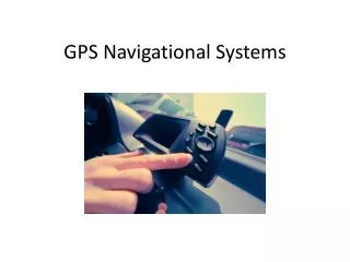
Electronic Navigational Charts (ENCs)
280 likes | 820 Vues
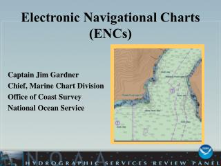
Electronic Navigational Charts (ENCs). Captain Jim Gardner Chief, Marine Chart Division Office of Coast Survey National Ocean Service. Nautical Charting Products. Suite of over 1000 paper charts Raster Charts Print on Demand Charts Update Service

Electronic Navigational Charts (ENCs)
E N D
Presentation Transcript
Electronic Navigational Charts(ENCs) Captain Jim Gardner Chief, Marine Chart Division Office of Coast Survey National Ocean Service
Nautical Charting Products • Suite of over 1000 paper charts • Raster Charts • Print on Demand Charts • Update Service • Electronic Navigational Charts (NOAA ENCs)
Nautical Charting - Brief History 1994 Rasterized full suite of paper charts 1997 NOAA’s first ENCs Collected (in house) 1999 Contracting out for ENC collection 2000 Raster Update Service became operational 2001 ENCs become available to Public 2003 ENCs Become “Official” (Usable for Navigation) 2004 399 ENCs on Coast Survey Web site for Download
Raster vs. ENC A digital picture vs. A geo-referenced database
Why Build ENCs? • Conformance to International Standards • Non-proprietary, publicly available • IMO compliant • Data used in ECDIS & ECS • Power of Vector Data • Navigation Software can interact with data • Provide mariners Look-ahead capabilities & warnings • Configurable displays • Meet Accuracy Demands of Mariners in 21st century
MARINE TRANSPORTATION SYSTEM REPORT Report to Congress in September 1999 • The volume of domestic and international trade is expected to double over the next 20 years. • NOAA and USACE should explore; • Expanding Electronic Navigational • Chart (ENC) coverage, • Incorporating the latest hydrographic and shoreline survey information, • Enhancing the ENC with high resolution depth information and very-large-scale source data…
Approach to Building ENCs • Phase One • Limit coverage to 40 major commercial ports • 200 ENCs - 99% Completed • Phase Two • Seamless ENC Coverage Between US Ports • 200 ENCs - 60% Complete • Phase Three • All remaining US waters • 560 ENCs - 40% Complete • 968 ENCs to give 100% coverage
ENC Data • Integrating data from • different sources • Inshore depth areas & • obstructions • New channel information • Updated Aids to • Navigation
USCG/NOAA Partnership • MOA signed in 2001 • ENC Co-Production • NOAA Baseline ATON database • NOAA checks USCG LNM before publication, • reduction in error rate from 10% to < 1 %
Federal channel Working with the USACE • Build Federal channel framework • Expedite controlling depth reporting • Receive channel conditions surveys in compatible format
High Accuracy Source • Digital Shoreline • NOAA Hydrographic Surveys • USACE Dredge • Surveys
ENC Maintenance • Start out with monthly critical updates • Goal is to provide weekly updates • Integrate non-critical source as received • Implement incremental updates
ENC Maintenance • Maintaining an ENC is much • more intensive, requiring • more human resources than • the Raster chart • While developing ENC product line MCD must also continue to publish its other chart products
Build and maintain an ENC suite • Contract for… Quality Control of all work performed by a contractor is done by NOAA Cartographers • Building • Validation • Maintenance • IT Support
Build and maintain an ENC suite • Single Compiled Source Database • ENC database to product all chart products • Ensure consistency between products • Free up resources • Shorter update cycle
Data Distribution • NOAA ENCs are “Free on the web” • Get the ENC data in the most hands, end users and developers • Per the HSIA; Developing a certification program for private sector, value added products and services, using NOAA data Over 1.6 Million ENCs Downloaded since July 2001
Challenges • Marketing - The ENC is a new, better, “Next Generation” product. We need to improve the awareness in the maritime community. • Training – The ENC is a complex new tool, with many new options & capabilities. The mariners needs guidance on how to use it properly, what it provides and what it doesn’t.