Download
1 / 21
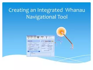
230 likes | 528 Vues
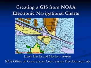
Creating a GIS from NOAA Electronic Navigational Charts. James Hawks and Matthew Austin NOS Office of Coast Survey Coast Survey Development Lab. Introduction. Background-- Nautical Charts, ENCs, S-57 ENC Direct to GIS Website Users Benefits Web Services Future Direction Conclusion.

E N D
Creating a GIS from NOAA Electronic Navigational Charts James Hawks and Matthew Austin NOS Office of Coast Survey Coast Survey Development Lab
Introduction • Background-- Nautical Charts, ENCs, S-57 • ENC Direct to GIS Website • Users • Benefits • Web Services • Future Direction • Conclusion
What is a Nautical Chart? • A graphic depiction of the marine environment
Nautical Charts Show: • Nature and form of the coast • General configuration of the sea bottom • Water depths • Aids to navigation • Topographic aids to support navigation • Used primarily as tool for safe navigation
Navigation Product:Electronic Navigational Charts • Electronic Navigational Charts (ENC) are databases of chart features used by navigation systems to produce a chart-like display.
What is S-57? • International Hydrographic Organization (IHO) for Transfer Standard for Digital Hydrographic Data • Uses International Standard Organization (ISO) 8211 file format • Platform independent structure • Provides a standard catalog for chart features • ENC is a product specification for S-57
S-57 Object Catalog • Chart features belong to object classes • Over 180 object classes defined • Each object has set of descriptive attributes • Object classes encoded as acronyms • Attributes encoded as acronyms and enumeration • Includes attribute data types and value domains
Using ENCs in GIS • Rich structure of the object catalog requires the use of data decoders to make sense of information contained in S-57 • Off the shelf GIS software packages do not support ENC in native S-57 format • S-57 standard is complex and hard to fully integrate in GIS
ENC Direct • Provides NOAA ENC data as online GIS • Uses ESRI ArcIMS internet mapping service • Data is available for download in GIS multiple formats through Spatial Direct online data transformation • Download can be customized to fit user requirements • Large Scale ENCs currently available • Updated monthly to include new coverage and ENC updates
NOAA ENC data conversion • Safe Software’s Feature Manipulation Engine (FME) used for data conversion • Custom translation developed in house • Converts S-57 to shapefile and ArcSDE • Chart features are merged together to create seamless GIS layers from NOAA ENCs
GIS layers of aggregated nautical features covering US waters • Contiguous information about Nautical Chart features available in GIS layers • Example: ENC Direct coastline layer contains information from 400 ENCs of the same scale that have been glued together • Over 200 GIS layers available
ENC Direct to GIS • Layers have been symbolized to give a chart like display • S-57 object classes have been organized into meaningful groups based on ESRI’s S-57 data model • Layers have scale dependency to improve performance. Layers are only visible at a particular scale
Data Download Choose data format, and spatial extent Zoom in Select Data Data is clipped, zipped and shipped
Benefits • Streamlines and expands access to NOAA ENC data for non-navigational use • Visualization of NOAA ENCs online • Access to multiple cohesive chart features-Soundings, Shipwrecks, Harbors, Marine Sanctuaries, Coastline, Landmarks
Web Services • Web Map Services and Web Feature Services • Eliminate need for data download • Data can be view directly through desktop GIS clients (ESRI clients only at the moment) and stacked with other web services
ENC Direct Architecture • Web Server: Windows 2003, Apache, Tomcat, ArcIMS 9.1, Spatial Direct • Data Server: Red Hat Linux, ArcSDE 9.1, Oracle 10g
Users • USGS National Map • US Coast Guard Homeland Security • Coastal Managers • Coastal Engineers • Marine Modelers • State and Local Government • Private Sector
Conclusion • ENC Direct to GIS expands access and usage of NOAA ENCs • For further information, contact: enc.gis@noaa.gov • http://nauticalcharts.noaa.gov/csdl/ctp/encdirect_new.htm