Download
1 / 70
700 likes | 830 Vues
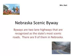
Traveling Proposed SC 46 Scenic Byway Route Starting from the east and heading west. One starts in the Town of Bluffton Then heads west on SC 46. Welcome sign to Bluffton on SC 46 just south of US 278. The SC 46 Scenic Byway will start at the intersection of SC 46 and Boundary.

E N D
Traveling Proposed SC 46 Scenic Byway Route Starting from the east and heading west
One starts in the Town of Bluffton Then heads west on SC 46 Welcome sign to Bluffton on SC 46 just south of US 278
The SC 46 Scenic Byway will start at the intersection of SC 46 and Boundary. Turn south onto Boundary Street
Bluffton Scenic Byway From Boundary Street and SC 46 to the County Line (North Side of Road – Heading West) In the southwest corner a new church is being built and a gas station is located to the east. In the northwest corner, a building is under construction. Recommendation: Space within this building will be ideal for visitor/welcome center for both the Town of Bluffton and SC 46 Scenic Byway. The suggested location for the visitor/welcome center would be within the building being built in the lot in the southeast corner of this photo.
Within the Village of Bluffton West side of Boundary Street heading south Art Gallery A church located to the north of the Art Gallery is in the planning stages for remodeling.
Within the Village of Bluffton West side of Boundary Street heading south The Heyward House The Heyward House ca 1840 serves as both a museum and welcome center
Take a historic walking tour through the Village of Bluffton The Fripp-Loden House (ca. 1909) and Seven Oaks (ca. 1850)are just a few of the buildings on the historic walking tour. Maps for the walking tour are available at the Heyward House Museum / Welcome Center
Within the Village of Bluffton Turn west on Bridge Street which brings you to Calhoun Street Also known as “Artisan’s Row”
Within the Village of Bluffton East side of Calhoun Street heading North One never knows what one might find at Eggs’n tricities, one of the shops on Calhoun Street.
Within the Village of Bluffton East side of Calhoun Street heading North Red Stripe Gallery 69 Calhoun Street
Within the Village of Bluffton East side of Calhoun Street headed east Fun quirky signage in the “Eclectic” Town of Bluffton
Within the Village of Bluffton East side of Calhoun Street heading north Coastal Chic specializing in fine furnishings
Within the Village of Bluffton East side of Calhoun Street heading north Calhoun Street Art Gallery
Within the Village of Bluffton East side of Calhoun Street heading north Red Heifer Gallery at 41B Calhoun Street for handmade art, craft, pottery, stained glass and jewelry Shop apart from the rest of the Herd
Within the Village of Bluffton East side of Calhoun Street heading north Antiques & the Garden on Calhoun Street
Within the Village of Bluffton East side of Calhoun Street heading north Coming soon… Next door to Milan Concepts will be a coffee house Malian Concepts Interior Design on the corner of Calhoun and Church Street
Within the Village of Bluffton East side of Calhoun Street heading north Sassy Girl
Within the Village of Bluffton East side of Calhoun Street heading north Pluff Mudd for Fine Art, Framing etc. 27 Calhoun Street
Within the Village of Bluffton East side of Calhoun Street heading north Pottery (Block off Calhoun Street on Church Street)
Within the Village of Bluffton East side of Calhoun Street heading north Preston Studio on the corner of Calhoun and Church Street
At the end of Calhoun Street, turn left onto SC 46 and head west.
Mile Marker 0.0 to 0.4 From Boundary Street/SC 46 to the County Line (North Side of Road – Heading West on SC 46) History of the Bruin House, ca 1910 The Bruin House is just one of twenty-five historic buildings included on the Town of Bluffton Historic Walking Tour.
Mile Marker 0.0 to 0.4 From Boundary Street/SC 46 to the County Line (North Side of Road – Heading West on SC 46) Oscar’s BBQ is one of a number of restaurants located on SC 46 The restaurant is set up in a rail car
Mile Marker 0.0 to 0.4 From Boundary Street/SC 46 to the County Line (North Side of Road – Heading West on SC 46) Just past Goethe Road is the Chevron Station, BBQ Caboose Restaurant and a fun and funky directional signage.
Mile Marker 0.0 to 0.4 From Boundary Street/SC 46 to the County Line (North Side of Road – Heading West on SC 46) A closer look at the canopy Looking west from the Chevron Station, one can see the canopy of trees over the road in the background.
Mile Marker 0.0 to 0.4 From Boundary Street/SC 46 to the County Line (North Side of Road – Heading West on SC 46) Stock Farm Antiques and Bess’ of Bluffton Delicatessen are located just past Shults Street at mile marker .2 Need photo of Bess Stock Farm Antiques Next door is the old state health clinic which is being turned into a police substation.
Mile Marker 0.0 to 0.4 From Boundary Street/SC 46 to the County Line (North Side of Road – Heading West on SC 46) Looking west down SC 46 at mile marker .2
Mile Marker 0.0– .04 From Boundary Street/SC 46 to the County Line (North Side of Road – Heading West on SC 46) Looking west past Pepper’s Porch Restaurant is a wonderful canopy Mile Marker .04
Mile Marker 0.5 to 0.9 From Boundary Street/SC 46 to the County Line (North Side of Road – Heading West on SC 46) A combination of live oaks and palm trees are just a few of the interesting flora along the byway.
Mile Marker 0.5 to 0.9 From Boundary Street/SC 46 to the County Line (North Side of Road – Heading West on SC 46) Historic home converted into a law office. Oak Tree in front creates a canopy over SC 46.
Mile Marker 0.5 – 0.9 From Boundary Street/SC 46 to the County Line (North Side of Road – Heading West on SC 46) Squat’n Gobble Local Flavor Restaurant
Mile Marker .05 - .09 From Boundary Street/SC 46 to the County Line (North Side of Road – Heading West on SC 46) A suggestion was made to turn this building into an artisan’s center Piggly Wiggly Grocery Store is located next door to the Squat and Gobble. They are proposing to move and the building will be available. Mile Marker .06
Scenic Bicycle Route There is a three to four foot shoulder which runs nearly the entire length of SC 46 on both sides of the road(from Boundary Street to SC 170) This is looking down SC 46 east just before the BP Station A 7 mile section from the village to SC 170 has been designated a bike route
Mile Marker 1.0 – 1.4 From Boundary Street/SC 46 to the County Line (North Side of Road – Heading West on SC 46) The seven miles of 3 foot shoulder is used by both pedestrians and bicyclists. But the speed of the traffic and narrowness of the shoulder makes this “greenway space” unsafe. Recommendation: Add a regulation bike /pedestrian path on both sides of SC 46 This is looking down SC 46 east just before the BP Station
Mile Marker 1.0 North Side of SC 46 Heading West Two views of SC 46 heading west
Nearly a mile of canopy from Buck Island to Smith Lane at Tabby’s Place Mile marker 1.1 – 1.9
Mile Marker 2.0 – 2.5 From Boundary Street/SC 46 to the County Line (North Side of Road – Heading West on SC 46)
Mile Marker 2.0 – 2.4 continued From Boundary Street/SC 46 to the County Line (North Side of Road – Heading West on SC 46) Trees provide a nice overhang in front of Root Hill Nursery. Mile Marker 2.0
Mile Marker 2.0 – 2.4 continued From Boundary Street/SC 46 to the County Line (North Side of Road – Heading West on SC 46) The intersection at Buckwalter and SC46 is the only traffic light along the entire route. Just past the intersection and to the right is a long linear park. Mile Marker 2.5 Looking west down SC 46 towards the Buckwalter Intersection
Mile Marker 2.5 From Boundary Street/SC 46 to the County Line (North Side of Road – Heading West on SC 46) Intersection of SC42 and Buckwalter
Mile Marker 2.5 – 2.9 From Boundary Street/SC 46 to the County Line (North Side of Road – Heading West on SC 46) Barton’s Run, a new development, is on the right and goes from mile marker 2.5 to 3.3. View from Mile Marker 2.8
Mile Marker 3.0 – 3.4 From Boundary Street/SC 46 to the County Line (North Side of Road – Heading West on SC 46)
Mile Marker 3.5 – 3.9 From Boundary Street/SC 46 to the County Line (North Side of Road – Heading West on SC 46)
Mile Marker From Boundary Street/SC 46 to the County Line (North Side of Road – Heading West on SC 46) Large live oak and spanish moss
Mile Marker 3.5 – 3.9 From Boundary Street/SC 46 to the County Line (North Side of Road – Heading West on SC 46)
Mile Marker 4.0 – 4.4 From Boundary Street/SC 46 to the County Line (North Side of Road – Heading West on SC 46)
Mile Marker 4.5 – 4.9 From Boundary Street/SC 46 to the County Line (North Side of Road – Heading West on SC 46) Construction Entrance to Rose Dhur Creek (4.7) A Gated Equestrian Community
Mile Marker 5.0 – 5.5 From Boundary Street/SC 46 to the County Line (North Side of Road – Heading West on SC 46) Another canopy of Live Oaks is located just west of Old Miller Road at mile marker 5.0 Old Miller Road is at mile marker 4.9 on SC 46