Download
1 / 25
250 likes | 375 Vues
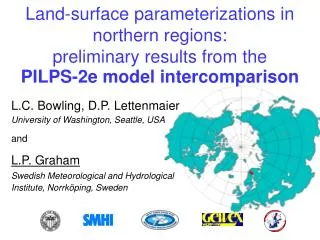
Land-surface parameterizations in northern regions: preliminary results from the PILPS-2e model intercomparison. L.C. Bowling, D.P. Lettenmaier University of Washington, Seattle, USA and P. Graham Swedish Meteorological and Hydrological Institute, Norrköping, Sweden.

E N D
Land-surface parameterizations in northern regions: preliminary results from the PILPS-2e model intercomparison L.C. Bowling, D.P. Lettenmaier University of Washington, Seattle, USA and P. Graham Swedish Meteorological and Hydrological Institute, Norrköping, Sweden
PILPS 2e: Arctic Model Intercomparison Experiment • PILPS Phase 2e is a multi-year, spatial intercomparison of hydrology and land surface transfer schemes in northern regions, patterned after PILPS 2c and 2d. • The purpose of PILPS 2e is to evaluate the performance of land surface parameterizations in high latitudes, in a context that allows evaluation of their ability to capture key processes spatially. • PILPS 2e is a joint activity of GEWEX, (through GLASS), and the Arctic Climate System Study (ACSYS). • Represents the initial test of the stable data exchange format (netcdf with the GDT convention) established by ALMA (Assistance for Land Surface Modellers).
PILPS 2e Stages • Stage 1: Torne/Kalix Rivers - 58,000 km2 river system in Sweden • Stage 2 (proposed): - 1,8000,000 km2 Mackenzie River • Stage 3 (proposed): - 2,400,000 km2 Lena River
Some Science Questions • What is the ability of the inter-comparison models to estimate runoff in gauged and ungauged catchments? • How would Arctic river runoff respond to spatial and temporal variations in climate forcings? • What are the effects of permafrost on the surface water and energy cycles, and their related impacts on carbon sequestration at high latitudes? • What is the feasibility of using the intercomparison models for assessment of the hydrologic impacts in Arctic drainage basins via long-term climate simulations?
PILPS 2e Stage 1 Participants • 21 models participating, from • 11 different countries (Australia, Canada, China, France, Germany, Japan, Netherlands, Russia, Sweden, U.K., U.S.A.)
PILPS 2e Participants • Hadley Center, U.K. / MOSES • Canadian Forest Service, Northern Forestry Centre, Edmonton AB, Canada / IBIS • Dept. of Hydrology and Water Resources, University of Arizona, U.S.A. / SAST • Swedish Meteorological and Hydrological Institute and Department of Meteorology, Stockholm University, Sweden / RCA • National Center for Atmospheric Research (CNRM, Toulouse, France) / ISBA • NASA Goddard Space Flight Center and SAIC/General Sciences Corp. / HY-SSiB • GKSS Research Center, Institute for Atmospheric Physics, Germany / SEWAB • KNMI (Dutch MetOffice), The Netherlands / MECMWF • Institute for Hydrospheric-Atmospheric Sciences, Nagoya University, Japan / IHAS • Atmos. Phys. Sec. Atmos. Envir. Div. NIES / MATSIRO
PILPS 2e participants, cont. • Meteorological Services of Canada / CLASS • Macquarie University / CHASM • NCEP/EMC and NOOS Office of Hydrology, U.S.A. / NOAH • Common land model working group, U.S.A. / CLM • Institute of Water Problems, Russian Academy of Sciences, Russia / SWAP • Institute of Geography, Russian Academy of Sciences, Moscow, Russia / SPONSOR • Department of Hydrology and Water Resources, University of Arizona and Georgia Institute of Technology, U.S.A / VISA • UCLA, U.S.A. / SSiB • Department of Civil and Environmental Engineering, University of Washington, U.S.A. / VIC • European Center for Medium Range Weather forecasting. EC / ECMWF • Center of Ecology and Hydrology, Wallingford, U.K. / MOSES-CEH
Experiment Design • 58,000 km2 Torne/Kalix river system in northern Sweden • Represented by 218 - 1/4 degree grid boxes • Forcings provided at one hourly time step • Simulation period: 1989 - 1998 • Model spin-up: 1979 - 1988
PILPS 2e Forcing Data • Precipitation • Gridded from SMHI station data • Lapsed for elevation and adjusted for gauge undercatch per SMHI recommendations • Statistically disaggregated to hourly • Air temperature • Gridded from SMHI daily station data • Lapsed for elevation • Disaggregated to hourly based on nearest station • Pressure, specific humidity, cloud cover • Interpolated from 1o gridded SMHI dataset that was optimally interpolated from station data
PILPS 2e Forcing Data • Wind Speed • NCEP/NCAR Reanalysis ‘surface wind’ fields • Longwave Radiation • Calculated from air temperature • Adjusted for observed cloud cover • Shortwave Radiation • Originally estimated using Tennessee Valley Authority (1972) method to estimate clear-sky transmittance • Replaced with estimate using Eagleson (1970) method calibrated to station data
Preliminary Conclusions • Limited net radiation provides a lower bound on runoff generation. Although the seasonal runoff response is dominated by snowmelt, the volume is controlled by sublimation. • An increase in net radiation results in relatively larger changes in sensible heat. • Hydrologic parameters that effect storage (either through calibration or changes to model structure) primarily change runoff timing, not volume.