Download
1 / 33
560 likes | 2.19k Vues
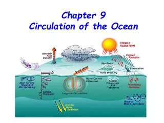
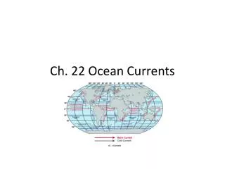
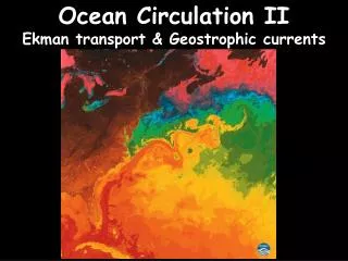
Ocean Circulation II Ekman transport & Geostrophic currents. Ocean Circulation. Surface Circulation Wind Driven Ekman Transport and Geostrophic Currents Surface layer and Picnocline zone 0 – 50,100m / 50,100m - ~1000m Affects ~25% of total water mass Fast (1-2 m/s)

E N D
Ocean Circulation II Ekman transport & Geostrophic currents
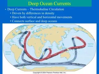
Ocean Circulation • Surface Circulation Wind Driven • Ekman Transport and Geostrophic Currents • Surface layer and Picnocline zone • 0 – 50,100m / 50,100m - ~1000m • Affects ~25% of total water mass • Fast (1-2 m/s) • Deep Circulation Density Driven • Thermohaline Circulation • Below Picnocline zone (>~1000m) • Affects ~75% of total water mass • Slow (~ m/day)
Surface Ocean Circulation • Ekman Spiral • Geostrophic Currents • Open Ocean Currents • Global Surface Circulation
Ekman Spiral • 45o surface transport offset • 90o net water transport • Stronger winds cause deeper water movement • Wind 10 m/s 50 – 100 m watercolumn • Wind 20 m/s 100 – 200 m watercolumn
Consequences of Ekman Transport • Ekman affects picnocline layer • Coastal Upwelling • Cold surface water, high nutrients • High phytoplankton productivity • Great fisheries (Sahara bank, Peru) • Coastal Downwelling • Warm surface water, low nutrients • Low phytoplankton • Poor fisheries (Northern Brazil)
Pressure Gradient and Coriolis equilibrium: Geostrophic currents
Geostrophic currents Geostrophic currents follow lines of equal pressure / height
Upwelling and DownwellingConvergence and Divergence • Downwelling – Convergence • Subtropical Gyres • Sargasso Sea example of Geostrophic current • Upwelling – Divergence
Western Boundary Currents Gulf Stream, Kuroshio, Agulas currents Narrow (100 km) Deep (<2000 m) Swift (1.5 m/s) Warm High Volume (50-75 Sv) Eastern Boundary Currents California, Canary, Peru currents Broad (1000 km) Shallow (<500 m) Sluggish (0.3 m/s) Cool Low Volume (10-15 Sv) Oceanic Gyres 1 Sverdrup = 100000 m3/s
Western Boundary Current Intensification Stronger Coriolis force at higher latitudes
Western Boundary Current Intensification Subtropical Gyres displaced to the West
Gulf Stream 150 Sv 30 Sv