Transforming Map Making: The Power of Geographic Information Systems (GIS)
Geographic Information Systems (GIS) represent a groundbreaking technology in map-making and analysis, combining geographic location data with descriptive information. GIS allows users to create customizable maps by stacking and manipulating layers of spatial data. This innovative system aids in visualizing complex interrelations between data points, facilitating efficient decision-making. Applications range from optimizing emergency services to urban planning, demonstrating that GIS is a vital tool for enhancing planning, resource allocation, and real-time geographic analysis.

Transforming Map Making: The Power of Geographic Information Systems (GIS)
E N D
Presentation Transcript
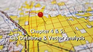
Chapter 5- GIS GIS – Geographic Information Systems- is a new mapping technology that has revolutionized map making and map analysis.
GIS are maps that you can make on a computer by stacking layers of specific geographical or spatial information. GIS allow you to remove or add layers of information to adapt the map to a particular purpose. It also has the capability of producing three-dimensional maps.
Purpose of GIS GIS has three purposes: 1. To link geographic locations to descriptive information. E.g. linking a specific address to a specific person. 2. Create maps with many different pieces of spatial information arranged in layers on top of one another. These layers can be manipulated to show how the data may be interrelated. 3. To help users analysis spatial information.
Why use a GIS • GIS can integrate and relate any data with a spatial component, regardless of the source of the data. For example, you can combine the location of mobile workers, located in real-time by GPS devices, in relation to customers' homes, located by address and derived from your customer database. GIS maps this data, giving dispatchers a visual tool to plan the best routes for mobile staff or send the closest worker to a customer. This saves tremendous time and money.
Examples of some uses GIS may impact your life • Getting 911 emergency services to your home as quickly as possible. • Planning water and sewage services for a new residential area. • Deciding if there are enough children of the specific age group to justify building or combining schools in an area.
How GIS programs work • GIS’ start with a base map. Transparent layers, each contain specific data are overlaid on the base map. The GIS combines the features of a database program with those of a drawing program.