Stream Erosion and Transport
190 likes | 544 Vues
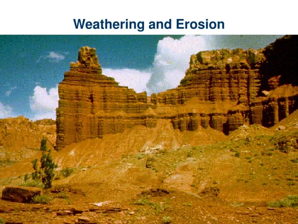
Stream Erosion and Transport. Erosion: Hydraulic action – erosion caused by the movement of water against stream sediment Abrasion – erosion caused by particles scraping and grinding the streambed How much and how large of sediment can a river carry?

Stream Erosion and Transport
E N D
Presentation Transcript
Stream Erosion and Transport Erosion: Hydraulic action – erosion caused by the movement of water against stream sediment Abrasion – erosion caused by particles scraping and grinding the streambed How much and how large of sediment can a river carry? Competence – Refers to the size of particle that at river can move (controlled by velocity) Capacity- Refers to the amount of sediment a river can carry (controlled by volume) • What part of the river is usually most competent? • What part of the river has the most capacity for sediment transport?
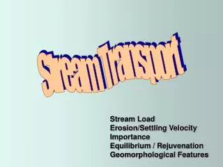
Sediment Transport in Rivers Load: Any sediment that is transported due to river flow Different Types of Load: • Suspended Load • Bed Load • Solution Load Rolling Traction Saltation
Types of Sediment • Clay • Silt • Sand • Gravel (pebbles) • Cobbles and Boulders
Watershed Dynamics • A Watershed is a catchment area for rainfall that drains into a common body of water. • Large watersheds are made up of smaller watersheds (sub-watersheds)
Drainage Systems • Drainage systems develop in such a way as to efficiently move water off the land. Each stream in a drainage system drains a certain area, called a drainage basin. • In a single drainage basin, all water falling in the basin drains into the same stream. • Drainage basins can range in size from a few km2, for small streams, to extremely large areas, such as the Mississippi River drainage basin which covers about 40% of the contiguous United States. • A divide separates each drainage basin from other drainage basins.
Drainage Patterns • Depending on the topography of an area water will drain differently through its watershed • Before any channels exists water flows over the surface in a thin film (sheet flow) • Eventually erosion begins and rills (small depressions) and gullies begin to form • These features are what will eventually evolve into streams and rivers given enough time and increased flow • The most common types of drainage patterns are illustrated on the next slide
Drainage Patterns • Dendritic drainage patterns are most common. They develop on a land surface where the underlying rock is of uniform resistance to erosion. • Radial drainage patterns develop surrounding areas of high topography where elevation drops from a central high area to surrounding low areas. • Rectangular drainage patterns develop where linear zones of weakness, such as joints or faults cause the streams to cut down along the weak areas in the rock.
Flow Dynamics • The best way to visualize how water moves through a river is in cross section • The volume of water passing any point on a stream is called the discharge. Discharge is measured in units of volume/time (m3/sec) • Cross Sectional Shape - varies with position in the stream and discharge. The deepest parts of a channel occur where the stream velocity is the highest. Both width and depth increase downstream because discharge increases downstream. As discharge increases the cross sectional shape will change, with the stream becoming deeper and wider.
Flow Dynamics • Discharge - The discharge of a stream is the amount of water passing any point in a given time. Q = A x V • Discharge (m3/sec) = Cross-sectional Area (width x average depth) (m2) x Average Velocity (m/sec)
Flow Dynamics • Where water is moving fast streams tend to be straighter (steep slopes) • Once the water slows the river becomes more sinuous and meanders across a flatter surface
Flow Dynamics • If you look at your typical Meandering stream, you will find that flow velocity is greatest near the surface directly above the deepest part of the channel • The deepest part of the channel will vary depending on the what part of the river you are observing
Flow Dynamics • If you look at your typical Meandering stream, you will find that flow velocity is greatest near the surface directly above the deepest part of the channel • The deepest part of the channel will vary depending on the what part of the river you are observing
Flow Dynamics Point Bar: The inner portion of a meander bend. More shallow due to increased deposition resulting from lower flow velocities Cut Bank: the outer portion of a meander bend. It is subject to the highest rates of a erosion due to elevated flow speeds and the deepest part of the channel
River Morphology • When a meander bend erodes far enough to cut itself off an Oxbow lake forms • If no lake forms but the dried creek bed remains a meander scar is the result
River Morphology Floodplains and Levees: • As a stream overtops its banks during a flood, the velocity of the flood will first be high, but will decrease as the water flows out over the gentle gradient of the floodplain. • Because of the sudden decrease in velocity, the coarser grained suspended sediment is deposited along the riverbank, eventually building up a natural levee. • Natural levees provide some protection from flooding because with each flood the levee is built higher and discharge must be higher for the next flood to occur.
River Morphology Alluvial Fans • When a steep mountain stream enters a flat valley, there is a sudden decrease in gradient and velocity. • Sediment transported in the stream will suddenly become deposited along the valley walls in an alluvial fan. • As the velocity of the mountain stream slows it becomes choked with sediment and breaks up into numerous distributary channels.
River Morphology Deltas: • When a stream enters a standing body of water the sudden decrease in velocity causes deposition of sediment in a deposit called a delta. • Deltas build outward from the coast, but only survive if the ocean currents are not strong enough to remove the sediment. • As the velocity of a stream decreases on entering the delta, the stream becomes choked with sediment and conditions become such that the stream breaks into many smaller streams called distributary streams.