Download
1 / 34
660 likes | 2.18k Vues
PHOTOGRAPHY INTERPRETATION AND PHOTOGRAMMETRY. Concept of Photography There are various definition of photography exposed by various scholars but all together they falls on the same perception or point of views.

E N D
PHOTOGRAPHY INTERPRETATION AND PHOTOGRAMMETRY Concept of Photography There are various definition of photography exposed by various scholars but all together they falls on the same perception or point of views. Therefore photography Can be defined as the process or art of producing images of objects on sensitized surface by the chemical action of light or of other forms of radiant energy, as x rays, gamma rays, or cosmic rays.
Cont… • is the science, art and practice of creating durable images by recording light or other electromagnetic radiation either electronically by means of an image sensor, or chemically by means of a light-sensitive material such as photographic film
Cont… • Or is a pictorial representation of remote sensed data recorded on film. Remote Sensing is the technique of obtaining information about the object through analyzing the data that are collected without being in contact/touch with that object
Cont… • The instruments used to detect or record the data without being in contact with an object are called Remote Sensors. The remote sensors include photographic cameras, mechanical scanners, Radar systems etc. Photographs are produced when cameras are used to collect data and produce pictures by the processes known as photography.
Cont… • Cameras may be mounted on the ground platform such as ladder, scaffolding, tall building, cherry picker, crane etc. or on aerial platform such as stable wing aircraft or helicopter.
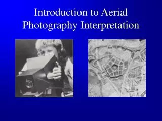
AERIAL PHOTOGRAPHY • Photographs of the earth surface that are produced by cameras mounted on an aerial platform are called aerial photographs. • Also it can be defined as a process of taking photographs of the ground from an elevated/direct-down position. Usually the camera is not supported by a ground-based structure.
Cont… • Platforms for aerial photography include fixed-wing aircraft, helicopters, • Multicolor Unmanned Aircraft Systems (UAS), balloons, blimps, rockets, pigeons, kites, parachutes, stand-alone telescoping and vehicle-mounted poles.
TYPES OF AERIAL PHOTOGRAPHY • Depending on the orientation of the camera at the time of exposure, aerial photography are classified as • Vertical Aerial Photography • Oblique Aerial Photography.
Vertical Aerial Photographs: • Vertical photographs are taken by camera pointing directly vertical to the ground (90 degrees). Since the cameras are mounted on the aircraft during the photo exposure usually there are slight angular rotations or tilts on vertical photographs -+3 degrees from vertical.
Cont… • Vertical Aerial photography presents a relatively undistorted overhead view of the landscape. • They are used and are essential for accurate mapping and interpretation. • Overlapping vertical air-photos can be viewed stereoscopically to produce a three-dimensional view of the landscape.
Oblique Aerial Photographs • Oblique photographs are taken with inclination of the camera axis to the ground. The inclination usually not exceeds 90 degrees from the vertical. • From the same altitude oblique aerial photograph capture large ground area than vertical aerial photography.
Cont… • Oblique photographs perspective views are distorted. i.e the distant object appears smaller than a similar size object in the foreground. • Oblique aerial photographs are similar to views of the ground through an aero plane window. • They are used to show specific features or supplement the vertical photographs.
Cont… • High oblique air photos show the surface, the horizon and the portion of the sky, regardless of the altitude from which they are taken. • Low oblique aerial photography shows only the surface. • Oblique aerial photography their perspectives are distorted with distant objects smaller than a similar feature in a fore ground.
USES OF AERIAL PHOTOGRAPHY Aerial photograph has two uses that are of interest within the context of this course • Cartographers and Planners take detailed measurements from aerial photos in the preparation of maps. • Trained interpreters utilize aerial photos as source of geographical data that can be used to obtain information on the earth surface about land-use, environmental conditions, earth resource and the cultural landscape among other things.
MPORTANCE OF AERIAL PHOTOGRAPHY • Aerial photographs have advantages over ground observation. These advantages include • It Improves vantage (observation) point It permits to look at a big picture in which objects of interest reside (exist). i.e objects can be seen at the same time for a large area. All observable earth surface features are recorded at the same time. Different people might extract different information from the same photography.
Cont… • Capability to stop action: Aerial photographs give us capability of stopping action view. Thus useful in studying of dynamic phenomena E.g. floods, moving wild life population, oil spills, forest fire etc.
Cont… • It Permit recording of information quickly Aerial photographs are permanent records of existing condition. Aerial photographs acquired at different times they facilitate towards depicting changes over time and records information over time.
cont… • Broadened spectrum of observation: Aerial photography can see phenomenon that the eye cannot see. Aerial photography spectrum range (UV-0.3 micron to IR-0.9 micron), Eye range –Visible spectrum (0.4-0.7). • With aerial photograph invisible energy can be detected and recorded in the form of visible image enabling to see phenomenon our eyes cannot see
Cont… • Increased spatial resolution and geometric accuracy: Viewed under magnification, we are able to observe spatial details on aerial photography than we can see with un aided eye. • With proper ground reference data we can obtain accurate measurements of position, distance, directions, areas, heights, volume and slopes from aerial photos. Most topographic maps are produced from aerial photograph measurements.
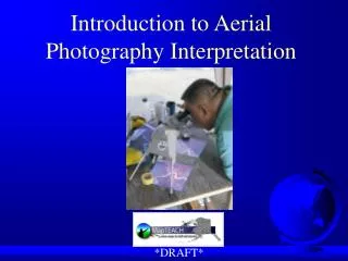
AERIAL PHOTOGRAPH INTERPRETATION • Aerial Photograph Interpretation is a process of identifying objects and conditions in aerial photographs and determining their meaning or significance.
Visual elements to be taken into account during Aerial photograph interpretation • Tone: This is the variation of colours such as dark, white, blue, green etc. or relative lightness of the same colour. • It is the fundamental element for distinguishing between different features in the photography therefore different colour shows the meaning of different features.
Cont… • Tone allows other elements such as shapes, texture and patterns of objects to be distinguished. Without tone difference, none of other visual elements could be understood. • If the colour in the photograph could be the same throughout, we could not understand the exact visualized objects/features. Tone is therefore the primary visual element.
Cont… • Shape: The shapes of features are also fundamental elements for distinguishing different objects in the photograph. It is the general form, structure, or outline of an individual objects. • Some objects are identified on the basis of their shapes such as Rectangular, round or triangular shape.
Cont… • The regular shapes such as rectangular, are indicators of human influence for example football stadium; • Straight or linear shapes represent urban areas or agricultural fields. • Irregular shapes represent natural features such as natural forest reserves, national parks etc.
Cont… • Size.This is due to the scale of the photograph itself. The scale helps to determine if the water body in the photograph is either a Pond or a Lake. One has to use the scale so as to know this. • Large buildings such as factories, suggest the presence of commercial properties and small ones indicate residential housing. This also should be measured by scale.
Cont… • Pattern: This is also an important element for distinguishing different objects in the photograph. It refers to the spatial arrangement of objects. It may be random pattern followed by unmanaged spatial areas or orderly and systematic pattern followed by spaced areas.
Cont… • Texture: This is the arrangement and frequency of tonal variations in particular areas. The impressive smoothness or roughness on the aerial photography is basically caused by texture
Cont… • Shadow: The shadow provides an idea of the profile and relative height of an object. Tall buildings will be indicated by tall or long shadows and vice versa. • The shadow eliminates interpretation where the shadow itself obscures some other objects.
Cont… • Association: This involves taking into account the relationships between other recognizable objects. Some objects are always associated with other objects. • For example Grasslands are associated with the presence of animals in an area; forests near the coast will be the mangrove forests and on the mountain, they will be called mountainous forests.
FACTORS HINDERING EFFECTIVE PHOTOGRAPHY INTERPRETATION • When viewing a two-dimensional aerial photography we lose our sense of depicted height. • Viewing objects from directly above, provides a very different perspective than what we are familiar with.
Cont… • Targets (Objects/features) in the aerial photography have different scale than scales that we are familiar with. • In the aerial photography, there are lack of recognizable details and this make the most familiar object unrecognizable in an aerial photography.
Cont… • The imaging of wavelengths outside the visible energy window is more difficult for us to comprehend. Therefore Under photography we see only the visible wavelengths and the aerial photographs contain wavelength beyond the visible spectrum but other wave lengths are not seen.
Photogrammetry • is the science of making measurements from photographs. • The output of photogrammetry is typically a map, drawing, measurement, or a 3D model of some real-world object or scene. Many of the maps we use today are created with photogrammetry and photographs taken from aircraft.
Cont… • Site: Giving the quality of the area by relating with the geographical environment. The location of objects in relation to the environment is called the site. • It is important in identifying the vegetation types, landforms and cultural features. For example Forest near the coast is the mangrove etc