Plan of the presentation 1./ The new DEM/SRTM data set available over the balkans region

Plan of the presentation 1./ The new DEM/SRTM data set available over the balkans region
E N D
Presentation Transcript
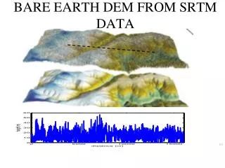
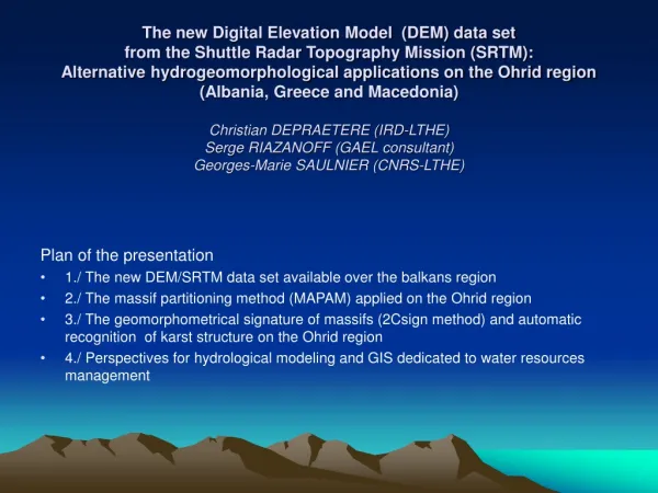
The new Digital Elevation Model (DEM) data set from the Shuttle Radar Topography Mission (SRTM): Alternative hydrogeomorphological applications on the Ohrid region (Albania, Greece and Macedonia)Christian DEPRAETERE (IRD-LTHE) Serge RIAZANOFF (GAEL consultant) Georges-Marie SAULNIER (CNRS-LTHE) Plan of the presentation • 1./ The new DEM/SRTM data set available over the balkans region • 2./ The massif partitioning method (MAPAM) applied on the Ohrid region • 3./ The geomorphometrical signature of massifs (2Csign method) and automatic recognition of karst structure on the Ohrid region • 4./ Perspectives for hydrological modeling and GIS dedicated to water resources management
1./ The new DEM/SRTM over the Ohrid region A new Digital Elevation Model data set (DEM) from the Shuttle Radar Topography Mission (SRTM) at 3 arc-sec resolution had become available at no cost for the Balkanic region from november 2003.
1./ The new DEM/SRTM over the Ohrid region The rationale of this paper focuses on the specific geomorphometry approach with two types of predefined morphological unit : catchment basins and massifs. The choice of catchment basin is obvious for hydrology as a functional unit. Massifs are not so commonly used despite the fact that they constitute the logical complementary element of the previous. They are also suitable for morpho structural partition of the land surface as we will see in this presentation.
2./ The massif partitioning and merging method (MAPAM) applied on the Ohrid region MAPAM is exemplified on the Gorenichka massif located at the north of the Ohrid lake At the initial step (Step 0), the region is partitioned into 69 small massifs associated with the same number of summits. In this case, the entire massif is aggregated after 2 steps of merging. Beyond step 2, the Gorenichka massif is merged with one of its neighbours.
2./ The massif partitioning method (MAPAM) applied on the Ohrid region MAPAM is exemplified on the Gorenichka massif located at the north of the Ohrid lake At the initial step (Step 0), the region is partitioned into 69 small massifs associated with the same number of summits. In this case, the entire massif is aggregated after 2 steps of merging. Beyond step 2, the Gorenichka massif is merged with one of its neighbours.
2./ The massif partitioning method (MAPAM) applied on the Ohrid region An index of massif pertinence Imassif is defined and calculated at each step of merging When this index tends to 1, it means that the elevation of the highest saddle point is close to the minimum elevation and reflect the fact that the massif is clearly topographical disconnected from its neighbours. The index of massif will be used to select the optimal massif partition whatever step considered.
Plan versus profile convexities combination as defined by Ruhe (1975) 3./ The geomorphometrical signature of massifs (2Csign method) and automatic recognition of karst structure on the Ohrid region The difference of signature is mainly related to the concave/convex properties of landforms especially around talweg and crest lines. To quantify this difference, plan and profile convexities will be considered in this explorative phase. The combination of those two types of convexities makes a set of landforms as defined by Ruhe (1975)
3./ The geomorphometrical signature of massifs (2Csign method) and automatic recognition of karst structure on the Ohrid region
4./ Perspectives for hydrological modeling and GIS dedicated to water resources management This presentation demonstrate the limitation and the potential of the newly available DEM/SRTM for analysis of hydrogeomorphometric signature. This approach is at the intersections of hydrology and geomorphology. It leads to a closer link between landform signature and hydrological processes. Methods such as MAPAM combined with C2SIGN can help to overcome the recurrent problem of hydrologically pertinent and robust partition of the geological land surface for water resource modelling.
Massif partitioning: a long historical tradition Reverse side of tetradrachm coin representing the pattern of major massifs of the region of Ephesus (issued between 336 and 334 BC to pay the persian army) The same region as depicted by the DEM/SRTM in 2004 Thank you…