Monitoring and Evaluation
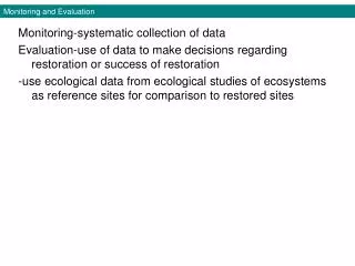
Monitoring and Evaluation. Monitoring-systematic collection of data Evaluation-use of data to make decisions regarding restoration or success of restoration -use ecological data from ecological studies of ecosystems as reference sites for comparison to restored sites. Adaptive Management.

Monitoring and Evaluation
E N D
Presentation Transcript
Monitoring and Evaluation • Monitoring-systematic collection of data • Evaluation-use of data to make decisions regarding restoration or success of restoration • -use ecological data from ecological studies of ecosystems as reference sites for comparison to restored sites
Adaptive Management • Educators have defined evaluations called formative and summative assessments and most of the evaluation that has been done in restoration ecology would be summative • Summative evaluation involves completion criteria or performance standards Table 5.1 Examples of Mine site restoration in Finland • Formative assessments are more difficult to conduct but has become important in recent years as a type of recurrent decision making based on site-specific feedback called adaptive management Fig. 5.1
Adaptive Management • Ex. Tidal Marshes • -for many projects, the initial monitoring in adaptive management is driven by a comparison between the original plan and the outcome Fig. 5.2 • -Sweetwater Marsh, a restoration of a salt marsh in San Diego restored to mitigate loss of wetlands and endangered species habitat caused by highway construction and flood control projects required yearly monitoring and assessment of goals including one, which was the establishment of five patches of endangered salt marsh bird’s beak Fig. 5.3 • -monitoring revealed flowering but no seed production and further research indicated that ground-nesting beetles were needed for pollination, so the plant was introduced at other sites that had beetles
Figure 5.2 A comparison of the proposed (A) and “as-built” (B) topography of a hypothetical restored tidal wetland. The As built has less inundated topography and may need more work
Figure 5.3 The salt-marsh bird’s beak, a hemiparasitic annual plant, had been extirpated from Sweetwater marsh and reintroduced in the 1980s mitigation project
Choosing Monitoring Parameters • Parameter-property whose measures determine the characteristics or behavior of something • Ex. Secchi disk readings are a commonly measured parameter for detecting change in water clarity in aquatic ecosystems Fig. 5.4 • Table 5.2 lists some desirable characteristics for monitoring parameters
Monitoring Protocols- Data collection methods • -data collection protocols form the instruction manual for the monitoring plan • -detailed descriptions are needed for two reasons: • Insure all observers collect data with minimal deviation • Those evaluating the data understand the nature of the information • -if possible use standard methods that have emerged from research and practices in ecology and population biology
Figure 5.7 Environmental staff inspecting revegetation on a mined land rehabilitation site in the jarrah forests of Western Australia
Monitoring Protocols- Spatial issues • -some parameters related to small populations of plants or animals can be monitored by recording observations of all individuals=census • -most parameters are estimated from samples taken at selected locations • -parameters that can be directly observed lend themselves to monitoring relatively large areas Ex. Species composition of birds or plants in an ecosystem using comprehensive censuses, along transects, or in plots • -some parameters may be sampled at strategic locations like animal watering holes or attractants like bait or light Fig. 5.8
Figure 5.8 Scientists sample night-flying insects from a broad area by using a light to attract them to a single place
Monitoring Protocols- Spatial issues • -in large areas, multiple samples are often needed and use 4 sampling schemes: • -grids were used at 1-2 meter intervals with interpolation and mapping of elevation to determine balance in erosion and sedimentation at Provo River restoration in Utah Fig. 5.10
Figure 5.9 Alternative sampling schemes for an oil pad restoration site on Alaska’s North Slope
Figure 5.10 Change in channel elevation due to sediment losses and gains during a prescribed flooding event on the Provo River
Monitoring Protocols- Spatial issues • How many sampling points or plots are needed to reliably represent an area? • -depends on variance-degree of dispersion of data points from mean • < variance= < sampling and > variance = > sampling Fig. 5.11 • -variance may change through time in restored ecosystems and consistent sampling at established stations provides the greatest sensitivity to changes over time and marking corners of plots with permanent markers allows observers to return to exactly the same site Fig. 5.12
Figure 5.11 These two sites have the same average number of individuals per microsite, but a very different variance.High variance requires more sampling to obtain accurate estimates
Figure 5.12 Markers to relocate sampling sites for long-term monitoring must be durable; it helps if they are visible, as well
Interpreting Monitoring Data- Comparisons to reference sites • -interpreting monitoring data often involves comparisons to reference sites near the restoration • -data from reference sites can also come from published literature or publicly available reports • Ex. Jarrah Forest in Australia restored after bauxite mining relied on comparisons to both nearby reference sites and sites from the published literature. Comparisons to the reference site (control) forest for mites sensitive to environmental factors like pH and soil moisture were used to compare pit restorations of different ages Table 5.3
Interpreting Monitoring Data- Data analysis • -modest monitoring projects yield large amounts of data • -must determine the likelihood that the differences observed in parameters is due to the restoration and not just due to chance or causes other than the restoration actions=Difference is statistically significant. • -use various statistical tests to compare parameters • Ex. At Neal Smith National Wildlife Refuge in Iowa, scientists observed an increase in soil organic carbon content over time after reestablishment of native tall grass prairie vegetation. It was lower than at reference sites but the regression analysis indicated that the increase over time was statistically significant Fig. 5.13 • Ex. Before-After-Control-Impact analysis can be used to determine if parameters have changed in response to an action by comparing values before and after the action Fig. 5.14
Figure 5.13 Changes in soil organic carbon content over a 14-year period in a restored tallgrass prairie (Case K)
Figure 5.14 Before–After–Control–Impact (design) analysis can be used to compare restored ecosystems with intact reference sites
Interpreting Monitoring Data- Using data for decision making • Decision tree-graphic representation of potential restoration decisions in which alternatives are dichotomous branches in the tree, each branch corresponding to a range of conditions that might occur in one or more parameters • Ex. Decision tree developed for prioritizing sites for control of introduced, invasive salt cedar on the Dolores River in the southwestern USA Figs. 5.15-5.16
Figure 5.15 Restorationists are working to reverse the spread of an introduced woody plant, Tamarix spp., in the floodplain of the Dolores River, Colorado and sites for restoration were prioritized with a decision tree
Figure 5.16 Decision tree for prioritizing sites for tamarisk control on the Dolores River, Colorado area, and logical extension of previous projects
Managing Project Records and Monitoring Data Sets- Case histories • Case history- the record of actions and changes to restoration sites or recovering populations • -complete case histories contain four kinds of information
Managing Project Records and Monitoring Data Sets- Data management • Data must be managed so that it is high quality and complete. Errors include: • -monitoring plans should include procedures to minimize these errors and make data available to current and future researchers Ex. BP’s environmental team maintains restoration of oil and gas resource areas in Alaska using a simple GIS map with links to sites that when opened contain site maps, plans, and progress reports