Download
1 / 24
250 likes | 488 Vues
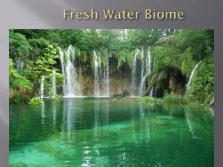
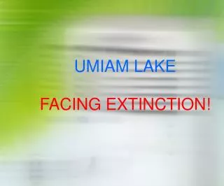
UMIAM LAKE FACING EXTINCTION!. Umiam Lake - Snippets. Reservoir of Umiam Hydel Project – Stage I. Commissioned in 1965 – Ist Hydel Project of NE. Area –10.27 sq km; Area of catchment –220 sq km

E N D
Umiam Lake - Snippets • Reservoir of Umiam Hydel Project – Stage I. • Commissioned in 1965 – Ist Hydel Project of NE. • Area –10.27 sq km; Area of catchment –220 sq km • Engineering marvel with life span till 2115 faces extinction within 2040 if present ecological impingement continues unabated. • Immense tourism potential besides power generation remains to be harnessed.
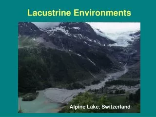
FACTORS ENDANGERING LIFE OF LAKE. • Colossal flow of the following from catchments: • Sediment & Silt. • Sewage. • Solid Waste. • Multiple pollutants. • Rise of lake bed level due to enormous deposit of above materials reducing volume of water holding capacity. • What causes such inflow into the lake: • Topographical location – valley; surrounded by hilly catchments. • Extensive ecological degradation including loss of forest cover in catchments made soil totally vulnerable to erosion & displacement. • Multiple network of streams originating & flowing through catchments discharge into Wah Umkhrah or Umshyrpi which join with Wah Roro & finally drain into the lake.
What reveals the grim scenario! • Hydrographic survey • Water quality analysis • Situation analysis & assessment study of lake catchments. • Sediment flow rate data.
Factors responsible for denigration of catchments: • Hilly terrain with deep gorges & ravines. • Extensive loss of forest cover rendering vast stretches into “open” land exposed to severe erosion leading to destabilization of soil profile & structure. • Population growth and human activities like deforestation; diverse land use pattern; faulty cultivation; lack of soil & water conservation; random mining & quarrying; unplanned development of road, buildings et al.
Is the situation beyond salvage?Grim! But not yet if we act now. • Implement tangible remedial & preventive measures simultaneously. • Multi pronged approach both short & long term. • Administrative measures & enactment of relevant prohibitive Acts & invoking existing ones with diligence. • People’s participation through mass awareness & sensitization campaign.
Interventions ~ • Holistic Action Plan for reclamation & rehabilitation of catchments: Massive afforestation programme – all other measures incidental & essential with depletion of this cover. • Extensive soil conservation measures with focus to check run-off & haphazard movement of water to the lake. • Stream management strategy to check silting of such seasonal / perennial drainage channels; reducing flooding & maintaining optimal capacity to canalize storm water. • Essence of rehabilitation need to be based on National River Conservation Plan & National Lake Conservation Plan. • Regulate inflow into Lake.
A viable cyclic technology for treatment of sewage, effluent & other pollutants and regulating sediment, plastic, paper et al in waste water including tertiary treatment before transfer is allowed into the lake. • An alternative route for sewage transfer avoiding the lake. • Dredging & Excavation – most effective mechanism to remove huge silt and other contaminant deposit. • Plug possible seepage points evident in reservoir revealed from down stream discharge study. • Engineering structures as ancillary preventive measures. • Remedial measures primarily desiltation techniques like flushing, density current venting, sluicing et al is imperative.
RESERVOIRS – Meant for ~ • FLOOD CONTROL • IRRIGATION • DRINKING WATER • HYDROPOWER • INDUSTRIAL Endangered by Sedimentation
RESERVOIR SEDIMENTATION PROBLEM • STORAGE CAPACITY LOSS • DECREASE OF LIFE TIME
SEDIMENTATION FACTORS • RESERVOIR SHAPE • SEDIMENT CHARACTERISTICS • RESERVOIR OPERATION • SEDIMENT/ RESERVOIR VOLUME RATIO • INFLOW CAPACITYRELATIONSHIP
Reservoir Level DAM Streambed Delta formation Area Bottom Deposit Area Back Water Area DEPOSIT AREA
Flood control space Conservation Storage Inactive Storage Dead Storage Outlet STAGE: II
Flood control space Conservation Storage Inactive Storage Dead Storage Outlet STAGE: III
Flood control space Conservation Storage Inactive Storage Dead Storage Outlet STAGE: IV
STAGE: V Flood control space Conservation Storage Inactive Storage Dead Storage Outlet
BACKWATER DEPOSIT CHARACTERISTICS • COARSE SAND & GRAVEL • UPSTREAM DEPOSIT ABOVE RESERVOIR LEVEL • DEPOSIT GROWS UPSTREAM & RESERVOIR • POSSIBLE EROSION DURING HIGH POOL WATER LEVEL
BOTTOM DEPOSIT CHARACTERISTICS • SILT & CLAY • TRANSPORTED BEYOND DELTA • SEDIMENTATION CLOSE TO DAM • RESERVOIR TURBIDITY
Flood control space Conservation Storage WATER & SEDIMENT Inactive Storage Dead Storage Outlet SLUICE OPEN – RAINY SEASON FLUSHING
SEDIMENT DIVERSION BYPASS PIPELINE Outlet HYDROSUCTION BYPASSING
DYKE CUM ROAD FOR MACHINERY AREA CLOSED BY DYKES & DRIED FOR EXCAVATION SEGMENTATION & DRY EXCAVATION
DREDGING • Material • Process • Dredger types • Disposal
. Thank You.