Bering Land Bridge: Beringia
240 likes | 1.4k Vues
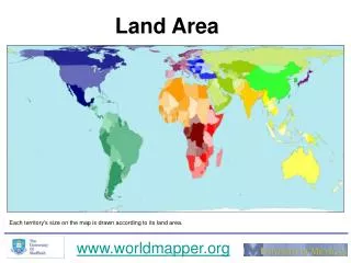
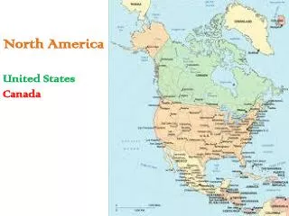
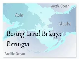
Bering Land Bridge: Beringia. Where is it?. It was located where the Bering Strait is today, between Russia and North America. The Bering Strait is the water way that separates Russia from North America.

Bering Land Bridge: Beringia
E N D
Presentation Transcript
Where is it? • It was located where the Bering Strait is today, between Russia and North America. • The Bering Strait is the water way that separates Russia from North America. • Under it lies a submerged landmass that once connected Asia with North America; called Beringia or the Bering Land Bridge.
How was it formed? • During the Ice Age changes in climate caused the formation of huge amounts of ice made from the surrounding seas. • This freezing caused the sea levels to fall and coastlines to change. • During this time a 12-mile wide, 1000 mile long “land bridge” formed (Beringa), approximately 40,000 B.C. to 10,000 B.C.
Geography • During cycles of global cooling, such as the most recent ice age, enough sea water became concentrated in the ice caps of the Arctic and Antarctic that the subsequent drop in sea levels exposed shallow sea floors.
People • The Earliest Americans crossed the Arctic Ocean from Asia to North America during the Ice Age. • Around 11,000 B.C. to 9,000 B.C., Native Americans walked across the land bridge and slowly migrated south establishing three of our earliest distinct cultures: the Inuits, the Anasazi, and the Mound Builders.
Where did it go? • At the end of the Ice Age (approx. 10,000 B.C.) temperatures began to rise and ice began to melt. • Eventually the water covered the 12-mile wide land bridge that had been created by glaciers and people could no longer “walk” to America.
Where did the people go? • People chose different lifestyles based on the climate, the food sources and movement. • Some chose to stay in the north and hunt while others moved further south and eventually became farmers.
At first, Scientists found proof that the first Americans were the Clovis people— named for an archeological site located near Clovis, New Mexico and that they walked across the Bering Land Bridge and spread into what is now the United States about 13,500 years ago.
In recent years, however, researchers have unearthed many sites that appear to be pre-Clovis, some of them potentially doubling the time frame people have been in the Western Hemisphere. Look at interactive site http://www.pbs.org/wgbh/nova/stoneage/clovis.html What evidence do researchers have of pre-Clovis settlements? Those that settled in North America were deft hunters capable of bringing down massive animals while tolerating harsh environmental conditions, There is no evidence that early Americans hunted the short face bear and saber tooth cat. They did hunt Mastodon
dire wolf and peccary The giant ground sloth is just one of numerous large mammals that vanished forever as the Ice Age wound down in North America.
Stone Age Toolkit Draw (as best you can each tool) Guess what each tool was used for. 2 1 3 4 5 http://www.pbs.org/wgbh/nova/stoneage/toolkit.html http://www.pbs.org/wgbh/nova/stoneage/toolkit.html