Understanding Regional Sea Level Changes: Impacts and Predictions
Explore the factors influencing sea level changes, from ocean circulation to tectonic movements. Learn about measuring methods like tide gauges and satellite altimetry data. Discover the impacts on coastal areas, habitats, and vulnerable species due to rising sea levels, with predictions for the future. Stay informed on the challenges faced and potential solutions for adapting to changing sea levels.

Understanding Regional Sea Level Changes: Impacts and Predictions
E N D
Presentation Transcript
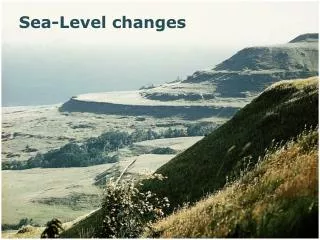
Regional Changes in Sea Level • Oceanographic factors • Ocean circulation (Atlantic Ocean vs. Gulf of Mexico) • Atmospheric pressure • Vertical land movements • Tectonics • Tectonic plates are rising and falling in different parts of the world from the weight of past glaciers (Glacial isostatic adjustment) • Subsidence and sedimentation • These changes do not alter ocean volume, but they change the shape and volume of ocean basins, affecting global mean sea level.
Measuring Sea Level: Tide Gauges • The longest running tide gauge is in San Francisco, CA dating back June 30, 1854. • The tide was measured using a float inside a stilling well. • The tide staff allowed scientists to manually measure sea level and compare it to the readings taken by the analog recording device (ADR) inside the tide house. • The tide was continually recorded using ink and a paper strip and was collected monthly. • Problems: • Recording errors • Marine fouling • Maintenance • Data processing time
Measuring Sea Level:Tide Gauges • Newer tide houses use an acoustic sounding tube to measure the tide, replacing the stilling well with a float. • Very accurate. • Minimal maintenance. • Also records wind speed and direction, water current speed and direction, air and water temperature, and barometric pressure. • Data is sent to NOAA headquarters every hour using satellite transmissions.
Satellite Altimetry Satellite altimetry data shows a rate of sea level rise at 3.3mm/year or 1.6 inches from 1st grade to 12th grade!
Impacts Already Being Felt • Flooding during high tide • Compromised flood control structures • Saltwater intrusion on drinking water sources • Well fields • Porous limestone structure (can’t build sea wall) • Movement of saltwater beneath freshwater tables • Landward migration of freshwater wetlands that may experience peat collapse along the coast • Saltwater intrusion → plant mortality → peat collapse → permanently flooded area.
Bruun Rule For every foot of sea level rise, the amount of land that is inundated ranges from an average of 100 feet in the United States to as much as 1000 feet in Florida.
Predicted Future Impacts • Flooding and coastal inundation • Loss of infrastructure • Displacement of people • Habitat and species loss
Flooding and Storm Surges • Flooding from rain storms and storm surges can overwhelm current drainage infrastructure. • Could cause serious damage to existing infrastructure.
Human Displacement • Vulnerability of People and Land Under 4 ft. • 2.4 million people • 107 towns and cities • 1.8 million acres of land • Most Vulnerable Cities: • #1 Miami • #7 Tampa
Sea Level Rise Predictions The Florida Keys and much of south Florida will be completely inundated by a rise 2.0 meters of sea level rise (about 6.5 feet).
Effects on Plants • Most plants can not tolerate saltwater of any kind. • Plants that are exposed to saltwater due to sea level rise will die and many species will become extinct. • Some plants have developed adaptations to getting rid of salt.
Plants Threatened by Sea Level Rise Johnson’s Seagrass Sea Rosemary American Toadwood Beach Sunflower Coralberry SmallflowerLilythorn
Mangroves • Red Mangrove, Black Mangrove, and White Mangrove. • Provide coastal stability • Can tolerate saline conditions of estuaries and intertidal zones, but not seawater • In some parts of Florida they cant keep up with the rate of sea level rise and they are disappearing. • Used as nurseries for fish, crustaceans, and mollusks • Roosts and rookies for coastal birds • Food source for fishes, shrimp, and claims
Effects on Animals • Habitat degradation and fragmentation • Local extinctions • Global extinctions • Human-animal conflicts
Animals Threatened By Sea Level Rise Diamondback Terrapin Peninsular Ribbon Snake Lower Keys Marsh Rabbit Key Deer Loggerhead Sea Turtle Striped Newt Florida Panther Mangrove Cuckoo Okaloosa Darter Fish Short Tailed Shrew American Crocodile Short Tailed Hawk
What Factors Make a Species Vulnerable? • Habitat inundation • Erosion of substrate • Barriers of movement • Dependence on habitat climate • Salinity tolerance • Storm surge and runoff tolerance • Biotic interactions • Dispersal ability • Variation in traits • Genetic diversity • Adaptive rate • Population Size