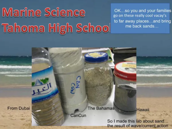
Exploring World Oceans: An Introduction to Ocean Basins and Continents
360 likes | 476 Vues
Dive into the interconnected world oceans and major ocean basins, discover the continents, and study the unique features of each ocean. Explore maps, learn about ice coverage, and understand coordinates on a globe.

Exploring World Oceans: An Introduction to Ocean Basins and Continents
E N D
Presentation Transcript
Haltom High School Aquatic Science • Unit 1 – An Introduction Joel Villegas
World Ocean • All oceans of the world are connected. • Could a ship attempting to travel through all oceans do so without being stopped? • What about ice? • The waters beneath the ice do connect the ocean basins.
Ocean Basins World’s Ocean is divided into 4 major ocean basins: • Arctic • Atlantic • Indian • Pacific There are no natural boundaries that entirely separate the 4 ocean basins. 1955 – The United Nations established the boundaries of the oceans and continents.
Aquatic Science Unit I, Section 1 Oceans and Continents
Arctic Ocean (Northern Ocean) • Smallest • Includes waters north of the North American and Eurasian continents. • It is bounded from the Pacific by the Bering Strait and from the Atlantic at about the 650 latitude (just north of Iceland). • The central part of the ocean is permanently covered in about 10 feet of ice.
Atlantic Ocean • 2nd largest and youngest • Connects the polar ocean waters • Located between the continents of North and South America, Europe, Africa and Antarctica. • Covers about 20% of the Earth's surface • Busiest shipping ocean • Crude oil and natural gas
Indian Ocean • 3rd largest ocean • It is surrounded by southern Asia, the Arabian Peninsula, Africa, the Malay Peninsula, the Sunda Islands, Australia and Antartica. • Trade route between Africa and Asia! • Petroleum extracted from Persian Gulf
Pacific Ocean • Largest • Covers approximately one-third of the earth’s surface • More surface area than all the continents combined! • The tallest mountain in the world is found in the Pacific Ocean: Mauna Kea of the Hawaiian Islands. • Earthquakes and Tsunamis common
Seas The term sea is a term of tradition and is not used consistently. Some seas are enclosed lakes. (Caspian Sea and Sea of Galilee) Some seas are partially enclosed or isolated from other sections of ocean. (Mediterranean Sea and North Sea) “The Seven Seas” and “the South Seas” are terms of ancient times or of literature and not places on maps and charts.
Seas as Enclosed Lakes Sea of Galilee Caspian Sea
Continents Large land masses There are 6 major continental land areas: • Africa • Antarctica • Australia • Eurasia • North America • South America
The 1955 United Nations agreement divided the landmasses according to political boundaries. Africa – continent bordered to the north by the Mediterranean Sea, to the west by the Atlantic Ocean, to the east by the Red Sea and the Suez Canal, and to the east-southwest by the Indian Ocean Antarctica – continent of the South Pole Australia – smallest of the continents – It is located between the Indian and Pacific Oceans.
Eurasia – a single continuous landmass that includes Europe and Asia – Asia includes Saudi Arabia and on political maps also includes Japan, Taiwan, Indonesia and the Philippines. Europe is separated from Asia by political boundaries set from the Caspian Sea north along the Ural Mountains to the Kara Sea. North America – includes Canada, U.S., Mexico and Central America down to Panama. Islands in the Arctic Ocean are included in North America on political maps. South America– includes all the countries south of Panama
ICE • Ice covers 10% of the total surface of the Earth. • 4.5% is on land • the remaining 5.5% is on the ocean’s surface
Section 2 – Maps Globes, since the earth is spherical, represent its surface features more accurately than any map. Cartographers (map makers) today can make very detailed and accurate maps of the earth using photographs from satellites and much improved data collected on earth.
Maps give a two-dimensional representation to a three-dimensional object. Even flattening the carved surface of a sphere onto a 2-dimensional surface changes the way it looks.
Types of Maps Three types of maps are used in the study of continents and ocean basins: • Homolosine maps – (refer to figure 1-1 on page 2) distorts the continents as little as possible. • equal-area maps – (refer to fig 2-1 page 8) appear as if globes were cut apart but each has an equal area • cylindrical projection map – (refer to fig 2-2 page 8) to get a “full” map the ends would be connected (most maps used in the classroom)
Section 3 Locating Points on a Globe There are two types of reference lines used to make accurate maps and to locate points or positions on globe, map or chart of the earth. They are: • Parallels of latitude • Meridians of longitude The primary reference lines are: • The equator (latitude) • The prime meridian (longitude)
The Equator, Hemisphere, Axis, and Directions The Equator is a reference line drawn around the earth halfway between the north and south poles. The earth rotates daily around the axis. The north and south poles are the points where the axis enters and exits.
The Northern Hemisphere is the half of the earth north of the equator. What continents are in the Northern hemisphere? The Southern Hemisphere is the half of the earth south of the equator. What continents are in the Southern hemisphere? *hemi = half
Parallels of latitude Latitude is the distance measured in degrees from 00 to 900 north and south of the equator. Parallels of latitude are imaginary reference lines that form complete circles around the earth parallel to the equator and each other. Every point on a parallel is the same distance from the equator.
Degrees of latitude are measured from an imaginary point at the center of the earth. Except for positions located right on the equator (00), degrees latitude are always labeled to tell whether they are north or south of the equator. Examples: Honolulu, Hawaii is on the 210 North Parallel. Sydney, Australia is located on the 340 South parallel.
Longitude Distance east and west of the Prime Meridian is measured in degrees from 00 to 1800. All meridians of longitude are given in degrees east or west of the Prime Meridian. Meridians of longitude are imaginary lines forming half circles passing from the North Pole to the South Pole.
The Prime Meridian (00), by international agreement is drawn through Greenwich, England. Examples: Washington, D.C. is on the 770 West Meridian. Rome, Italy is on the 120 East Meridian.
The International Date Line The International Date Line is an imaginary line running mostly along the 1800 meridian. Events immediately right or left of the date line are 24 hours apart. The International Date Line was adjusted to allow certain land masses to remain together in the same day.
Location Lines of latitude and longitude form a global grid system. Any point on the globe can be located by specifying its latitude and longitude. So that a point can be located more exactly, degrees are subdivided into minutes and minutes into seconds. (Minutes and seconds do not refer to time, but to parts of degrees of an angle. 10 = 60 minutes (60’) 1 minute = 60 seconds (60”)
Distance measured by marine and air navigators is in Nautical Miles. 1 nautical mile = 1.85 km (1.15 miles) (1 nautical mile – 1 minute of an arc measured along a meridian of longitude.) 1 knot – 1 nautical mile per hour