Integrated Petroleum Resource Potential and Geoscience Studies of Bowser and Sustut Basins
This project, a collaboration between the BC Ministry of Energy and Mines and the Geological Survey of Canada, focuses on the integrated assessment of petroleum resource potential and geoscience studies in the Bowser and Sustut Basins of Northern British Columbia. The initiative aims to engage and educate local communities, attract private investment, reduce exploration risk, and enhance employment opportunities. The project involves biostratigraphic studies, geochronology, thermal maturity assessments, and extensive mapping and data analysis over a four-year period, with significant participation from academic institutions and resource companies.

Integrated Petroleum Resource Potential and Geoscience Studies of Bowser and Sustut Basins
E N D
Presentation Transcript
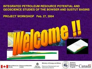
INTEGRATED PETROLEUM RESOURCE POTENTIAL AND GEOSCIENCE STUDIES OF THE BOWSER AND SUSTUT BASINS PROJECT WORKSHOP Feb. 27, 2004 Welcome !! energy resource studies... mapping... basin analysis... structural analysis... Northern Resource Development Program Natural Resources Canada Ressources Naturelles Canada CAE Feb27/04
INTEGRATED PETROLEUM RESOURCE POTENTIAL AND GEOSCIENCE STUDIES OF THE BOWSER AND SUSTUT BASINS Project Overview A joint program undertaken by the Resource Development and Geoscience Branch of the B.C. Ministry of Energy and Mines, and the Northern Resource Development Program of the Geological Survey of Canada (Natural Resources Canada) Current collaborators: Simon Fraser University, Gitcorp GOALS: -engage and educate northerners in geoscience -attract private sector investment to this frontier region -reduce exploration risk -increase employment opportunities for northerners. Bowser Basin N.E. British Columbia CAE Feb27/04
INTEGRATED PETROLEUM RESOURCE POTENTIAL AND GEOSCIENCE STUDIES OF THE BOWSER AND SUSTUT BASINS Project Overview Research and technical team J.Ryan (GSC) Poulton (GSC) Sweet (GSC) Chen (GSC) Fowler (GSC) Turner (GSC)Mate (GSC) Baker (GSC) Wagner (ESS) Quat (GSC) Joseph (GSC) Ritcey (GSC) Evenchick (GSC) Ferri (BCMEM) McMechan (GSC) Osadetz (GSC) Stasiuk (GSC) Wilson (GSC) Hannigan (GSC) Enkin (GSC) Lowe (GSC) Snyder (GSC) McNicoll (GSC) B.Ryan (BCMEM) Mustard (SFU) GOAL: attract private sector investment to this frontier region / reduce exploration risk / increase employment opportunities for northerners. BY:providing relevant geoscience framework and data for understanding energy resource potential; communication/publication (activities shown below) TIME:4 years, starting April 1, 2003. WHO:Joint GSC / BC MEM project, SFU, Gitcorp Biostratigraphic studies Petroleum resource studies and assessment INTEGRATED GEOSCIENCE FRAMEWORK / PETROLEUM ASSESSMENT Geochronology / isotopic studies Potential Field studies Stratigraphic/structural framework Paleomagnetic studies Outreach Seismic interpretation GIS, map production, database, and information management Community communication Thermochronology studies CAE Feb27/04
Revised Thermal Maturity Model And Indications For Effective Petroleum Systems Relative prospectivity based on thermal maturity Thermal maturity pre-2002: a largely unknown picture, but assumed to be bleak Thermal maturity July 2002: new data release thoroughly revises perceptions of prospectivity Complicated patterns of thermal maturation and maximum temperatures indicate that large areas of the Bowser Basin are in the oil and gas windows. from GSC/BCMEM Open File 4343 CAE Feb27/04
REGIONAL GEOLOGICAL FRAMEWORK - location • north-central British Columbia • in Intermontane Belt of the Canadian Cordillera, a region of low metamorphic grade relative to the bounding Omineca Belt (metamorphic) and Coast Belt (plutonic and metamorphic • overlies Stikine Terrane (Stikinia), a terrane allochthonous to the North American margin prior to deposition of Bowser and Sustut basin strata • Stikinia and overlap basins are separated from certain North American rocks by oceanic Cache Creek terrane CAE Feb27/04