Meteorology
Meteorology. Subject List. Basic Weather- METARs, TAFs, Ect Temperature, Pressure & Winds Atmospheric Moisture, Fog & Clouds Air Masses & Frontal Systems Thunderstorms, Icing & Windshear High Altitude Weather . METARS, TAF’S, ect. Reports, Symbols & Forecasts.

Meteorology
E N D
Presentation Transcript
Subject List • Basic Weather- METARs, TAFs, Ect • Temperature, Pressure & Winds • Atmospheric Moisture, Fog & Clouds • Air Masses & Frontal Systems • Thunderstorms, Icing & Windshear • High Altitude Weather
METARS, TAF’S, ect • Reports, Symbols & Forecasts
METAR • Aviation Routine Weather Report • Issued by the National Weather Service to determine the flying category- VFR, MVR, or IRF • 2 Types: METAR and aviation selected special weather report (SPECI) • Standard METAR: observed hourly between 45 min after the hour till the hour and transmitted between 50 minutes after the hour till the hour. • SPECI: non-routine aviation weather report taken when any of the SPECI criteria are listed (see slide 8) • Used to produce the Aviation Terminal Forecast (TAF) • Reports weather phenomena within 5-10sm of the airport
SPECI • Issued when there is a significant weather change during the interim period between reports • Issued immediately • The following displays guidelines for an issuance of a SPECI
REMARKS [RMK] • Follows the altimeter in the body and precedes the actual remark. • Time entries will be shown as min past the hour if the time reported occurs during the same hour of the observation • Phenomena • within 5sm of the point of observation will be reported as at the station • between 5 and 10 sm will be reported as in the vicinity, VC • >10 sm will be shown as distant, DSNT • Direction will be indicated by eight points of the compass (i.e. N, NE, E, SE, S, SW, W, NW) • The following displays guidelines for an issuance of a SPECI
TAF • Terminal Area Forecast • Concise statement of expected meteorological conditions within a 5 sm radius from center of an airport’s runway complex • Issued for a 30 hour period • Issued 4 times a day at 6 hour intervals • (0000, 0600,1200,1800) • Forecasts Wind, Visibility, Significant weather, sky conditions, nonconvective low-level wind shear, change indicators and probability forecast
TAF- Note the extended time • KJFK 071722Z 0718/0824 18012KT P6SM SCT025 BKN050CB TEMPO 0718/0722 3SM SHRA BR BKN025 FM072200 21010KT P6SM VCSH SCT015 BKN050CB FM080200 23004KT 2SM BR OVC006 FM080500 VRB04KT 1SM BR OVC002 FM081100 24006KT 5SM BR SCT002 BKN100 FM081400 21011KT P6SM SCT040 BKN080 FM081800 17014KT P6SM SCT040 BKN100
Surface Analysis Charts • Computer-generated chart • Transmitted every 3 hrs • Provides overall picture of pressure systems, fronts, and observations from a number of reporting stations • A legend is printed on each chart stating its name, valid date and valid time
Temperature Temperature is the measurement of heat • Fahrenheit • Celsius • Kelvin • Rankine
C=5/9(F-32) • F=9/5(C=32) or “Double it and add 30” • The 2 degree F lapse rate is an average only • Temp-Inversions commonly occur near the ground on cool clear nights or a warm front over running a cold front
Temperature and Wind • High temperatures affect aircraft performance, e.g., a 100(F) day in Denver, elev. 5280’, can raise density altitude over 10,000’ • Diurnal & topographic temperature variations create local winds, e.g., shore winds
Pressure • Pressure: the force per unit area exerted by the weight of the atmosphere • 14.7 PSI • 29.92” • 1013mb • Decreases at 1”/1000ft the first few thousand feet above sea level, them diminishes
The relationship between pressure and temperature pV=nRT • The Ideal Gas Law… • P is absolute pressure of gas • V is the volume of the gas • n number of moles • R is the universal gas constant • T is absolute temperature
Winds • Differences in temperature create differences in pressure • -Drake Passage • -Hood River, Oregon • -Boulder, Colorado
Wind Origins • Convection-Two surfaces heating unequally • Pressure Gradient Force-Air moving across isobars, • Coriolis Force, employs Newton’s First Law to Pressure Gradient Force through the earth’s rotation. This leads to the prevailing Easterlies flowing from the North Pole and leveling at 60 degrees. The prevailing Westerlies flow from the Equator and level at 30 degrees.
Land, Water and Wind • Large bodies of water such as oceans and large lakes add water vapor to the air. Expect the greatest frequency of low ceiling, fog and precipitation in areas where prevailing winds have an over-water trajectory, especially when winds blow upslope.
Atmospheric Moisture, Fog & Clouds St. John’s Fog
Humidity & Dew Point • Absolute Humidity: A measure of the actual amount of water vapor (moisture) in the air, regardless of air temperature. The higher the amount of water vapor, the higher the absolute humidity. [expressed as grams of water vapor per cubic meter volume of air] • Relative Humidity (RH): Measures water vapor in the air, but RELATIVE to the air temp.[indicated as a %] • Dewpoint: This is referred to as the temperature at which the air must be cooled in order for that air to be saturated. It provides a measure of the actual amount of water vapor in the air.
While dewpoint gives a quick idea of moisture content in the air, relative humidity does not since the humidity is relative to the air temp. The actual air temperature must be known as well. • When RH=100%... Maximum amount of moisture is in the air at that temperature. Air must rise at a sufficient rate to enhance condensation of water vapor into liquid water droplets or ice crystals and to promote growth of water droplets. This growth is known as “collision-calescence.” When this occurs the droplets fuse together.
Therefore……. • When temperature rises above the standard temp for the locality, the density of the air in that locality is reduced and the density altitude increases. Aircraft aerodynamic performance and engine horsepower output both decrease. Check aircraft performance
FogIf you can’t see, you can’t see…. • Radiation Fog is shallow fog that occurs on cool calm nights with a small temperature-dew point spread (high relative humidity) and forms at night or near dawn. It results from terrestrial cooling. Restricted to land because water surfaces cool little from nighttime radiation. • Advection Fog forms when warm moist air moves over colder ground or water. Most often seen in coastal areas, but can sometimes be found inland. Commonly found in Southern California in Springtime and the Gulf Coast in Winter.
More fog.. • Upslope Fog: forms when moist, stable air being cooled adiabatically as it moves up sloping terrain. Once the upslope wind ceases, the fog dissipates. It is common along eastern slopes of the Rockies. Quite dense and extends to high altitudes. • Precipitation Fog: occurs when warm rain falls through cool air. Evaporation from the rain saturates the cool air and forms fog • Ice Fog occurs in cold weather when the temperature is far below freezing and water vapor sublimates directly into ice crystals. Typically temperatures -25F or colder are required.
High • Composed entirely of ice crystals, ranging from 16,500-45,000’ • Cirrus • Cirrocumulus • Cirrostratus
Middle • Primarily water, much of which is supercooled, ranging from 6,500 to 23,000’ • Altostratus • Altocumulus • Nimbostratus
Low Clouds Low clouds are almost entirely water, but may be supercooled. At subfreezing temperatures can contain snow & ice particles
Clouds with vertical development • Usually contain supercooled water above the freezing but the upper parts can freeze into ice crystals • Towering cumulus • Cumulonimbus
Air Masses & Frontal Systems • AIRMASSWhen a body of air comes to rest or moves slowly over an extensive area having fairly uniform properties of temperature and moisture, the air takes on these properties, becoming somewhat of an entity.
Modification • An air mass tends to further take on properties of underlying surface when it moves away from it’s origin • Warming from below • Cooling from below • Adding water vapor • Subtract water vapor • They can have stable or unstable characteristics
Fronts • A front is the meeting zone of two air masses • Cold Front • Warm Front • Stationary Front • OccludedFronts…when one front catches up with another, usually a cold catching a warm
Frontolysis & Frontogenesis • Frontogenesis is the dissipation of adjacent air masses as temperatures and pressures equalize across a front. • Frontogenesis is the generation of a front when relatively sharp zone of transition develops between two air masses as they contrast.
Dew Point Front (Dry Line) • Common in West Texas and New Mexico where Gulf Air abuts dry air from the Southwest with little air mass contrast. Low level clouds develop east, the west is dry. This often spawns squall lines and tornados
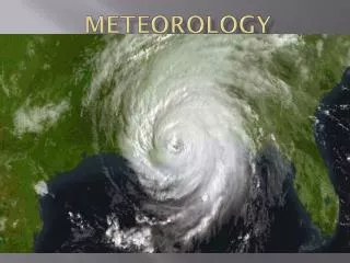
Thunderstorms, Icing & Wind Shear Not good for business
Recipe for aThunderstorm: • Sufficient water vapor • Unstable lapse rate • Initial upward boost (Lifting) Lifting comes from: Surface heating Converging winds Sloping terrain Frontal surface or…any combination
Thunderstorm Stages Dissipating Mature Cumulus
So what exactly is going on? • Cumulus Stage- warm, moist air rises in a buoyant plume or in a series of convective updrafts. A cloud then forms when the air becomes saturated, and the cloud begins to grow.The warm air rises, more water vapor condenses, thus releasing the latent heat of vaporization. The heat causes convection which causes the buoyant air to grow faster. The cloud edges during this stage are distinct. At this point the cloud is composed primarily of water droplets. The cloud grows up past the freezing level where supercooled water droplets and ice crystals form.
Mature Stage: This consists of both updrafts and downdrafts within the cloud. Downdrafts are created by the falling precipitation. The cold air descending will often reach the ground before the precipitation. Cloud to ground lightning usually begins when the precipitation first falls from the cloud. The top of the cloud flattens out forming the anvil shape that one can see from afar.