NOAA Ecological Forecasting Roadmap
170 likes | 317 Vues
NOAA Ecological Forecasting Roadmap. Allison Allen NOAA Ecological Forecasting Roadmap Portfolio Manager August 6, 2014. What Are Ecological Forecasts?.

NOAA Ecological Forecasting Roadmap
E N D
Presentation Transcript
NOAA Ecological Forecasting Roadmap Allison Allen NOAA Ecological Forecasting Roadmap Portfolio Manager August 6, 2014
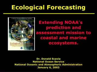
What Are Ecological Forecasts? • Ecological forecasts predict likely changes in ecosystems in response to environmental drivers and resulting impacts to people, economies and communities. • Ecological forecasts provide early warnings of the possible effects of ecosystem changes (e.g., harmful algal blooms, hypoxia, etc.) on coastal systems and human well-being with sufficient lead time to allow for corrective or mitigative actions.
Why is Ecological Forecasting Important? • Oceans and coasts are constantly changing • Aids scientists to determine environmental conditions • Allows policy-makers to make informed decisions locally, regionally, or for the coast • Helps decision-makers respond to natural and man-made disasters, such as chemical run-off and oil spills
NOAA’s Ecological Forecasting Roadmap: What we will achieve • Strong science to enable delivery of forecasts • Delivery of more products and services building on existing NOAA and partner capacity • Delivery of more consistent, efficient, reliable, and national forecasts (tailored to region-specific needs)
NOAA Ecological Forecasting Roadmap Structure and Priorities Focus Areas: HABs, Hypoxia, Pathogens, Habitat/Species Distribution • Selected based on • relative maturity and potential readiness to transition to operations • Nation-wide applicability to NOAA’s core missions • well-identified needs with strong, interested constituencies
Key Principles • Partnerships are essential • Priorities are driven by customer/stakeholder needs, values, and uses • Using a One-NOAA approach integrates efforts across disciplinary and jurisdictional boundaries • Supporting a full continuum of ecological forecasts • National in scope but regional in delivery and specificity
Forecasts Under Development HAB: • West Florida Shelf (operational) • Texas (operational) • Lake Erie (demo/experimental) • Gulf of Maine (demo/experimental) • Puget Sound (demo/experimental) • Washington Coast (demo/experimental) • California (future) • Chesapeake Bay (future) Hypoxia: • Gulf of Mexico (demo/experimental) • Chesapeake Bay (demo/experimental) • Puget Sound (demo/experimental) Pathogens: • Chesapeake Bay (demo/experimental) • Delaware Bay (demo/experimental) • Tampa Bay (demo/experimental) • Gulf of Mexico (future, location may change)
Leveraging Core Infrastructure • Environmental Intelligence Network • Coastal and meteorological observations • Modeling Backbone • NWS/NCEP high performance computing • Shared coastal modeling development and community modeling testbed • Integrated product delivery • AWIPS • GIS technology • NOAA Platforms
EFR HAB Goals • Develop a standardized and modular data integration for analysis, production and dissemination of HAB forecasts on a national scale • Ensure maintenance of existing operational HAB Forecasts, and improve through validation and refinement; • Transition existing HAB forecasts from R&D and demo phases to operations; • operational forecasts in Gulf of Maine, Gulf of Mexico (FL, TX), Chesapeake Bay, Lake Erie, PNW, California; • Progress towards establishing operational systems in NY (Long Island Sound), Alaska, Caribbean, other regions • Capacity for National Forecast and Early Warning for Event Response to HABs • Build national infrastructure to support HAB forecast system, including advancing HAB detection capabilities
Operational HAB Bulletins • NOS HAB-OFS issues operational HAB forecast bulletins for southwest FL and TX, based on • NOS OFS forecasts of current • NESDIS ocean color • NWS wind forecasts • observations (NWS NDBC & local partners) • public health & life guard reports • Disseminated to coastal managers via subscriber listserve
Hypoxia Ecological Forecasting Roadmap Elements • Evaluation of monitoring/observation needs and new technologies (Gulf Hypoxia Monitoring Plan, glider workshop, Spring 2013) • Evaluation of data management, synthesis and visualization needs • Linking NWS river forecasting with seasonal hypoxia prediction to extend forecasting window (qualitative implemented in 2012 & 2013) • Long-term action: Integrate nutrient-based models (water quality management) with living resource models (fisheries management) • Build from Gulf of Mexico to national capabilities • Further evaluation of user needs for ecosystem mgmt. and short-term forecasts
A National scale pathogen ecoforecasting system • Approach: • Predictive Vibrio algorithms • NOAA’s regional hydrodynamic operational forecasting system (OFS) • Priorities: • Validate and maintain hydrodynamic model accuracy • Temperature and salinity observations • Vibrio samples • Improve predictive algorithms for Vibrio
Open sourced community based system – either FVCOM or ROMS Must be compatible with latest release of model software code Grid should extend upstream to head of tide or ocean based navigation Ocean open boundary should allow for forcing from NWS/NCEP ocean models Highly resolve navigational channels (100 meters or less) Nested subgrids and wetting/drying accepted Hindcast simulations assessed using high quality publically available or peered reviewed datasets, and provide a comprehensive peer-reviewed hindcast skill assessment technical report. Minimum output variables; water levels, currents, water temperature and salinity Must be capable of being transitioned to Nowcast/Forecast system running four times per day on NWS/NCEP supercomputer using forceing and boundary conditions available in NCEP data tanks with minimum of 48 hour forecast period. Capable of incorporating data assimilation approaches Exploring accepting model guidance from external partners National Operational Coastal Modeling Program: Model Requirements
Ecological Forecasting Modeling Gaps • Need to plan for entire R2O process upfront • Identify operator • Establish a Con-Ops • Understand modeling requirements • Identify resources for transition and operation activities • Hypoxia: Build on the initial work of the testbed on Chesapeake Bay Hypoxia and use of hydrodynamic models to improve forecasts. • Integrate nutrient-based models with living resource models • Pathogens: Improved capacity for modeling additional environmental parameters (e.g. water clarity, chlorophyll). • HAB and Species Distribution: Evolving • Cross-cutting: • Earth system modeling; Advancing coupled physical and biogeochemical models • Continue coverage of operational forecast systems; coupling of hydrologic and coastal models
Questions & DiscussionContact: Allison.Allen@noaa.gov240.638.6882301.713.2981 x161