Spatial Patterns
Spatial Patterns. Urban spatial patterns: explore PM concentrations in urban settings. Urban/Rural spatial patterns: explore the differences between urban and rural PM concentrations.

Spatial Patterns
E N D
Presentation Transcript
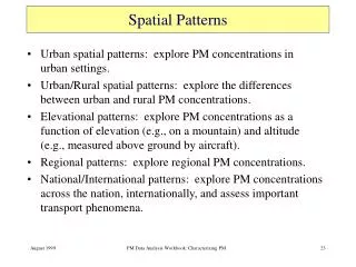
Spatial Patterns • Urban spatial patterns: explore PM concentrations in urban settings. • Urban/Rural spatial patterns: explore the differences between urban and rural PM concentrations. • Elevational patterns: explore PM concentrations as a function of elevation (e.g., on a mountain) and altitude (e.g., measured above ground by aircraft). • Regional patterns: explore regional PM concentrations. • National/International patterns: explore PM concentrations across the nation, internationally, and assess important transport phenomena. PM Data Analysis Workbook: Characterizing PM
Urban PM Concentration Spatial Pattern • Urban areas contain sources of PM that increase PM concentrations and cause “hot spots” (areas with concentrations in excess of background concentrations) in the PM spatial pattern • Urban PM concentrations vary greatly from day to day • Knowledge of urban concentrations aids in the siting of monitors TSP concentration isopleths in the Los Angeles Basin during 1983. (Turco, 1997) Key reference: Capita PM Data Analysis Workbook: Characterizing PM
Daily Average PM10 Concentrations Philadelphia, July 1995 PM10 concentration contour maps with monitoring stations superimposed PM10 concentrations in Philadelphia exhibit large differences among sites from day to day. Background concentrations on July 8, 1995 were 30 to 38 μg/m3. High concentrations (above 70 μg/m3) were only observed at one urban site. On July 20, 1995, the background PM10 concentrations were 30-46 μg/m3 and multiple locations experienced high concentrations. PM Data Analysis Workbook: Characterizing PM Key reference: Capita
Monthly & Seasonal Average PM10 Philadelphia, Summer 1995 PM10 concentration contour maps with monitoring stations superimposed The monthly and seasonal concentrations in Philadelphia have a high spatial variance although the variation is generally less than that of the daily concentrations. Local source-influenced sites are represented as “hotspots” in the spatial concentration maps. The summer average concentrations tend to show less spatial variation than average concentrations for the single month of July. PM Data Analysis Workbook: Characterizing PM Key reference: Capita
Dependence of PM on Elevation • The dependence of PM2.5 on elevation is needed to assess the representativeness of a monitoring site to its surrounding areas. For example, a high elevation site outside the haze layer is not representative of nearby valley concentrations. • PM2.5 dependence on elevation is the result of the limited extent and intensity of vertical mixing, source elevation, and changes in the chemical and physical removal processes with height. • These causal factors vary both seasonally and diurnally; therefore, the PM2.5 dependence on elevation should also vary with season and time of day. PM Data Analysis Workbook: Characterizing PM Key reference: capita
Vertical Profile of the Light Scattering Coefficient in the Los Angeles Basin Mean morning and afternoon summer light scattering profiles • The light scattering coefficient, bscat, is largely dependent on particle concentrations between 0.1 - 1 mm. • The bscat is highest in the mixed layer, fairly uniform through the layer, and drops to low levels above the mixing layer. PM Data Analysis Workbook: Characterizing PM Key reference: Capita
Seasonal PM2.5 Dependence on Elevation in Appalachian Mountains Monitor Locations and topography • During August, the PM2.5 concentrations are independent of elevation to at least 1200 m. Above 1200 m, PM2.5 concentrations decrease. • During January, PM2.5 concentrations decrease between sites at 300 and 800 m by about 50% . PM2.5 concentrations are approximately constant from 800 m to 1200 m and decrease another ~50% from 1200 to 1700 m. PM Data Analysis Workbook: Characterizing PM Key reference:
Topographical Influence on PM • Mountains can restrict the horizontal flow of particles while the mixing height restricts the vertical mixing of particles. • Pollutants can be “trapped” in valleys depending upon the height of the surrounding mountains and the height of the mixed layer. When the mixed layer is lower than the mountain top site, the elevated site may have low concentrations. • The analyst needs to know the physical and meteorological properties of the mountain sites in order to assess the data collected at that site. PM Data Analysis Workbook: Characterizing PM Key reference: Capita
Incorporating Barriers in Mapping PM10 Topography Spatial estimation of PM10 using topography Sierra Nevada San Joaquin Valley South Coast Basin Because topography can significantly affect PM concentrations, it should be considered in preparation of spatial contour maps of PM concentrations. As an example of the mountain-valley effect, the concentrations in the San Joaquin Valley and South Coast Basin are much higher than in the Sierra Nevada Mountains. Without the incorporation of topography, the higher concentrations would "spread" across neighboring mountains. PM Data Analysis Workbook: Characterizing PM Key reference: Capita
National and International Spatial Patterns • Annual PM2.5 concentration maps are useful in identifying potential non-attainment areas of the PM2.5 NAAQS (annual average of 15 μg/m3 ) • Monitoring data are used to estimate PM2.5 maps. • The limited number of PM2.5 monitoring data requires the application of surrogate data (i.e., PM10 and visibility) in the mapping process. PM Data Analysis Workbook: Characterizing PM Key reference: US EPA, 1997
Annual Average PM2.5 Concentrations (1994-1996) Visibility-Aided PM2.5 PM10-Aided PM2.5 (visibility and PM10 data are used as surrogate variables for PM2.5 in estimating PM2.5 concentration maps ) Annual average PM2.5 concentrations are above 15 μg/m3 in the San Joaquin Valley and South Coast Basin of California. Annual average PM2.5 concentrations in Pittsburgh, St. Louis, Roanoke, and an area stretching from New York City to Washington D.C. are above 15 μg/m3 in both maps. The visibility-aided estimates indicate a larger region above 15 μg/m3 along the eastern seaboard. Additional areas above 15 μg/m3 are shown with PM10-aided estimates including Atlanta and eastern Tennessee. PM Data Analysis Workbook: Characterizing PM Key reference: capita
The PM2.5 concentrations peak during the summer, Q3, in the Eastern US. The PM2.5 concentrations peak in the winter, Q1, in populated regions of the Southwest and in the San Joaquin Valley in California. These maps illustrate the regional differences in PM. The same control strategies may not be effective if applied on a national scale. Seasonal Maps of PM2.5 (1994-1996) PM Data Analysis Workbook: Characterizing PM Key reference: capita
Global Pattern of Haze Based on Visibility Data • A rough indicator of PM2.5 concentration is the extinction coefficient corrected for weather conditions and humidity. There are over 7000 qualified surface-based visibility stations in the world. • The June-August haze is most pronounced in Southeast Asia and over Sub-Saharan Africa, where the seasonal average PM2.5 is estimated to be over 50 g/m3. • Interestingly, the industrial regions of the world such as over Eastern North America, Europe and China-Japan exhibit only moderate levels of haze during this time. Squares are scaled to average bext values. PM Data Analysis Workbook: Characterizing PM Key reference: capita