Download
1 / 19
190 likes | 360 Vues
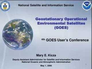
National Satellite and Information Service. Geostationary Operational Environmental Satellites (GOES). 4th GOES User's Conference. Mary E. Kicza Deputy Assistant Administrator for Satellite and Information Services National Oceanic and Atmospheric Administration May 1, 2006. AGENDA.

E N D
National Satellite and Information Service Geostationary Operational Environmental Satellites (GOES) 4th GOES User's Conference Mary E. Kicza Deputy Assistant Administrator for Satellite and Information ServicesNational Oceanic and Atmospheric Administration May 1, 2006
AGENDA • NOAA Geostationary Satellite History • Operational Status • GOES-N Launch Activities • GOES-10 Support to South America • 2005 Accomplishments
NOAA Geostationary Satellite History1974-1982 • NASA's Synchronous Meteorological Satellites (SMS) 1 & 2 • Became NOAA’s GOES-1 through GOES-3 • Geostationary satellite experiment begun in 1966 • Limited operational capability • Observed earth only 10% of the time • Monitored cataclysmic weather events • Visible Infrared Spin Scan Radiometer (VISSR) • Full-disk day and night imagery of clouds
NOAA Geostationary Satellite History1980-1996 GOES-4 through GOES-7 • Added vertical sounding – First geostationary satellite to provide vertical • atmospheric temperature and moisture profiles • Imaging and sounding instruments could not operate simultaneously • GOES-7 carried experimental search & rescue payload providing near- • instantaneous detection of emergency distress signals
NOAA Geostationary Satellite History1994-Present GOES-8 through GOES-12 • Three-axis stabilized spacecraft with separate imager & sounder • Provides simultaneous imaging and sounding, 100% of the time – visual • and infrared • Receives data from world-wide in situ sensors: free-floating balloons, • buoys and remote automatic data collection stations around the world
NOAA Geostationary Satellite History2006 - Present GOES-N through GOES-P • Simultaneous and independent imaging and • sounding allows more frequent imaging • “Stare” capability added • Improved pointing accuracy and less thermal • distortion • Flexible scan control allows for improved short- • term weather forecasts in local areas • Improved power subsystem permits uninterrupted • operations during eclipse periods
GOES Constellation Two satellites and on-orbit spare • GOES I-M (8-12)* Series: Operational since 1994 • GOES N-P Series: • GOES-N: Launch date no earlier than May 18, 2006 • GOES-O: In storage • GOES-P: In assembly phase • GOES R Series: In Program Definition and Risk Reduction Phase * Note: satellites are labeled with letters on the ground and changed to numbers on-orbit N Subsatellite Point Equator 22,300 Mi S
GOES Mission GOES East GOES West
Severe Weather Outbreaks & Tornadic Events
GOES Operational Status • GOES-9: Launched May 23, 1995 • Status: Back-up spacecraft located at 155° West Longitude • Partially mission-capable & nearing end of life • GOES-10: Launched April 25, 1997 • Status: Operational as GOES West at 135° West Longitude • Will begin drift maneuver to 60° West Longitude in support South American coverage following successful GOES-Nlaunch and checkout • GOES-11: Launched May 3, 2000 • Status: On-orbit spare located at 114° West Longitude • Replacement for GOES-10 at 135° West Longitude location following GOES-10 drift and GOES-N launch and check-out • GOES-12: Launched July 23, 2001 • Status: Operational as GOES-East at 75° West Longitude • Sounder filter wheel running slower than normal – ground software modification under consideration
GOES-N Launch and Checkout • Launch scheduled for May 18, 2006 • Window: 2214-2314 GMT (6:14-7:14 p.m. EDT) • Launch vehicle: Delta IV • Flight Readiness Review – May 12 • Launch Readiness Review – May 17 • Launch vehicle and spacecraft are “Go” • Post-Launch Test – Two major phases • Bus & Payload Activation & Characterization Test -- 32 days • Instrument activation • Spacecraft bus testing • System performance and operations testing – 148 days • Image navigation and registration (INR) • Radiometric calibration • Start of station keeping cycle • Spacecraft placed into storage at conclusion of post-launch test • NOAA begins mission operations approximately 204 days after launch
Integrated Global Observing System Global Integrated U.S. GOES India INSAT Comprehensive Sustained
Group on Earth Observations (GEO) • Membership open to all countries • 60 countries (including the EC) are now represented • International organizations are participants • 43 organizations are now represented • Organized into 5 subgroups • Established GEO Secretariat • Established Implementation Plan Task Team
GOES-10 Support South America • Agreement between NOAA and World Meteorological Organization (WMO) Regional Association #3 – Nov 2005 • Objectives • Allow Region 3 members to optimize detection, forecast and warning of severe weather events • Strengthen professional growth and training opportunities • Improve data reception • Regional Benefits • Enhance WMO’s World Weather Watch Global Observing System • Help limit effects of natural disasters in South America – primarily flooding • Improve energy and water resource management • Implementation • GOES-10 will be drifted to 60° West Longitude to provide sensor coverage • Contingent upon successful launch and activation of GOES-N • GOES-10 could be recalled if GOES constellation should experience failures • Operations planned to begin about October 2006
GOES Program 2005 Accomplishments • Operational spacecraft – Continues to provide vital data • Played significant role during 2005 hurricane season • Unprecedented coverage – one image every five minutes for five days • GOES image provided in real time to airborne NOAA P-3 crew performing Katrina mission • First-ever South American support planned for later in 2006 • GOES-N Series – Ready for launch • Upgraded power subsystem – significantly reduced eclipse period outages • Improved pointing accuracy – more consistent imagery • Increased quantity – 1400 more imagery products; 500 more sounder products per year • GOES-R Series – Acquisition program underway • Program Definition and Risk Reduction Phase in progress • Successful Systems Requirements Review • Will provide significant increases in quantity and quality of data
GOES Tracks Hurricane Katrina
Your feedback is vital to the success of GOES – now and in the future