Understanding Weather Patterns: El Niño, La Niña, and Meteorology Basics
This educational resource helps learners comprehend and apply meteorological concepts, focusing on phenomena like El Niño and La Niña. El Niño involves the warming of Pacific waters, leading to rain and flooding, tornadoes, and fewer hurricanes. Conversely, La Niña cools Pacific waters, causing snow and drought conditions. Students learn about the water cycle, cloud formation, and weather systems, including high and low pressure. Using tools like psychrometers and exploring weather fronts, learners gain practical knowledge for understanding and predicting weather events.

Understanding Weather Patterns: El Niño, La Niña, and Meteorology Basics
E N D
Presentation Transcript
Weather Learning Goal: Comprehend and apply weather in role play of being meteorologists.
El Nino El Nino - (El Nee-nyo) is the warming of water in the Pacific Ocean. Rain and flooding along the Pacific Coast Warm water disrupts the food chain of fish, birds, and sea mammals. Tornadoes and thunderstorms in the southern US Fewer than normal hurricanes in the Atlantic
La Nina La Nina - (Lah Nee-Nyah) is the cooling of water in the Pacific Ocean. Snow and rain on the west coast Unusually cold weather in Alaska Unusually warm weather in the rest of the USA Drought in the southwest Higher than normal number of hurricanes in the Atlantic http://esminfo.prenhall.com/science/geoanimations/animations/26_NinoNina.html
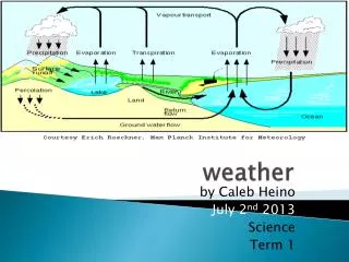
Water Cycle Amount of water remains the same as it moves through the cycle Fresh water is limited All living organisms need liquid water Earth’s water is continually being recycled
Evaporation – process by which water molecules escape into the air by radiant energy from the sun changing water into a gas (water vapor). Relative humidity – the percentage of moisture the air holds relative to the amount it could hold at a particular temperature. Psychrometer – instrument used to measure the amount of R. humidity in the air. It consist of two thermometers, one wet and one dry.
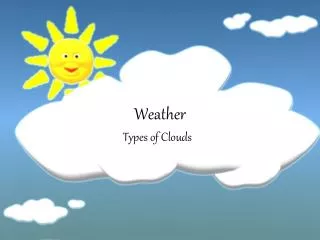
Cloud formation Clouds form when water vapor in the air becomes liquid water or ice crystals. Water vapor changing into a liquid----CONDENSATION The temperature at which condensation begins is called dew point.
Cumulonimbus – Thunderstorm clouds that produce severe weather, tornadoes, hail, strong winds. Have anvil shape to top of cloud.
Clouds Cumulus – usually indicate fair weather. 2 to 7 miles in the sky (cotton balls).
Cirrus – Feathery or fibrous in appearance. Very high altitudes usually between 6 and 12 kilometers. Indicate the onset of rain or snow in a few hours.
Stratus clouds – smooth gray clouds that cover the whole sky and block out the sun are called stratus clouds. These clouds produce steady, light precipitation.
Precipitation – Water vapor that condenses and forms clouds that can fall to the Earth as rain, sleet, snow, freezing rain or hail. sleet – water droplet that freezes when it falls through cold air. (winter) snow – forms when water vapor changes directly to a solid. Hail – ice balls that fall after water is frozen in the air then pushed further up and collects more water and freezes again, over and over until it becomes to heavy to stay suspended in the air. The stronger the uplift the larger the hail stone. (summer)
Freezing rain – rain that freezes upon contact with the ground.
IsobarA line on a weather map connecting places that have the same air pressure
high-pressure system A generally calm and clear weather system that occurs when air sinks down in a high-pressure center and spreads out toward areas of lower pressure as it nears the ground. (More dense cold air)
low-pressure system A large and often stormy weather system that occurs when air moves around and into to a low-pressure center, then moves up to higher altitudes. (Less Dense Warm Air) http://www.bom.gov.au/lam/Students_Teachers/pressure.shtml
Storms Caused by: Changes in temperature & drop in barometric pressure Ex: Hurricanes are a low pressure mass over tropical (warm) water http://news.bbc.co.uk/2/hi/5328524.stm http://profhorn.meteor.wisc.edu/wxwise/tornado/t.html http://www.suu.edu/faculty/colberg/Hazards/Hurricanes_Noreasters/Hurricanes_Anim_1.html
Weather Fronts Air mass-a huge body of air that has similar temperature, humidity, and air pressure Front-the area where two air masses meet and do not mix Dense,cold air moves underneath the less dense warm air, pushing it up
Front Types Cold front-rapidly moving cold air mass that runs into a slowly moving warm air mass Move quickly, causing violent storms Warm front- warm air that collides with cold air Moves slowly, causing fog or rain for days, and in the winter, snow
Cold Front(More Dense cold Air) Cold Front
Warm Front(Less Dense Warm Air) Warm Front
Stationary Front http://www.stevemcentee.com/animation3.html Stationary Front
Weather Forecasting Meteorologists-scientists who study weather and try to predict it Forecasting has greatly improved due to computer technology Collecting weather data has improved because of satellites and balloons
Seasons and Climate Earth has seasons because Earth’s axis tilted as it moves around the sun Winter-axis tilted away from sun resulting in shorter days and indirect rays Summer-axis tilted toward sun resulting in longer days and direct rays
Climate Caused by: Altitude Latitude Mountain barriers Proximity (closeness) to oceans Climate is classified by precipitation and temperature based on these factors http://www.edheads.org/activities/weather/index.shtml