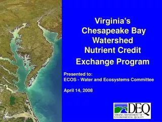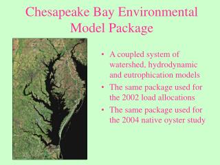
Chesapeake Bay Program Watershed Model 101
Chesapeake Bay Program Watershed Model 101. Role of Models. Clarity. What is the Concentration? What are the filtering rates? Where are the streams?. Research. Monitoring. Modeling. What is the environmental effect of any particular management scheme?. How do we balance many


Chesapeake Bay Program Watershed Model 101
E N D
Presentation Transcript
Chesapeake Bay ProgramWatershed Model101 Chesapeake Bay Program Modeling
Role of Models Clarity What is the Concentration? What are the filtering rates? Where are the streams? Research Monitoring Modeling What is the environmental effect of any particular management scheme? How do we balance many different interests? Management Power Chesapeake Bay Program Modeling
CBP Modeling Structure Regional Acid Deposition Model Watershed Model Chesapeake Bay Estuary Model Package Chesapeake Bay Program Modeling
Topics • Description of the Watershed Model • Calibration • Data • Use in Management • Description of the Watershed Model • Calibration • Data • Use in Management Chesapeake Bay Program Modeling
Purposes of the Watershed Model 1. Accurately deliver loads to the Water Quality Model 2. Equitably account for all load sources 3. Assess changes due to management Chesapeake Bay Program Modeling
Requirements for WSM • Daily flow, nutrient, and sediment load • Accurately simulate any major land use • Responsive to • Nutrient input to land • Structural BMPs • Changes in stream chemistry • Meteorology Chesapeake Bay Program Modeling
HSPF • Hourly time step • Heavily parameterized • sensitive to many inputs • very flexible • Open Source, Free • Supported by USGS and EPA • Wide usage Chesapeake Bay Program Modeling
HSPFLumped parameterPhysically-based models Chesapeake Bay Program Modeling
HSPF - lumped model Chesapeake Bay Program Modeling
Surface Interflow Lower Zone Ground Water Land Simulation --1 Acre Chesapeake Bay Program Modeling
Water simulation - physically based Surface Interflow Lower Zone Ground Water Chesapeake Bay Program Modeling
Water simulation - physically based Precipitation or percolation Evapotranspiration (time series) f(time series, land properties) RO f(soil properties, slope, temp) Percolation f(soil properties, slope, temp) Chesapeake Bay Program Modeling
Nutrient and Sediment Simulation Meteorology Precipitation Land Morphology Runoff and Groundwater Phosphorus Cycle Sediment Export Nitrogen Cycle Nutrient Inputs Chesapeake Bay Program Modeling
Nutrient and Sediment Simulation Nitrogen Cycle Chesapeake Bay Program Modeling
Export Export Export Export Export Export Export Nitrogen Cycle in Watershed Model Forest Trees Denitrification Roots Leaves Nitrate Atmospheric Deposition Particulate Particulate Solution Labile Refractory Ammonia Organic N Organic N Solution Solution Adsorbed Labile Refractory Chesapeake Bay Program Modeling Ammonia Organic N Organic N
Model Nutrient Balance Denitrification Volatilization Atmospheric Deposition Export to Streams Chesapeake Bay Program Modeling
Land Uses Modeled Forest Chesapeake Bay Program Modeling
Model Nutrient Balance Denitrification Volatilization Atmospheric Deposition, other sources Uptake by grasses Export to Streams Chesapeake Bay Program Modeling
Land Uses Modeled Pervious Urban, Impervious Urban Chesapeake Bay Program Modeling
Model Nutrient Balance Denitrification Volatilization Atmospheric deposition, Manure, Fertilizer Uptake by Crops Export to Streams Chesapeake Bay Program Modeling
Land Uses Modeled High Till, Low Till, Hay, Pasture Chesapeake Bay Program Modeling
Land-Water Connection X 3000 acres X 400 acres X 100 acres X 300 acres X 200 acres X 900 acres Chesapeake Bay Program Modeling
River Simulation River 3 Chesapeake Bay Program Modeling
N River Simulation NO3 } Algae NH3 ORGN Sediment Chesapeake Bay Program Modeling
River Simulation River 3 River 2 River 1 Chesapeake Bay Program Modeling
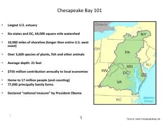
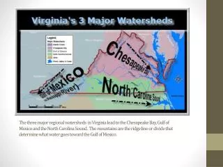
Watershed Model • 64,000 square miles • Nine land uses • 94 segments Chesapeake Bay Program Modeling
Topics • Description of the Watershed Model • Calibration • Data • Use in Management • Description of the Watershed Model • Calibration • Data • Use in Management Chesapeake Bay Program Modeling
RiverReach 2 points of calibration Rain Land Surface Chesapeake Bay Program Modeling
Exports from land Literature values Analysis of input River input to tidal waters Data at all major inputs Upstream points Calibration Chesapeake Bay Program Modeling
RiverReach 2 points of calibration Rain Land Surface Chesapeake Bay Program Modeling
________________________________________________________________________________________________________________________________________________________ CHESAPEAKE BAY WATERSHED MODEL APPLICATION AND CALCULATION OF NUTRIENT AND SEDIMENT LOADINGS Appendix E: Land Use and Linkages to the Airshed and Estuarine Models ____________________________________________________________________________ A Report of the Chesapeake Bay Program Nutrient Subcommittee Annapolis, MD August 1998 Printed by the U.S. Environmental Protection Agency for the Chesapeake Bay Program Calibration Reviews • Modeling Subcommittee • Tributary Strategy Work Group • Model Evaluation Group Chesapeake Bay Program Modeling
Topics • Description of the Watershed Model • Calibration • Data • Use in Management • Description of the Watershed Model • Calibration • Data • Use in Management Chesapeake Bay Program Modeling
Types of Input Data • Point sources • Land use • Nutrient loads to land • Management Actions Chesapeake Bay Program Modeling
Point Sources • Facility by facility list • Monthly data where available • Years 1984 - 1999 • Estimates for future scenarios Chesapeake Bay Program Modeling
Point Source Workgroup representation from all states + DC Documented on the modeling subcommittee web site Point Source Info ____________________________________________________________________________ CHESAPEAKE BAY WATERSHED MODEL APPLICATION AND CALCULATION OF NUTRIENT AND SEDIMENT LOADINGS Appendix F: Point Source Loadings ____________________________________________________________________________ A Report of the Chesapeake Bay Program Nutrient Subcommittee Annapolis, MD August 1998 Printed by the U.S. Environmental Protection Agency for the Chesapeake Bay Program Chesapeake Bay Program Modeling
Land Use } Forest Impervious Urban Pervious Urban Farms } EMAP GIRAS } Land Use Data Base Crop Hay Pasture Mixed Open Agricultural Census, CTIC Population Estimations, Projections Sources Outputs Chesapeake Bay Program Modeling
Tributary Strategy Workgroup representation from all states + DC Documented on the modeling subcommittee web site Land Use ____________________________________________________________________________ CHESAPEAKE BAY WATERSHED MODEL APPLICATION AND CALCULATION OF NUTRIENT AND SEDIMENT LOADINGS Appendix E: Land Use and Linkages to the Airshed and Estuarine Models ____________________________________________________________________________ A Report of the Chesapeake Bay Program Nutrient Subcommittee Annapolis, MD August 1998 Printed by the U.S. Environmental Protection Agency for the Chesapeake Bay Program Chesapeake Bay Program Modeling