Download
1 / 52
520 likes | 558 Vues
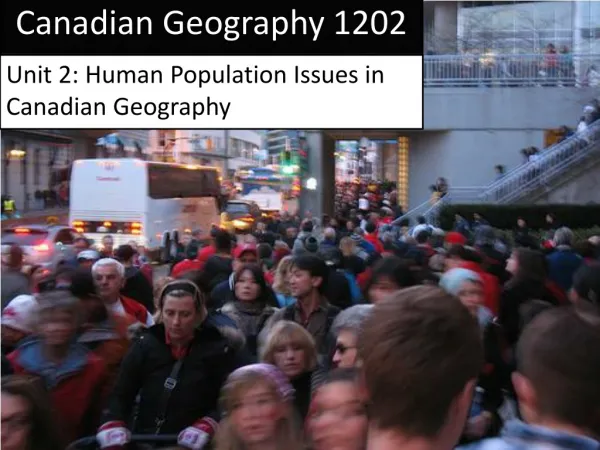
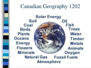
Prepare for the Canadian Geography exam with these review questions covering provinces, compass rose, maps, geologic eras, immigration, industries, sustainability, climate, and more.

E N D
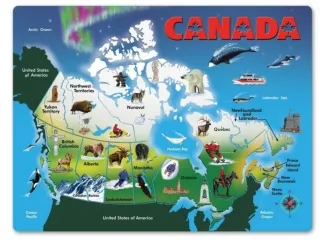
Question 1 - 10 • How many provinces and territories does Canada have? And list them
Answer 1 – 10 • 13 • Newfoundland and Labrador Alberta • Nova Scotia British Columbia • PEI Yukon • New Brunswick N.W Territories • Quebec Nunavut • Ontario Saskatchewan • Manitoba
Question 1 - 20 • What are the Ordinal Points on the Compass Rose?
Question 1 - 30 • What is the difference between a large scale map and a small scale map?
Answer 1 – 30 • Large Scale: Large detail in a SMALL area • Very detailed • Small Scale: small detail in a LARGE area • Gives general information
Question 1 - 40 • List the types of maps and give an example or explain each of them • Hint: There are 3 types
Answer 1 – 40 • Topographic: contour lines to show change in elevation • Grid system to locate places • Thematic: very specific, on one particular topic • General Purpose: broad understanding of the location • Road Maps- location of major highways
Question 1 - 50 • List the Geologic Eras in order from oldest to newest and give the years that each of them lasted.
Answer 1 – 50 • Precambrian- earliest life- 4600-570 mya • Paleozoic: 570-245 mya • Mesozoic: 245-66 mya • Cenozoic: 66 mya- NOW
Question 2 - 10 • What is a push factor? • If someone leaves a country to live in another country, what are they considered as in the new country?
Answer 2 – 10 • Push Factor: reason why someone would leave their country to move to another country • Family, job, safety,… Immigrant
Question 2 - 20 • How do we classify immigrants?
Answer 2 – 20 • Working (Economic) Immigrants • Family Immigrants • Refugees
Question 2 - 30 • What percentage of Canadians live within 600 kms of the US border?
Answer 2 – 30 • 90%
Question 2 - 40 Please describe what this graph is telling us
Answer 2 – 40 • First Nations have a very young population • The population decreases rapidly after age 30-35. • Canada’s average has more elderly population than the First Nation population
Question 2 - 50 • What is the Natural Increase Rate
Answer 2 – 50 • Natural Increase Rate: The difference between the birth rate and the death rate of a country • Natural Increase Rate = birth rate- death rate • Often given as percentages
Question 3 - 10 • What are Canada’s Primary Industries?
Answer 3 – 10 • Agriculture • Fishing • Forestry • Mining
Question 3 - 20 • These commercial fishing operations typically make day trips and are privately owned.
Answer 3 – 20 • Inshore
Question 3 - 30 • List the types of Forestry
Answer 3 – 30 • Clear Cutting • Shelterwood Cutting • Selective Cutting
Question 3 - 40 • Renewable vs. Non-Renewable resources
Answer 3 – 40 • Non-Renewable: resource that can only be used once • Oil, iron ore • Renewable: resource that replaces itself • Trees, fish..
Question 3 - 50 • What are the 4 levels of Industries and please explain each level.
Answer 3 – 50 • Primary- remove raw resource • Secondary- processing raw materials • Tertiary- services (transportation, education..) • Quaternary- Ideas (consulting, research, design)
Question 4 - 10 • What is the definition of Urban Sprawl?
Answer 4 – 10 • Unplanned growth which leads to cities growing outward • Using land that was originally used for agriculture
Question 4 - 20 • What is the definition of Sustainability?
Answer 4 – 20 • Development that meets the needs of the present without compromising the ability of future generations to meet their own needs • Maintains well-being of current and future generations
Question 4 - 30 • Tell me about a Megaproject in Canada • Where is it located? • What does it do?
Question 4 - 40 • What is Global Warming and what is causing it?
Answer 4 – 40 • Global Warming: the rising of the average temperature of Earth • Caused by an increase in green house gases like Carbon Dioxide..
Question 4 - 50 • Draw me what the Greenhouse Effect looks like NOW
The Greenhouse Effect - Now A thickened atmosphere, caused by pollution More rays are held in, warming up the Earth Sun’s rays
Question 5 - 10 • What is a Map?
Answer 5 – 10 • Representation of Earth’s features drawn on a flat surface • Simplifies the real world • Cannot show what land actually looks like
Question 5 - 20 • Describe Latitude and Longitude
Answer 5 – 20 • Longitude: East-West position of a point • Measured from the Prime Meridian • Latitude: North-South position of a point • Up and down from the equator
Question 5 - 30 • What are the factors that affect Climate
Answer 5 – 30 L- Latitude: how far away from the equator are you? O- Ocean Currents: warm vs. cold ocean currents W- Wind and Air Masses: is it originating over the ocean or over land E- Elevation: as elevation increases, precipitation decreases but condensation increases R- Relief: dependent on which side of the mountain N- Near Water: climate is more moderate near oceans
Question 5 - 40 • What are the 4 components that make up soil?
Answer 5 – 40 • Air • Moisture • Minerals • Organic Materials