Download
1 / 51
530 likes | 911 Vues
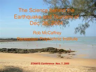
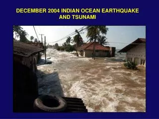
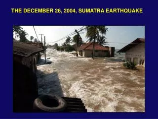
The December 26, 2004 M w 9.0 Western Sumatra Earthquake and Tsunami. Michael Bunds Department of Earth Science Utah Valley State College. The Earthquake’s Statistics Magnitude 9.0 (Mw) Sunday, December 26, 2004 at 00:58:53 (UTC)

E N D
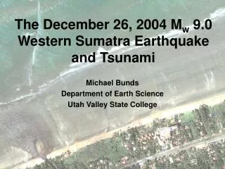
The December 26, 2004 Mw 9.0 Western Sumatra Earthquake and Tsunami Michael Bunds Department of Earth Science Utah Valley State College
The Earthquake’s Statistics Magnitude 9.0 (Mw) Sunday, December 26, 2004 at 00:58:53 (UTC) Sunday, December 26, 2004 at 7:58:53 AM local time at epicenter Saturday, December 25, 2004 at 5:58:53 PM Mountain Standard Time Energy Released = 2 x 10¹⁷ Joules Equivalent to 475 megatons of TNT or 23,000 Hiroshima bombs Tsunami energy estimate = 1014 Joules (10 Hiroshima bombs) Over 225,000 fatalities, 5 million homeless people in Indian Ocean – most as a result of earthquake-induced tsunami
2 4 3 5 1 • The Earthquake in Historical Context • Four Largest Earthquakes on Record • M 9.5 Chile, 1960 • M 9.2 Prince William Sound, Alaska 1964 • M 9.1 Andreanof Islands, Alaska, 1957 • M 9.0 Kamchatka, 1952 • M 9.0 Sumatra, 2004 10 of 11 largest on subduction zone megathrusts surrounding Pacific Ocean Most deadly tsunami recorded history
RUSSIA Asia CHINA INDIA Sri Lanka Phuket Sumatra Epicenter
Banda Aceh Sri Lanka Phuket Epicenter Southeast Asia
Tectonic Setting U.S.G.S
Destructive historical tsunamis at the western coast of Sumatra 1797/02/10 M>8.0 Central part of the western Sumatra. Padang was flooded by powerful waves. More then 300 fatalities. 1833/11/24 M=8.8-9.2 South coast of the western Sumatra. Huge tidal wave flooded all southern part of the western Sumatra. Numerous victims. 1843/01/05 M=7.2 Terrible wave came from the south-east and flooded all the coast of the Nias Island. Many fatalities. 1861/02/16 M>8.2 Several thousand fatalities.
What is an Earthquake? Ground shaking caused by a sudden release of energy within Earth. Most result from slip on a fault. Elastic Rebound
Hypocenter and Epicenter epicenter hypocenter fault
Sumatra Andaman Isl. Original Position 200 to 500 years later Overriding crust flexes 10 to 50 meters, storing energy to be released in earthquake Uplift Subsidence During earthquake Overriding crust snaps back to original position 200 – 250 km wide areas uplift and subside
Aftershocks (yellow circles) outline ruptured area on fault M9.0 Epicenter ~1200 km by 200 km area of fault ruptured U.S.G.S
Expected Areas of Uplift and Subsidence Andaman Islands Probable area of uplift Probable area of subsidence U.S.G.S
Andaman Islands Probable tectonic uplift from earthquake Before After
Before After Andaman Islands Probable tectonic uplift from earthquake Emergent coral reef Submerged coral reef
earthobservatory.nasa.gov Probable Tectonic Subsidence in Banda Aceh, Sumatra
Comparison of Sumatra Earthquake Fault Rupture Area to Cascadia Subduction Zone
Seismicity in Area 1900 – 2002, M > 6 U.S.G.S
Seafloor Displacement in Earthquake Vertical uplift 5 m max. Horizontal movement 11 m max. Cal Tech
Generalized Tsunami Wave Characteristics • Usually more than one wave is created • In open ocean • Wavelength: 200 to 250 km (dist. between wave peaks) • Wave height: 0.5 m • Speed: 700 km/hr • Period: 17 minutes (time between wave peaks) • Near shore • Wavelength: 10 km • Wave height: meters to tens of meters • Speed: 36 km/hr • Period: 17 minutes (time between wave peaks)
Waves Compress as They Near Land Waveheight increases Wavelength decreases But tsunamis do not break like the pictured wind waves
Wind waves are tall and short wavelength Tsunamis often are no taller than wind waves, but involve much more water due to long wavelength
Usual water level Low Water Preceding Tsunami Wave in Sri Lanka earthobservatory.nasa.gov
People Collecting Fish During Low Water Preceding a Tsunami. Oahu, Hawaii, 1957
Variations in Tsunami Intensity An individual tsunami can have vastly different heights in different places depending upon: • Distance and direction from source • Wave source directivity (most wave energy was directed east and west) • Configuration of local seafloor and coastline • Shielding by other landmasses
Calculated Maximum Water Height A. Piatenesi, Tsunami Research Lab, Russia
Sumatran Tsunami Maximum Heights Sumatra, north-west coast 10-15 m Sri Lanka, east coast 5-10 m Thailand (incl. Phuket) 3-10 m India, east coast 5-6 m Andaman Islands > 5 m Kenya 2-3 m Additional Factor: In Thailand and Sumatra tsunami closely coincided with highest tide for the month
Banda Aceh Sri Lanka Phuket Epicenter Southeast Asia
before after Banda Aceh, Sumatra earthobservatory.nasa.gov
before after Banda Aceh, Sumatra earthobservatory.nasa.gov
before after Banda Aceh, Sumatra earthobservatory.nasa.gov
Banda Aceh, Sumatra (before)
Banda Aceh, Sumatra (after) earthobservatory.nasa.gov
before after Khao Lak earthobservatory.nasa.gov
Banda Aceh, Sumatra (before) earthobservatory.nasa.gov
Banda Aceh, Sumatra (after) earthobservatory.nasa.gov
Banda Aceh, Sumatra (before) earthobservatory.nasa.gov
Banda Aceh, Sumatra (after) earthobservatory.nasa.gov