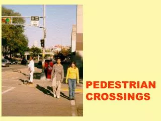
Pedestrian Facilities Inventory
Pedestrian Facilities Inventory . Kristin Bennett, AICP Senior Transportation Planner Bicycle, Pedestrian, and Neighborhood Traffic Programs Manager City of Colorado Springs. Project Evolution. Change in City Code – City responsible for sidewalk capital maintenance (March 2005)

Pedestrian Facilities Inventory
E N D
Presentation Transcript
Pedestrian Facilities Inventory Kristin Bennett, AICP Senior Transportation Planner Bicycle, Pedestrian, and Neighborhood Traffic Programs Manager City of Colorado Springs
Project Evolution • Change in City Code – City responsible for sidewalk capital maintenance (March 2005) • Council request to infill sidewalks • Increasing public demand for sidewalks • Increasing number of ADA complaints to DOJ • No pedestrian infrastructure mapped or inventoried, even hard copy • No Citywide Pedestrian Plan
Initial Steps by Staff • Windshield survey of 7 areas of the City • Cost to infill 7 areas estimated • Staff provided initial infill recommendations for $250,000 special allocation • Opportunity to request permission to proceed with Pedestrian Plan and Inventory (recommended in City’s transportation plan ** Had to “sell” concept to internal staff as well as to City Council **
Multi-Department Use of Data • Transportation Planning • Overall City Needs Assessment • Cost Estimation – What is the Total Price Tag? • Application of Criteria to Prioritize Improvements • Support Data for Funding Applications • Traffic Engineering, incl. School Traffic staff • School route planning • Maintenance of crosswalk markings • Project development activities - prioritization
Multi-Department Use of Data • City Engineering • Curb ramp installation prioritization • Sidewalk infill prioritization • Stormwater management calculations (more precise impervious surface information) • Mountain Metro Transit • Analysis tool to recommend priority for sidewalk/ ramp installations along transit routes • Support Data for Funding Applications
Multi-Department Use of Data • Urban Redevelopment • Downtown / Old Colorado City Pedestrian Facilities • Community Development Block Grant (CDBG) funds • Street Maintenance • Sidewalk condition ratings kept on paper now; could be cataloged into Citywide Facilities Inventory • Alley paving – ADA issues at alley/sidewalk intersect;
Combine with Existing GIS Data • Roadway Functional Class • Corridor Traffic Volumes • Transit Routes, Stops (Pads, Benches, Shelters) • Trails, Park Space • School Locations • Neighborhood Strategy Areas (CDBG-fund eligible) • Curb Ramp Installations (database)
GIS Analysis Opportunities • Transit Routes with Missing Sidewalk/Ramps • #’ radius around school sites with Missing Sidewalk/Ramps • Parks/open spaces with missing sidewalk adjacent to them • Principal and/or Minor Arterial Streets with missing sidewalks/ramps • Transit Routes within Neighborhood Strategy Areas with missing sidewalk/ramps • Missing Sidewalk/Ramps along routes that serve both transit and schools…..
Geodatabase Development Steps • Developed parameters for what to digitize • Developed actual geo-database • Tested geo-database with sample sections to determine any changes needed • Intern staff acquired (4 part-time initially, now 3 part-time on this project) • Digitize, digitize, digitize – very detailed work! • Modifications to geo-database as issues arise, interns ID improvements • Field checking required – shadows, trees, etc.
What Are We Digitizing? • Sidewalks – existing, missing with social trail (“goat path”) distinction • Accessible curb ramps • new w/ truncated domes, older era, vertical curb • position (corner or mid-block) • type (perpendicular, diagonal, parallel/dip) • Ramp ID # • Trails not owned/maintained by Parks Dept. • Crosswalks (painted, unpainted, school xing, type of traffic control)
Field Checking – Two Approaches • Manual Field Checking • Identify areas to field check while digitizing • Travel out to locations and check in person • More time and resource consuming (fuel/vehicle) • Video-Based Field Checks • Video log may be available • Some communities have highly detailed video captures of streets (e.g., Cartegraph) • Field check in the office – time/resource savings
Colorado Springs’ Cartegraph Video • Entire City street network (~1,800 centerline miles) being captured on digital video • Cameras on van in all directions so visibility of sidewalk network is excellent (360°) • High resolution • Digitize on one monitor and view field check area frame by frame on 2nd monitor
Other Key Project Information • Only $30,000 assigned to project – necessitated use of interns • Approx. 1,800 centerline miles being digitized • Project about 60% complete – 1,300 hours to date (Feb. 2006 start) • Geographic areas assigned to interns – • Digitize sections • Field check completed sections • Quality control by peer (some checks by Senior GIS staff)
Lessons Learned • Spend time drafting geodatabase before actual creating it (saves time in the long run) • Train everyone in specific application, assumptions • Routine meetings to address issues, answer questions, changes to geo-database • Expect changes will need to be made to database structure as it is used • Accurate facility digitization is time consuming • Talented interns can produce an exceptional product, add value
Special Thanks to Our Team… • Beth Diana, MS – Public Administration (UCCS) • Aaron Moss, MS – Community Planning (U. of Wyoming) • Nancy Olson, MS – Geography (UCCS) • Angela Zakaras, BS – Geography (UCCS) • Phil Friesen, Senior GIS Analyst, City of Colorado Springs
For More Information on the City of Colorado Springs Pedestrian Facilities GIS Inventory Project, contact…. Kristin Bennett, AICP Senior Transportation Planner City of Colorado Springs (719) 385-5622 kbennett@springsgov.com