Map Projection Methods
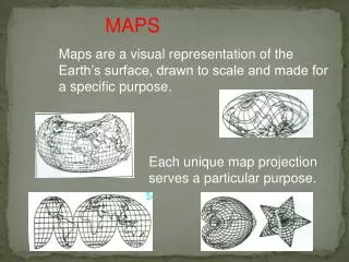
Map Projection Methods. Geography Grade 10. Projection Methods of Maps. A projection method is used to transfer images from the globe to a flat surface. It is used primarily for making small-scale maps, allowing a whole country or continent, or even the world to fit into one page.

Map Projection Methods
E N D
Presentation Transcript
Map Projection Methods Geography Grade 10
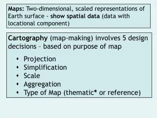
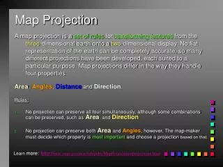
Projection Methods of Maps • A projection method is used to transfer images from the globe to a flat surface. • It is used primarily for making small-scale maps, allowing a whole country or continent, or even the world to fit into one page. • The three most common types of projection are: plane, conical, and cylindrical.
Plane Projection • Restricted to mapping small areas such as the North or South Pole • Accurate in the centre • Clearly shows the converging meridians • Inaccurate around the edges
Conical Projection • Used for countries, continents or regions with an east-west alignment • Accurate along the “standard parallel” which occurs approximately half way up the map • Very distorted near the top and bottom
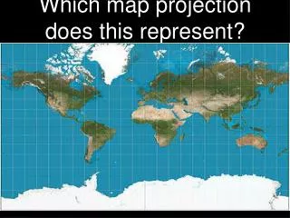
Cylindrical Projection • Useful for mapping equatorial regions and producing world maps • Only projection method that can gather most areas of the globe onto one map • Accurate along the equator • Almost useless beyond 60 degrees latitude
Map Projection Methods • There is a wide variety of specific projection methods (eg. Mercator, Equal-Area, Peters, Winkle-Triple, etc.) • Each method has advantages and disadvantages • Generally speaking, there is no one overall best map projection method. Each method has value depending on your purpose.