Download
1 / 66
690 likes | 1.09k Vues
Oceanic Procedures. Maj James B. Rose AFFSA/A3OT DSN 884-6603 https://wwwmil.tinker.af.mil/AFFSA. Reason for Emphasis. 1200 Oceanic Flights/day 33 GNEs/year (2006) (Caught in the Act) How Many More Corrected w/out Knowledge 8 Total AMC Oceanic Incidents (25%) (2005)

E N D
Oceanic Procedures Maj James B. Rose AFFSA/A3OT DSN 884-6603 https://wwwmil.tinker.af.mil/AFFSA
Reason for Emphasis • 1200 Oceanic Flights/day • 33 GNEs/year (2006) (Caught in the Act) • How Many More Corrected w/out Knowledge • 8 Total AMC Oceanic Incidents (25%) (2005) • Numerous other “ATC saves” • DoD responsible for 25% of GNEs w/ only 4% of oceanic flights (North Atlantic) • 90% of GNEs are pilot error
Crews Beware! Do not take modern technology for granted! Crews should be especially vigilant during periods of low workload, guard against complacency and over-confidence, and adhere rigidly to MAJCOM approved standard operating procedures.
Crews Beware! Do not take modern technology for granted! Crews should be especially vigilant during periods of low workload, guard against complacency and over-confidence, and adhere rigidly to MAJCOM approved standard operating procedures.
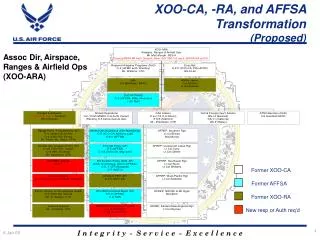
Where Are We Now! FAA Safety Division Oceanic Conference • FAA: Concerned About Military Oceanic Procedural Knowledge • AF/HQ AFFSA Secondary* IRC Special Interest Item (Briefing Linked) *To be covered at the discretion of IRC Inst • AMC: FCIF Apr 07 “All AMC Aircrews Need to Familiarize Themselves with the MNPS Manual…the Authoritative Guide for Ops…”
What is Next! • AFFSA: • Oceanic Chapter to AFMAN 11-217 • Update FLIP to Correct Known Errors • IRC Test Bank Oceanic Questions • Market Information to Pilot Force • FAA/AF • Expedite GNE Feedback Loop • AMC – Develop Oceanic Standard Operating Procedure (SOP), Provide Required Materials to Pilots
Acronym Review • Know the Airspace, Track System you are in • Oceanic Areas have Mostly Common Rules with Unique Exceptions • Let’s Review
Flight Information Regions • Add World Picture
NAT MNPS Airspace Minimum Navigation Performance Specification • Goal: All Flights Meet Highest Std of Horizontal & Vertical Navigation Performance & Accuracy • Authorization: Pilot MNPS Approval = Training • State of Registry (aircraft) • State of Operator (pilot) • Separation: 60NM Lateral Separation (current) • Equipment: RVSM Equipment + High Stds of Horizontal Performance (specified in guidance)
Where is NAT MNPS Airspace? Busiest Oceanic Airspace World FL 285 to FL 420 (Cruising Levels FL 290 to FL 410 Aircraft Separation Assured Thru Technology and Operator Discipline Published, Flexible Organized Tracks
Organized Track System50% of NAT Traffic • WATRS: West Atlantic Route System • US/CAN to Bermuda and Caribbean NATs: North Atlantic Tracks (Track Message 22z/14z) • Eastbound Evening: 0100 to 0800 UTC at 30W • Westbound Morning: 1130 to 1900 UTC at 30W • NARs: North American Routes (Can & US) • Interface between Oceanic and Domestic • NERS: N. Atlantic European Routing Scheme • PACOTS: Pacific Organized Track System (NOTAM Notification) • NOPACS: Eastbound and Westbound Peak Flow Times (Published between Alaska – Japan) • Named Reroutes (“Reroute 1”) • NOTA: Northern Oceanic Transition Area (NOTA) • SOTA: Shannon Oceanic Transition Area (SOTA) • BOTA: Brest Oceanic Transition Area (BOTA) • Callsign “Brest Control” Script 52_1
NATOther Routes • Blue Spruce • 1 LRN OK (MNPS Cert) • No HF OK
NAT Track Message • Must Carry Onboard • (Even on Random Rt) Click here to see: North Atlantic Advisory published by ATCSCC Check Notams Check FLs, Date, & Times Letter Identifier NARs – Expect Routing North American Routes REMARKS: 1.TRACK MESSAGE IDENTIFICATION NUMBER IS 124 AND OPERATORS ARE REMINDED TO INCLUDE THE TMI NUMBER AS PART OF THE OCEANIC CLEARANCE READ BACK. Oceanic Entry/Exit Points
RVSMReduced Vertical Separation Minimums • Separation: 1000’ Vertical • Equipment: • Two Primary Altimetry Systems (two ADCs) • One Automatic Altitude-Keeping Device • One Altitude-Alerting Device • Notify ATC If: • Equipment Failure – “Unable RVSM Equip” • Loss of Redundancy of Altimetry Systems • Turbulence Prevents Flt Level Maintenance • Contingency
SLOPStrategic Lateral Offset Procedure • Hypothesis: Increased Instrument Accuracy Increases Potential for Mid-Air Collision • You May Use this Procedure (Shall?) • Currently 10% Usage Rate! • Three Aircraft Positions Allowed • 1 mile right, 2 miles right • 2 mile max (do not offset left) • Must Have Automatic Offset Capability • Return to Centerline On Oceanic Exit Point Script 10_1
Communication • VHF Coverage • HF Frequency Families (A,B,C etc.) • HF Radio Check Before Entering Airspace • Six Digit Short Code (MARSAT) or Regular Telephone Number (Chart) • Monitor 121.5 and 123.45 (worldwide) • Speaking to a Radio Operator (Bali 1 clip)
Oceanic Clearance Oceanic Clearance Frequencies on NAT Track Message Remarks Section (Westbound) • VHF • HF • Request Through Domestic Center • Data Link • Do Not Hold if Oceanic Clearance is not Obtained (Shanwick) REMARKS: 1.TRACK MESSAGE IDENTIFICATION NUMBER IS 124 AND OPERATORS ARE REMINDED TO INCLUDE THE TMI NUMBER AS PART OF THE OCEANIC CLEARANCE READ BACK. 2.CLEARANCE DELIVERY FREQUENCY ASSIGNMENTS FOR AIRCRAFT OPERATING FROM KENKI TO BOBTU INCLUSIVE: KENKI TO VIMLA 132.02 MIBNO TO LAKES/KENRI 134.2 MOATT TO SCROD 128.7 OYSTR TO DOTTY 135.45 CYMON TO YYT 135.05 COLOR TO BANCS 128.45 RAFIN TO BOBTU 119.42 3.GANDER OCEANIC CLEARANCE DELIVERY CREW PROCEDURES AS PER AIC 29/06 OF THE CANADIAN AIP. 4.OCEANIC PROCEDURES IN THE EVENT OF A GANDER ACC EVACUATION ARE PUBLISHED IN AIP CANADA [ICAO] PART 2 ENR 1.8. 5.OPERATORS ARE REQUIRED TO REFER TO NOTAM A7961/06 FOR SPECIFIC PROCEDURES IN NAT MNPS AIRSPACE.-
Oceanic Clearance What are the Three Components of an Oceanic Clearance? • Flight Level • Mach • Route
Oceanic Clearance Be Prepared to Provide this information at Oceanic Clearance Request: • Call Sign • Entry Point/ETA • Mach Number/Flight Level • Max Flight Level • Any Route Change • 1st and 2nd Track Requests
Equipment Failures Must Report These Equipment Failures to ATC • One or More Primary Altimetry Systems • Failure of all Automatic Alt-Control Systems • Navigation Doubt/Failure Require Notification • Two Independent LRNs Req’d • Consider location: • Prior to oceanic entry or • Established on oceanic segment
In-Flight Contingencies • 163 times (2006), two recent Gulfstream loss of pressurization (2007) • Common reasons: medical emergencies • Some Fuel Diverts: improper flight planning • All possible contingencies cannot be covered (Get a revised clearance whenever possible) • Procedures Provided For: • Inability to maintain assigned FL • Diversion across prevailing traffic flow • Loss of, significant reduction in required navigation capability
In-Flight Contingencies • Turn 90 degress left/right • Consider track system, sensitive airspace, terrain (?) • Consider traffic (SLOP acft below and to your right) • Consider location of divert field • Offset 15 NM and climb or descend 500 ft (below FL410) (Worldwide – Nov 2005) • Simulator trials show pilots are overshooting 5-10 miles! Near continuous turn req’d. Where is the next track? 30,50,60 miles! • FAA Notam states turn may be more or less than 90 degrees • Climb or Descend: • Climb or Descend 1000 ft if Above FL410 • Climb or Descend 500 ft When Below FL410 • Climb 1000 or Descend 500 ft if at FL410 (NAT only) • Do Not Cross Flow of Traffic until Below FL285 Why? Separation!
In-Flight Contingencies • Distress or urgency signal as appropriate • Distress: “Mayday, Mayday, Mayday” • Urgency: “Pan, Pan, Pan” • Turn on Lights, broadcast location/intentions • Best Position to Fly Relevant to Contingencies • 1 or 2 miles right (SLOP), consider going right • Above the Tracks? Align Yourself Parallel to Track • Question: Are you prepared in the case of a rapid decompression to follow the correct procedures? • Recent examples suggest not Pans Ops Doc 4444, ch 15
In-Flight Contingencies An Engine Flames Out! • Broadcast 121.5/123.45 • Contact ATC • Turn on Lights • Clear/TCAS • Turn 90 degrees left or right • Establish 15NM Offset • Program Offset in FMS • Determine Diversion Location • Aircraft Checklist(s) • Establish Driftdown • Determine Position Relative to Others Are You Prepared?
Weather Deviations(Script 42_1) • Scenerio 1: Able to Communicate w/ ATC • If possible, obtain clearance prior, say “Weather Deviation Required”, “Pan” if necessary • Scenerio 2: Unable to Obtain Clearance • Deviate away from track system (if able) • Announce intentions on 121.5, and 123.45 • Watch for conflicting traffic, turn on all ext lights • Up to 10NMs, stay at assigned level • Greater 10NMs (two variables: 1. Mag hdg 2. L or R Track • (East -300L/+300R)(West +300L/-300R) • N. Deviations Descend/S. Deviations Climb • Returning to track, regain flt level at 10NM Pans Ops Doc 4444, ch 15
Re-clearance Procedure(Script 4_1) #1 Reason for GNE • Both Pilots in the Seat • Both Pilots on Headset (verse speaker) • Both Pilots write Re-Clearance • PNF will Change Master Document • PNF Clearly Cross-out Old Waypoints • PNF Re-plots points on plotting chart • PNF Programs New Clearance in the FMS • PF independently Checks all PNF Actions • Waypoints, Distances, Mag Course • Re-compute Equal Time Point (if ETA changes by +/-?) • New Domestic Clrn b4 Oceanic Exit Point
Re-clearance Procedure Universal Tables of Tracks and Distances Tables • 10 Degress Longitude • Correct for Mag Variations • Correct for Winds
Performance Monitoring The horizontal & vertical navigation performance of operators within NAT MNPS Airspace is monitored on a continual basis. If a deviation is identified, follow-up action after flight is taken, both w/ the operator & the State of Registry of the aircraft involved, to establish the cause of the deviation & to confirm the approval of the flight to operate in NAT MNPS and/or RVSM Airspace. North Atlantic MNPSA Operations Manual
Degrees of Separation(MNPS/RVSM) Each one of these deviations is reported to AF/A3O-A. AF/A3O-A forwards to MAJCOM/DO. MAJCOM/DO then sends to your WG/CC for resolution! 7 Step Process Begins! • Lateral Separation = 1 degree (60 nm) lateral separation • Deviation of 25 nm or more = Gross Navigation Error Report • Reduced Vertical Separation = 1000 ft vertical separation • Deviation of 300 ft or more = Oceanic Altitude Deviation Rpt • Longitudinal Separation = 10 minute separation (assigned Mach) • Deviation of 3 minutes or more = Erosion of Longitudinal Separation Report • TCAS, Turbulence, Contingencies are Still Reported • Separation Standards assures 95% Target Levels of Safety • 1/100th Mach Difference Equals 3 minutes in 4 Hours • “1 Hour Club”…Are you a member? • Wing CC Forms a Committee • Operations Group Commander Freaks Out • Squadron Commanders Freak Out • Inquisition Pairs Tail Number to Aircraft Commander • Your Leave is Cancelled • You Deny All Knowledge! • Cornered, you blame it on the co-pilot!
Degrees of Separation(Pacific RNP 10/RVSM) • Lateral Separation = 50 nm lateral separation* • Deviation of 25 nm or more = Gross Navigation Error Report • Reduced Vertical Separation = 1000 ft vertical separation • Deviation of 300 ft or more = Oceanic Altitude Deviation Rpt • Longitudinal Separation = 15 minute separation • Deviation of 3 minutes or more = Erosion of Longitudinal Separation Report *30 NM Separation in Some Locations (Oakland, South Pacific) (30 NM lateral separation and 30 NM longitudinal)
Position Reports • “Gander, Reach 7033 Position on 8864” • Atlantic: Cleared Points (typically every 10 degrees) or Every 1+00 hour • Pacific: Mandatory Reporting Points or Every 1+20 hours • Check your FMS Estimate against CFP Computed Times • Is your FMS Winded for Route of Flight • Met Reports: Atlantic Random Routes/Shall give Met Reports at all Position Reports (temp, winds, turb, icing) • Met Reports Upon Request on NATs • Warning: You are Communicating to a Radio Operator (Script 18_1
4 Most Common Errors “How to get violated” • FMS input errors of one degree of latitude made while inserting a forward waypoint into the navigation system. • Crew is re-cleared on new route by ATC and makes a waypoint insertion error (Script 7_1) • #1 Cause for GNE…need to re-accomplish distance checks/Mag Courses • Don’t put FIR boundaries/ETPs in your FMS it causes problems with re-route • Autopilot inadvertently left in heading select mode (de-coupled) after avoiding clouds, maneuvering, or left in the VOR position after leaving the last domestic airspace VOR. • Errors arising in ATC/Pilot communication loop so that controller and crew have a different understanding of the clearance.
More Common Errors “How to get violated” • Aircrew Climbs IAW Flight Plan w/o Clearance • Beware of Oceanic Clearance Altitudes with insufficient range to make the entire crossing • Playing Poker: Step Climb Requests May Not be Honored
Best Practices The “Best Practices” described in this brief apply in any non-radar ATC environment. They also apply to the data-link upgraded aircraft. These aircraft will automatically tell on you via ADS!
Pre-flight Duties • Check NOTAMs for GPS and the NAVAID that you plan to use for gross navigation check before “coasting out” • Plan in advance for a radial/DME cross check because over-flight gross navigation checks are less accurate due to altitude errors • When initializing the FMS, ensure the current database is installed • Most long range navigation systems will dump the entire route if a navigation database change is made even while airborne • Script 5_1
Pre-flight Duties – cont’d • Ensure that environmental conditions do not hinder INS initialization • Conditions such as high winds, cargo loading or inadvertent aircraft movement will degrade the navigation solution • Script 6_1 • Ensure FMS clock has accurate Zulu time loaded or correct it Script 8_1
MNPS Best Practices • Record the initialization position programmed into the Long Range Navigation System (LRNS) • Establishes the starting point for navigation computations • In the event of navigation difficulties it facilitates diagnosis • RAIM Check for Route of Flight (51 minutes RAIM loss max) • FDE (Fault Dectective & Exclusion) • Use “Master Document” for: • Read back of ATC clearance; • Entering the route into the navigation system (1 pilot loads) • Check route in the navigation system (2nd pilot checks) • Plotting the route on your oceanic chart
MNPS Best Practices • Procedures Approaching a Waypoint • Check (Lat/Long, Mag, Dist, ETE) the Approaching Waypoint and Next Point • Procedures At a Waypoint • Immediately Check Outbound Track and Distance • Procedures After Crossing a Waypoint • Position Report Correctly • Gross Error Check, 10 min. plot your position (Approximately 2 degrees longititude after last point) • Should be Right on the Line, if not Investigate Immediately (consider SLOP)
MNPS Best PracticesUse of the Master Document • Only one master document should be used in the cockpit • Should be the CFP • One pilot should input waypoints from the computer flight plan • The other pilot should independently verify that the route loaded in the FMC matches the master document (Two Pilot Concept) • If re-route is received, both pilots should be in the cockpit to copy - Repeat the “two pilot process” for separate confirmation of all waypoints of the new route • Use appropriate symbology
MNPS Best Practices • Before departure, ensure all of the following sources agree: • Computer flight plan, the 1801, and track on the plotting chart • NAT Track Message also if filed on the track system • Plot your ATC cleared route on a suitable scale oceanic chart • Allows for a visual check on the reasonableness of the route and on its relationship to the Organized Track System (OTS), other aircraft, diversion fields, etc.
MNPS Best Practices • Plot your position regularly on the oceanic chart • Plot approximately 10 minutes after passing each waypoint • Check the present, next, and next +1 waypoint coordinates in the “box” against Master Document before making position report • This will save you if a reroute was issued and not input
Seat Swap Etiquette • Immediately before getting out of the seat, conduct a professional briefing on the status of the flight to include: • Aircraft position and current control agency • The current clearance and reroute information • Aircraft maintenance status and its effects on mission • Progress on “Master Document” and plotting chart • Mission timing and any contact with command and control • Police your area and take your pro-gear and trash with you • Briefly stick around for any questions before hitting the bunk
Learn from Past Mistakes… • Each pilot make an independent check of present position prior to entering it into the LRNS • Never relax with respect to cross-check procedures (especially nearing the end of a long duty day) • Avoid casual radio procedures – remember you are probably talking to a radio operator…not an air traffic controller • Before entering oceanic airspace note and record the check of LRNS positions at or near to the last NAVAID (Gross Nav Check) • Do not assume that the aircraft is at a waypoint because the alert annunciator indicates; cross-check by reading present position
Or you will be doomed…. • Flight Deck Drills. Navigation using automated systems is not a task which can be delegated to one crew member. The Aircraft Commander should always participate in all navigation cross-checking procedures • Before departure, check that the computer flight plan, flight plan filed by crew, oceanic plotting chart and North Atlantic Track (NAT) message agree (if applicable). Note NAT Track Identification Number for read back brevity. • Use an appropriate scaled flight progress chart on the flight deck. Periodic plots of position on a suitably sized chart and comparing current position with ATC cleared track help greatly in identifying errors before getting too far off track (i.e. GNE).