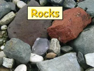
Ohio Rocks
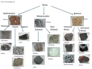
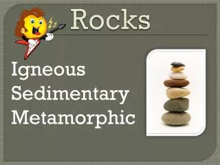
This Rocks!. SedimentaryIgneousMetamorphic. . SedimentaryRocks. Weathering ErosionDeposition. Sediments cemented by pressure over time.. Limestone. Shale. Sandstone. . IgneousRocks. Cooling magma or lava forms Igneous rock.. Granite. Pumice. MetamorphicRocks. . Changed by heat and pressure..

Ohio Rocks
E N D
Presentation Transcript
1. Ohio Rocks! Lynda Price
The Wilderness Center
2. What they knew: Alfred Wegner � continents fit together - continental drift, Pangea
well known paleontological observation that the same fossilized plants and animals from the same time period were found in South America and Africa.� The same was true for fossils found in Europe and North America, and Madagascar and India.�
Wegener was unable to provide an adequate explanation of the forces responsible for continental drift What they knew: Alfred Wegner � continents fit together - continental drift, Pangea
well known paleontological observation that the same fossilized plants and animals from the same time period were found in South America and Africa.� The same was true for fossils found in Europe and North America, and Madagascar and India.�
Wegener was unable to provide an adequate explanation of the forces responsible for continental drift
3. 1950�s oceanic exploration greatly expanded.
Global mid-ocean ridge discovered.
With mountains higher than any in US (except in Alaska)1950�s oceanic exploration greatly expanded.
Global mid-ocean ridge discovered.
With mountains higher than any in US (except in Alaska)
4. Magnetic imaging increased in 1950�s
Basalt � iron rich rock contains strongly magnetic mineral � magnetite
When magma cools � magnetic force direction is �locked in� Patterns � not irregular �
1960�s dated the floor (oil drilling) � youngest rocks nearest mid ocean ridgeMagnetic imaging increased in 1950�s
Basalt � iron rich rock contains strongly magnetic mineral � magnetite
When magma cools � magnetic force direction is �locked in� Patterns � not irregular �
1960�s dated the floor (oil drilling) � youngest rocks nearest mid ocean ridge
5. Hess and Dietz first coined the term �sea floor spreading�
They theorized the plates descend into trenches � deep, narrow canyons along the rim of the Pacific
ALSO: 1960�s Worldwide Standardized Seismograph Network (for nuclear bomb compliance) mapped earthquakes.Hess and Dietz first coined the term �sea floor spreading�
They theorized the plates descend into trenches � deep, narrow canyons along the rim of the Pacific
ALSO: 1960�s Worldwide Standardized Seismograph Network (for nuclear bomb compliance) mapped earthquakes.
6. Two continental plates meet � Himalayas,
Tsunami � ocean and continental crust meet
West coast � plates sliding past each other - transform
Mid-Atlantic ridge - divergent boundary - 2.5 cent. yearTwo continental plates meet � Himalayas,
Tsunami � ocean and continental crust meet
West coast � plates sliding past each other - transform
Mid-Atlantic ridge - divergent boundary - 2.5 cent. year
7. Continental crusts are less dense
Ocean crusts � balsaltic, denser
Spreading ocean ridges discovered in 1960�s, magnetic fields, oldest away from ridge.
Rift zone important for Ohio - earthquakesContinental crusts are less dense
Ocean crusts � balsaltic, denser
Spreading ocean ridges discovered in 1960�s, magnetic fields, oldest away from ridge.
Rift zone important for Ohio - earthquakes
8. The driving force cannot yet be tested directly and proven beyond a reasonable doubt
Lithosphere is the crust and topmost solid layer of mantle
Asthenosphere � spongy layer of mantle - solid but it can flow or move with convection � CONCECTION CELL
Outer core - molten � creates the magnetic field
Inner core - solid
The driving force cannot yet be tested directly and proven beyond a reasonable doubt
Lithosphere is the crust and topmost solid layer of mantle
Asthenosphere � spongy layer of mantle - solid but it can flow or move with convection � CONCECTION CELL
Outer core - molten � creates the magnetic field
Inner core - solid
9. Plate tectonics �
Drives the rock cycle - earth's crust is constantly destroyed and renewed.
Important to understanding Ohio geologyPlate tectonics �
Drives the rock cycle - earth's crust is constantly destroyed and renewed.
Important to understanding Ohio geology
10. This Rocks! Sedimentary
Igneous
Metamorphic
18. Geologic Time 1 million days = 2,740 years
1 million hours = 114 years Pass out Map, timeline and rocks
Will start at bottom of timeline to talk about OHIO rocks.
Packet includes: GEO FCTS #23 � Brief Summary of Geo History of Ohio
Hands on Earth Science #8 � Understanding Geologic TimePass out Map, timeline and rocks
Will start at bottom of timeline to talk about OHIO rocks.
Packet includes: GEO FCTS #23 � Brief Summary of Geo History of Ohio
Hands on Earth Science #8 � Understanding Geologic Time
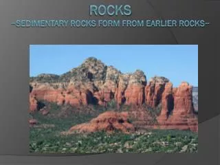
19. Precambrian Nearly 90% of the earth's history.
Earth 4.6 billion years old.
Info from wells and other seismic mapping
LOOK AT BOTTOM OF MAP
Mountain range formed, then eroded to gently rolling hills
Shelby and Auglaize counties in western Ohio � most seismic
Ohio�s Precambrian rocks appear to have been formed about 1.5 billion to 800 million years ago.Nearly 90% of the earth's history.
Earth 4.6 billion years old.
Info from wells and other seismic mapping
LOOK AT BOTTOM OF MAP
Mountain range formed, then eroded to gently rolling hills
Shelby and Auglaize counties in western Ohio � most seismic
Ohio�s Precambrian rocks appear to have been formed about 1.5 billion to 800 million years ago.
20. Sudden, widespread appearance of multicellular marine animals
Resulted in accumulation of hydrocarbons � organic substances such as oil and gas
1,000 to 10,000 feet below surfaceSudden, widespread appearance of multicellular marine animals
Resulted in accumulation of hydrocarbons � organic substances such as oil and gas
1,000 to 10,000 feet below surface
21. Shale - deposition in deeper, quieter waters
limestone- depositon in clearer, shallower waters.
The Cincinnati rocks serve as the official reference section for Upper Ordovician time.
The fossils make the rock economically un-useable. 1980 survey found Cincinnati area has highest cost from landslide damage of any city in US (due to shale beds).
CEASER"S CREEK rocksShale - deposition in deeper, quieter waters
limestone- depositon in clearer, shallower waters.
The Cincinnati rocks serve as the official reference section for Upper Ordovician time.
The fossils make the rock economically un-useable. 1980 survey found Cincinnati area has highest cost from landslide damage of any city in US (due to shale beds).
CEASER"S CREEK rocks
22.
24. Not many Silurian rocks exposed - covered by glacial sediments.
Dolomite has a high magnesium content � from the coral
Eurypterids - resemble scorpions
resistant Cedarville dolomite - provides scenery of Clifton Gorge State Nature Preserve and John Bryan State Park.- Little Miami downcutting. Greene County Not many Silurian rocks exposed - covered by glacial sediments.
Dolomite has a high magnesium content � from the coral
Eurypterids - resemble scorpions
resistant Cedarville dolomite - provides scenery of Clifton Gorge State Nature Preserve and John Bryan State Park.- Little Miami downcutting. Greene County
27. Limestone used as building stone � State House in Columbus made of Columbus limestone.
Crushed stone, aglime
Dark Ohio Shale � high in organic matter
Stagnant seas, oxygen only at top layers, so organic matter was deposited and not decomposed.
Source of natural gasLimestone used as building stone � State House in Columbus made of Columbus limestone.
Crushed stone, aglime
Dark Ohio Shale � high in organic matter
Stagnant seas, oxygen only at top layers, so organic matter was deposited and not decomposed.
Source of natural gas
29. Continental collisions to the East beginning Appl. Mts.
This picture not quite accurate for Ohio, less life as it was very muddy and sandy.
Berea sandstone used as building stone and
Black Hand Sandstone- middle more resistant to erosion (differentially cemented)
Black hand for canal locks and railroad bridges
Bedford shale used as a clay source for bricks, tile and ceramics.Continental collisions to the East beginning Appl. Mts.
This picture not quite accurate for Ohio, less life as it was very muddy and sandy.
Berea sandstone used as building stone and
Black Hand Sandstone- middle more resistant to erosion (differentially cemented)
Black hand for canal locks and railroad bridges
Bedford shale used as a clay source for bricks, tile and ceramics.
33. Flat coastal-plain swamp
Fluctuations in sea level resulted in alternating terrestrial, freshwater, and marine deposits.
Flint beds � lots of volcanic activity from the east. The volcanic ash (silica) fell into stream, dissolved and made the water more acidic so more silica was dissolved and then redeposited as microscopic crystals of quartz � hence state GEMSTONE
Also said to be marine � silica from skeletal support of sponges.Flat coastal-plain swamp
Fluctuations in sea level resulted in alternating terrestrial, freshwater, and marine deposits.
Flint beds � lots of volcanic activity from the east. The volcanic ash (silica) fell into stream, dissolved and made the water more acidic so more silica was dissolved and then redeposited as microscopic crystals of quartz � hence state GEMSTONE
Also said to be marine � silica from skeletal support of sponges.
34. Grand tree ferns, early conifers, reeds, and rushes � accumulated as peat � compressed to coal
Coal was used in steel industry and now for power plants
Sharon sandstone � fast flowing rivers
Clay used in the ceramic industry.Grand tree ferns, early conifers, reeds, and rushes � accumulated as peat � compressed to coal
Coal was used in steel industry and now for power plants
Sharon sandstone � fast flowing rivers
Clay used in the ceramic industry.
36. Influx of delta sand and mud, later characterized by uplift and erosion.Influx of delta sand and mud, later characterized by uplift and erosion.
37. Ohio was above sea level � erosion and nondeposition prevailed.
Ohio was above sea level � erosion and nondeposition prevailed.
38. Quaternary-
Two thirds of Ohio was covered by mile-thick ice during glacial periods (till 15,000 years ago)
Sand and gravel important aquifers.
Sediments deposited on surface.
Quaternary-
Two thirds of Ohio was covered by mile-thick ice during glacial periods (till 15,000 years ago)
Sand and gravel important aquifers.
Sediments deposited on surface.
40. Ohio Geology Lynda Price
The Wilderness Center Handouts in packet include:
GeoFact #11 and Hands on Earth Science #6 � regarding uses of Ohio rocks.Handouts in packet include:
GeoFact #11 and Hands on Earth Science #6 � regarding uses of Ohio rocks.
42. Tertiary � Age of Mammals, Ohio still above sea level
Tertiary � Age of Mammals, Ohio still above sea level
43. By end of Tertiary period, Ohio was a rolling hill country, drained by the Teays river system.
Headwaters were in the Mts of West Virginia flowing into Indiana. By end of Tertiary period, Ohio was a rolling hill country, drained by the Teays river system.
Headwaters were in the Mts of West Virginia flowing into Indiana.
44. Insert Jane�s Maps here. Geologic setting of the Mohican State Park area.Insert Jane�s Maps here. Geologic setting of the Mohican State Park area.