Rivers Revision
Rivers Revision. -We will revise the main topic areas of Water on the Land. Knowledge Checklist. Know the processes of erosion Know the processes of transportation Know how waterfalls and gorges are formed Know how meanders and ox-bow lakes are formed

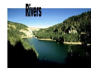
Rivers Revision
E N D
Presentation Transcript
Rivers Revision -We will revise the main topic areas of Water on the Land
Knowledge Checklist • Know the processes of erosion • Know the processes of transportation • Know how waterfalls and gorges are formed • Know how meanders and ox-bow lakes are formed • Know how flood plains and levees are formed • Know the factors that affect river discharge • Know the physical and human causes of flooding • Know a case study of a rich and poor country flood • Know how hard and soft engineering can be used in flood management • Know how water is used in the UK with areas of surplus and deficit • Know a case study of a reservoir in the UK
The Profile of a River Key Idea: The shape of river valleys changes as rivers flow downstream due to the dominance of different processes. Processes of erosion – hydraulic action, abrasion, attrition, solution; vertical and lateral erosion. Processes of transportation – traction, saltation, suspension and solution. Deposition and reasons for it. Long profile and changing cross profile.
The Water Cycle It is the main input to the drainage basin
The long profile and the drainage basin • The long profile of a river is a cross section from its source to its mouth. This whole area is known as the drainage basin. • They are divided into three sections: • Upper course • Middle course • Lower course • River gradient decreases gradually as the river flows downstream (ie. It becomes less steep)
Drainage Basin Key words • A river basin is the area of land drained by a river and its tributaries • Watershed – an area of higher land separating two drainage basins • Source – the place where a river begins • Tributary – a smaller river joining a larger one • Confluence – the place where two rivers join • Mouth – the place where a river enters a lake or the sea
Transportation • Material is carried in the river in four ways: • Traction: large stones are rolled along the river bed • Saltation: smaller stones ‘bounce’ along the river bed • Suspension: small particles of silt and clay float through the water • Solution: minerals are dissolved in the river
Deposition Deposition is the dumping of material and happens when the river loses its energy. This may be during a dry spell, on the inside of a river bend, or when the river reaches the sea (read on for more on this).
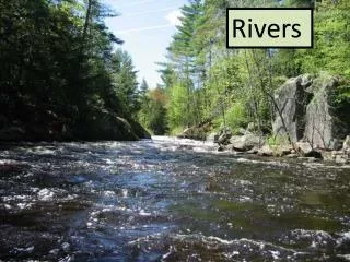
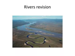
The Long Profile of a River L.Ob: to describe how a river changes from source to mouth Think about the 2 pictures of rivers: why are they so different?
UPPER COURSE MIDDLE COURSE LOWER COURSE SOURCE Lateral & vertical erosion, transportation, deposition Transportation & deposition Vertical erosion & transportation MOUTH V-shaped valley Meanders Ox-bow lakes SEA Waterfalls Levees Rapids Flood plain Interlocking spurs
Upper Course • Vertical erosion is the main process. • Valleys are v-shaped, interlocking spurs. • Waterfalls are formed. • Rapids are smaller scale feature formed where finer bands of varying resistance of rocks are found.
Foundation Question Higher Question
Waterfalls • A waterfall is a place on a river where the water flows vertically • They tend to occur in the upper course of a river • Softer rock erodes quickly, undercutting harder rock • Harder rock erodes more slowly, forming overhang • Overhang eventually collapses – the waterfall moves upstream • Steep sided valley (gorge) is formed • Plunge pool erodes under waterfall
Slow flow = loss of energy. Fast flow = lots of energy. Low energy = deposition. High energy=erosion
Meandering stream flowing from top of screen to bottom
Maximum deposition Maximum erosion
Meander scars Oxbow Lake Oxbow cuttoff
A Delta • Some rivers reach the sea in deltas, which form where river mouths become choked with sediment, causing the main river channel to split into hundreds of smaller channels or distributaries • Deltas only form under certain conditions • The river must be transporting a large amount of sediment • The sea must have a small tidal range and weak currents • The sea must be shallow at the river mouth • Famous deltas consist of the Mississippi delta, The Ganges and Brahmaputra delta (Bangladesh) and of course the Nile delta.
Flood Plains and Levees When a river continually floods, it spreads silt across the flood plain. Often this material piles up to form levees. Sometimes, humans make artificial levees to mimimise the impact of flooding.
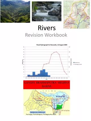
FloodHydrograph Peak Rainfall Peak Discharge LAG TIME DISCHARGE (cumecs) RAINFALL mm time
River DISCHARGE • Discharge is the volume rate of water flow, which is transported through the river channel. • Measured in cumecs (cubic metres per second)
The Flood Hydrograph – A = floods quickly (flash flood)B = slower rate of discharge, less likely to flood WHAT FACTORS AFFECT THE DISCHARGE LINE?
Factors Affecting Water in a River • Amount and type of rainfall • Previous weather conditions • Land use • Temperature • Rock type • Relief
Describe 5 factors that might affect the lag time (time it takes river to flood)