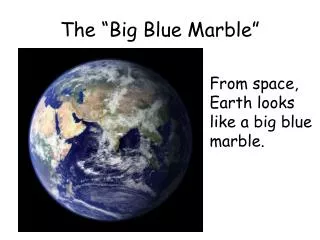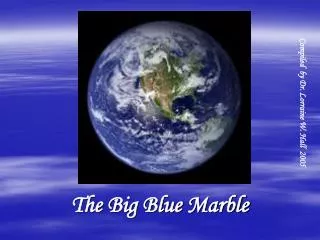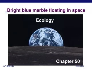
Bright blue marble floating in space
350 likes | 375 Vues
Explore the scientific study of how organisms interact with their environment, influencing distribution and abundance. Learn about ecological time, abiotic and biotic factors, and Earth's biomes.

Bright blue marble floating in space
E N D
Presentation Transcript
Bright blue marble floating in space Ecology Chapter 50
What is ecology? • Ecology • Is the scientific study of the interactions between organisms and the environment • These interactions • Determine both the distribution of organisms and their abundance • Where organisms are found and how many of them there are.
What is ecology? • Ecology • Both observational/descriptive and experimental • Observing what’s there and seeing how it changes. • Rigorous - mathematical modeling of populations and ecosystems. • Ecological time • Minute-to-minute interactions. • Compare to evolutionary time.
Environmental factors • Abiotic factors • non-living chemical & physical factors • Temperature • Light • Water, including salinity • Nutrients, including soil and rocks • Dissolved oxygen! • Biotic factors • living components
Climate in northern Australia is hot and wet, with seasonal drought. Kangaroos/km2 > 20 10–20 5–10 1–5 0.1–1 Red kangaroos occur in most semiarid and arid regions of the interior, where precipitation is relatively low and variable from year to year. < 0.1 Limits ofdistribution Southeastern Australia has a wet, cool climate. Southern Australia has cool, moist winters and warm, dry summers. Tasmania Environmental Factors • Affect the distribution and abundance of organisms
Climate in northern Australia is hot and wet, with seasonal drought. Kangaroos/km2 > 20 10–20 5–10 1–5 Red kangaroos occur in most semiarid and arid regions of the interior, where precipitation is relatively low and variable from year to year. 0.1–1 < 0.1 Limits ofdistribution Southeastern Australia has a wet, cool climate. Southern Australia has cool, moist winters and warm, dry summers. Tasmania The figure below (Figure 52.5 in the textbook) shows the distribution of red kangaroos in Australia. From this figure, you can predict that kangaroos: • eat plants. • prefer a hot dry climate. • don’t like saltwater. • prefer to live in areas where people don’t live. • are more abundant in some years than in other years.
Dispersal • Dispersal - the movement of individuals away from their area of origin or from centers of high population density. • Natural range expansion • Early humans “out of Africa” • Different from migration. • Species transplants • Potential vs. actual ranges • Where organisms could be versus where they are. • Invasive/introduced species.
Environmental factors • Climate - Long-term prevailing weather in a particular area. • Macroclimate - Patterns on a global, regional and local level. • Microclimate - Patterns on a smaller scale. • Eg. A community living under a log. Lichen Rotting Logs Tide Pools
Why do we have weather? • Latitudinal variation in sunlight intensity.
Why do we have weather? Seasonal variation in sunlight intensity.
Why do we have weather? Global air circulation and precipitation patterns.
Why do we have weather? • Global wind patterns. • Currents and other bodies of water.
Why do we have weather? • Mountains and elevation.
Marine/Aquatic Biomes coral reef benthos intertidal
30N Tropic of Cancer Equator Continentalshelf Tropic of Capricorn 30S Key Rivers Abyssal zone(below oceanicpelagic zone) Lakes Estuaries Intertidal zone Coral reefs Oceanic pelagiczone Marine/Aquatic Biomes coral reef benthos intertidal
Aquatic/Marine Biomes • Account for the largest part of the biosphere in terms of area • Can contain fresh (aquatic), brackish, or salt (marine) water • Oceans • Cover about 75% of Earth’s surface • Have an enormous impact on the biosphere
Intertidal zone Neritic zone Oceanic zone Littoralzone Limneticzone 0 Photic zone 200 m Continentalshelf Pelagic zone Benthiczone Aphoticzone Photiczone Pelagiczone Benthiczone Aphoticzone (a) 2,500–6,000 m Zonation in a lake. Based on light penetration, distance from short and water depth, and open water or bottom. Abyssal zone(deepest regions of ocean floor) (b) Marine zonation. Like lakes, the marine environment is generally classified on the basis of light penetration (photic and aphotic zones), distance from shore and water depth (intertidal, neritic, and oceanic zones), and whether it is open water (pelagic zone) or bottom (benthic and abyssal zones). Zonation • Are stratified into zones or layers defined by light penetration, temperature, and depth • Thermoclines - Narrow vertical zone of abrupt temperature change.
1 4 3 In autumn, as surface water cools rapidly, it sinks below the underlying layers, remixing the water until the surface begins to freeze and the winter temperature profile is reestablished. In winter, the coldest water in the lake (0°C) lies just below the surface ice; water is progressively warmer at deeper levels of the lake, typically 4–5°C at the bottom. In summer, the lake regains a distinctive thermal profile, with warm surface water separated from cold bottom water by a narrow vertical zone of rapid temperature change, called a thermocline. 8 8 2 In spring, as the sun melts the ice, the surface water warms to 4°C and sinks below the cooler layers immediately below, eliminating the thermal stratification. Spring winds mix the water to great depth, bringing oxygen (O2) to the bottom waters (see graphs) and nutrients to the surface. 16 16 24 24 Spring O2 (mg/L) Winter O2 (mg/L) 0 4 8 12 0 8 12 4 Lake depth (m) Lake depth (m) 8 16 24 O2 concentration High Medium Low 4 0 O2 (mg/L) 4 2 O2 (mg/L) 0 4 8 4 12 4 0 4 8 12 4 4 Lake depth (m) Lake depth (m) 4 4 22 4 8 20 4 4C 4C 4 18 4 16 8 6 4 5 4C 24 4C Autumn Thermocline Summer Nutrient turnover • Lakes and other marine/aquatic biomes experience turnover
LAKES An oligotrophic lake in Grand Teton, Wyoming A eutrophic lake in Okavango delta, Botswana Lakes • Oligotrophic - nutrient poor, oxygen rich • Eutrophic - nutrient rich, oxygen poor • Periodic oxygen depletion; large amount of decomposition • Biota - fish, invertebrates depending on O2 levels, phyto- and zooplankton.
WETLANDS Okefenokee National Wetland Reserve in Georgia Wetlands • Inundated with water at least periodically • Plants adapted to water-saturated soil • Highly productive • Important filters and breeding grounds • Birds, carnivores, crustaceans, plants, reptiles.
STREAMS AND RIVERS A headwater stream in theGreat Smoky Mountains The Mississippi River farform its headwaters Figure 50.17 Streams and Rivers • Current with lots of aeration • Aquatic plants and phytoplankton, fish, invertebrates, etc. • Ex. Potomac and Anacostia rivers, Rock and Sligo creeks, Chesapeake Bay watershed.
ESTUARIES Figure 50.17 An estuary in a low coastal plain of Georgia Estuaries • Transition between rivers and sea - brackish water with flow between the two. • Variable salinity depending on temperature, depth, and tides. • Worms, oysters, crabs, fish, etc. • Highly productive and important in filtering water.
INTERTIDAL ZONES Figure 50.17 Rocky intertidal zone on the Oregon coast Intertidal Zones • Periodically submerged and exposed. • Physical environment varies vertically, so species range varies vertically. • Oxygen and nutrients renewed tidally. • Sea grass, algae, worms, crustaceans, crabs, etc.
OCEANIC PELAGIC BIOME Figure 50.17 Open ocean off the island of Hawaii Oceanic Pelagic Biome • Open ocean, particularly deep water. • Driven by currents - lots of light and oxygen. Large photic zone. • Experience nutrient turn over - depends on temperature. • 70 percent of world’s surface - we will be going to Ocean Hall! • Phytoplankton and photosynthetic bacteria - makes our oxygen! • Zooplankton, fish, cephalopods, marine mammals, etc.
CORAL REEFS Figure 50.17 A coral reef in the Red Sea Coral Reefs • Formed from coral “skeletons” • Photic zone - zooxanthellae need light for photosynthesis; sensitive to change in temperature • Fringing reef --> barrier reef --> atoll island • Unicellular algae, coral animals, fish and invertebrate diversity.
MARINE BENTHIC ZONE A deep-sea hydrothermal vent community Marine Benthic Zone • Below neritic (near, coastal) and pelagic (noncoastal, open water) zones. • Deep benthic = abyssal zone; deep sea vents with chemoautotrophs. • Shallow benthic - oxygen from algae and seaweed. • Chemo- or photoautotrophs; worms, arthopods, echinoderms, etc.
Tropical rainforest distribution: equatorial precipitation: very wet temperature: always warm characteristics: many plants & animals, thin soil
Savanna distribution: equatorial precipitation: seasonal, dry season/wet season temperature: always warm characteristics: fire-adapted, drought tolerant plants; herbivores; fertile soil
Desert distribution: 30°N & S latitude band precipitation: almost temperature: variable daily & seasonally, hot & cold characteristics: sparse vegetation & animals, cacti, succulents, drought tolerant, reptiles, insects, rodents, birds
Temperate Grassland distribution: mid-latitudes, mid-continents precipitation: seasonal, dry season/wet season temperature: cold winters/hot summers characteristics: prairie grasses, fire-adapted, drought tolerant plants; many herbivores; deep, fertile soil
Temperate Deciduous Forest distribution: mid-latitude, northern hemisphere precipitation: adequate, summer rains, winter snow temperature: moderate warm summer/cool winter characteristics: many mammals, insects, birds, etc.; deciduous trees; fertile soils
Coniferous Forest (Taiga) distribution: high-latitude, northern hemisphere precipitation: adequate to dry (temperate rain forest on coast) temperature: cool year round characteristics: conifers; diverse mammals, birds, insects, etc.
Arctic Tundra distribution: arctic, high-latitude, northern hemisphere precipitation: dry temperature: cold year round characteristics: permafrost, lichens & mosses, migrating animals & resident herbivores
Alpine Tundra distribution: high elevation at all latitudes precipitation: dry temperature: cold year round characteristics: permafrost, lichens, mosses, grasses; migrating animals & resident herbivores