Download
1 / 16
160 likes | 186 Vues
Utilize the Georeferencing Error Calculator to determine uncertainty in coordinates for named places, junctions, addresses, and remote localities. Ensure accurate georeferencing measurements.

E N D
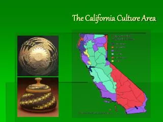
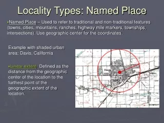
Locality Types: Named Place • Named Place – Used to refer to traditional and non-traditional features (towns, cities, mountains, ranches, highway mile markers, townships, intersections). Use geographic center for the coordinates. Example with shaded urban area: Davis, California • Linear extent- Defined as the distance from the geographic center of the location to the furthest point of the geographic extent of the location.
Named Place – Small town Example: Jean, Nevada
Locality Types - Named Place Use the error calculator to determine uncertainty
Locality Types: • Named Place – Lake, Mountain, Cultural Land, or Other Geographic Entity “Mount Vesuvius, Italy” • Extent is usually half the length from the coordinates of the center of the named place to the furthest point within the named place.
Locality Types: • Named Place – Street Address “#10 Downing St., London, England” Extent is the smallest area possible that cannot be mistaken for another address, sometimes ½ a city block.
Named Place – Junction Junction of Hwy 80 and Hwy 9, Hidalgo, New Mexico Measure the extent of the junction as if it were a named place. Use the following standards for extent: 10 m for two lane city street or highway, 20 m for four lane highway 30 m for large highways with medians
Named Place – Remote A locality that does not have a clear boundary on the map. Olancha, California Extent is half the distance to the center of the next nearest named place (or feature), which is Grant, CA.
Offsets: • Distance from a named place using the center of the named place as a starting point. Used with a heading to give direction and distance from named place. • These can be with a direction, direction and distance, direction along a path, etc. “5 miles north of Beatty, on US 95”
Locality Types: Offsets by road Error is smaller for by road than by air (5.261 miles), as there is no error in direction for offsets by road. Remember uncertainty in extent, direction, distance, units, coordinate precisions and other factors all contribute to error.
Locality Types: Offsets by road Locality Types: Offsets using 2 cardinal directions by air Error is smaller for both of these, compared to the error for one direction by air (5.261 miles).
Georeferencing Error Calculator: Error only 0.3 km east by road of “Kilometer Zero”, Puerta del Sol, Madrid, España
Georeferencing Calculator Examples • Locality: 0.5 km N of Little mermaid, Copenhagen, DK • Start with original coordinates for the mermaid: 55° 41' 34.18" N 12°35' 56.73" E • Then use the Georeferencing Error Calculator to determine the final coordinates AND the uncertainty.
Georeferencing Error Calculator: 0.5 km N of Little mermaid, Copenhagen, DK 55° 41' 34.18" N 12° 35' 56.73" E
Georeferencing Error Calculator: Can be used to convert distances, including distances on maps (if the map scale is known). This is very helpful when georeferencing with paper maps.
Georeferencing Templates Capture georeferences in database or spreadsheet (we will use an Excel template for examples)