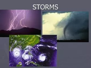
Extreme Storms
Extreme Storms. Reading: Applied Hydrology Sections 14-5, 14-6. http://www.tsarp.com/. Most costly urban flood disaster in the history of the United States. Major Highways during Tropical Storm Allison. I-10 West. I-45 South. http://www.chron.com/content/chronicle/special/01/flood/.

Extreme Storms
E N D
Presentation Transcript
Extreme Storms Reading: Applied Hydrology Sections 14-5, 14-6
http://www.tsarp.com/ Most costly urban flood disaster in the history of the United States
Major Highways during Tropical Storm Allison I-10 West I-45 South http://www.chron.com/content/chronicle/special/01/flood/
Kayaking on US 59, Houston(Tropical Storm Allison) http://www.chron.com/content/chronicle/special/01/flood/
Residential Flooding in Tropical Storm Allison http://www.chron.com/content/chronicle/special/01/flood/
The Human Cost Saving the wedding photos Cleaning out the car http://www.chron.com/content/chronicle/special/01/flood/
5-day rain total (Tropical Storm Allison) City of Houston Harris County
Watersheds Stream gaging station Watershed = area that drains to a particular river or stream network
Tropical Storm Allison http://www.hcfcd.org/downloads/reports/TS-Allison_PubReportENGLISH.pdf
PMP is ~31” in 12 hours 100 year storm Rain Gage Locations
100 year storm depths http://fbcmap.co.fort-bend.tx.us/floodplainmap/Drainage%20Criteria%20Manual%202011/Entire%20Document%201.pdf
Atlas of Depth-Duration-Frequency for Texas Return period = 2, 5, 10, 25, 50 100, 250, 500 years Duration = 15, 30 min, 1,2,3,6, 12 hr, 1,2,3,5,7 days 8 return periods x 12 durations = 96 maps http://pubs.usgs.gov/sir/2004/5041/pdf/sir2004-5041.pdf
Rainfall Frequency Analysis in Texas In 1998, William Asquith at the USGS Texas Office analyzed virtually all rainfall data available in the State of Texas using L-moment methodology and published the results in a USGS Water Resources Investigations Report (WRIR 98-4044). In November 2001, Dr. Asquith summarized his rainfall study of 1998 and generated the IDF and the DDF (depth-duration-frequency) values that are suitable for use in the City of Austin and Travis County.
City of AustinDepth-Duration-Frequency (inches) http://austintech.amlegal.com/nxt/gateway.dll/Texas/drainage/cityofaustintexasdrainagecriteriamanual?f=templates$fn=default.htm$3.0$vid=amlegal:austin_drainage$anc=
City of AustinIntensity-Duration-Frequency (In/hr) http://austintech.amlegal.com/nxt/gateway.dll/Texas/drainage/cityofaustintexasdrainagecriteriamanual?f=templates$fn=default.htm$3.0$vid=amlegal:austin_drainage$anc=
City of Austin Probable Maximum Precipitation The PMP values were derived using Hydrometeorological Report No. 52 (HMR-52) and Hydrometeorological Report No. 51 (HMR-51) per the guidance provided in the Hydrologic and Hydraulic Guidelines for Dams in Texas (January 2007) available from the Dam Safety Program at the Texas Commission on Environmental Quality (TCEQ).
Probable Maximum Precipitation Depths 6-hour, 200 mile2 6-hour, 10 mile2
Probable Maximum Precipitation Depths 12-hour, 10 mile2 24-hour, 10 mile2
Extreme Precipitation Estimates in Travis and Harris Counties Probable Maximum Precipitation (PMP) is for a 10 Km2 storm area
PMP Standard Storm Shape – Ellipse with axes 2.5:1 2.5 1.0 Smallest area = 10 mi2 Imagine this like a layer cake with most rain in A, less in B, less in C, and so on …..
Recommended Storm Orientationfor Austin is an azimuth of 200°
Waller Creek Watershed Orientation = 2.73 Θ = 70° 90 - Θ = 20° Azimuth = 180° + 20° = 200° 8.2 km 200° θ Azimuth from North of the watershed is ~ 200° 3.0 km Waller Creek falls right along the path of recommended storm orientation!
Depth-Area-Duration Curves for Leon Creek Leon Creek Area (mi2) For 10 square miles in Austin, the PMP depths are 1-hr 17.4”, 2-hr 21.6”, 3-hr 24.9”, 6-hr 31.1” 12-hr 37.6”, 24-hr 44.7”, 48-hr 50.0”, 72-hr 53.4” Slightly larger than for Leon Creek in Belton, Texas 6 12 24 48 72 Duration (hrs) PMP Depth (Inches) Mean annual precipitation in Austin is 34.2”
City of Austin Probable Maximum Flood To determine the PMF, each of the possible storm durations (1, 2, 3, 6, 12, 24, 48, and 72 hour storms) needs to be analyzed in order to determine the critical duration. The critical duration is the storm duration that produces the highest water surface elevation behind the dam. The PMF for each storm duration is derived using the PMP depths from Table 2-9 and using a rainfall-runoff model (HEC-1, HEC-HMS, TR-20). The runoff parameters used in the PMF model are the same as those used for runoff analyses of the more frequent storm events, with the exception of curve numbers and temporal distribution of rainfall. The rainfall-runoff model should use the temporal distribution as provided in the Hydrologic and Hydraulic Guidelines for Dams in Texas. The temporal distribution for each storm duration has been reproduced in Figure 2-4, Appendix E. Runoff curve numbers for the PMF need to reflect the assumption that the soils will be saturated. Therefore the runoff curve number should be based on Antecedent Moisture Condition III (AMC).