Download
1 / 21
210 likes | 227 Vues
This project aims to develop a hurricane wind field analysis in real-time for specialists, with data assimilation into numerical simulations. The research includes analysis software that is reliable, mass-conserving, and operationally flexible to facilitate quick decisions. Challenges include addressing errors such as Doppler radial velocity ambiguity and noise. Recent accomplishments include software development for sea-surface reflection removal and de-aliasing schemes. Future tasks involve enhancing data consistency and collaborating with NCEP/EMC to improve wind analysis.

E N D
Real-Time Dissemination of Hurricane Wind Fields Determined from Airborne Doppler Radar John Gamache NOAA/AOML/Hurricane Research Division Collaborators: Joseph Griffin, Peter Dodge, Nancy Griffin Supported by NOAA Joint Hurricane Test Bed
Project Goals • Develop a hurricane wind-field analysis in “real time” and make it available to hurricane specialists at the Tropical Prediction Center • Send reliable observations to the Environmental Modeling Center at NCEP for assimilation testing in numerical simulations
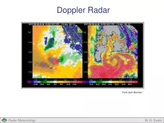
Airborne Radar on NOAA P-3 • Airborne Radar • Scanning axis along aircraft fuselage • 3-cm wavelength • Measures reflectivity (precipitation content) • Measures radial velocity from aircraft FOR MORE INFO... http://www.aoml.noaa.gov/hrd/project2003/doppler.html
Jorgensen et al., 1983, J. Climate Appl. Meteor, 22, 744-757
Present Analysis Software • Reliable--Works on multiple platforms • Mass-conserving • Consistent to within 1-2 m/s with Doppler observations • Operates in research mode • Researcher has plenty of time to make decisions regarding errors/assumptions • Final analysis may take years
Tangential wind (m/s) Radar Reflectivity (dBZ) And wind field Hurricane Humberto 23 Sep 2001 2330 UTC Altitude: 1km
Vertical cross-section of tangential and vertical winds and winds within the plane Hurricane Humberto 23 Sep 2001 2330 UTC Azimuth 350 15 10 5 0 10 35 range from center (km)
Main sources of error from NOAA P-3 Airborne Doppler Radar • Doppler radial velocity ambiguity • Reflection from sea surface • Incorrectly measured antenna pointing direction • Noise
Doppler Radial Velocity Ambiguity • Velocities determined from radar pulse phase measurements • -180o to 180o phase range • Corresponds to a radial velocity range • P3--range from -12.9 to 12.9 up to -25.8 to 25.8 meters per second--Nyquist velocity • Angles < -180o or > 180o are ambiguous • Corresponding velocity aliased or “folded” • True velocity is measured aliased velocity plus 2 times a multiple of Nyquist velocity
Noise • Receiver Noise--power threshold • Meteorological Noise • Turbulence in boundary layer • Turbulence in outflow from convection
Reflection from sea surface • Main antenna lobe • Beam width vs precipitation content • Side lobe • Annular--radius is height of aircraft • Fairly weak • “Second trip”--confusion with previous pulse • High spectral width • Usually removed easily by noise edit
Antenna pointing direction errors • Pointing direction relative to aircraft • Aircraft attitude • HRD has software to estimate these errors
Accomplishments • Sea-surface reflection removal software developed/preliminary test • Speckle removal developed • Minor bugs in present de-aliasing removed • Two-dimensional de-aliasing scheme development begun • Preliminary discussions with EMC on structure of “superobs”
Doppler Radial Velocity Hurricane Humberto 231754 UTC 23 Sep 2001
Doppler Radial Velocity Hurricane Humberto 232842 UTC 23 Sep 2001
Doppler Radial Velocity Hurricane Humberto 232855 UTC 23 Sep 2001
Doppler Radial Velocity Hurricane Humberto 232901 UTC 23 Sep 2001
Comparison of Analyses Created from Research-Quality and Automatically Edited Data At 1 km level in Hurricane Humberto 2330 UTC on 23 September 2001 Research Quality Automatic
Next Tasks • Improve two-dimensional de-aliasing • Produce consistent velocities within contiguous regions of data • Ensure overall velocity in each contiguous region is consistent with expected hurricane flow
Next Tasks • Begin interaction with NCEP/EMC • Determine structure of “superobs” • Begin determination of data error covariance of Airborne Doppler radial velocity measurements • Install new software on airborne workstations for 2004 Hurricane Season
Future Tasks • Produce test wind analysis aboard aircraft during 2004 Hurricane Season • Test sending a prototype superob by end of 2004 Hurricane Season • Develop analysis display for Hurricane Specialists during “off season” • Begin determination with EMC of Doppler data error covariance • Send wind analysis to specialists during 2005 Hurricane Season • Continue testing superob transmission during 2005 Hurricane Season