Introduction to World Geography
260 likes | 647 Vues
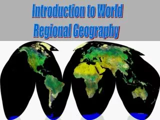
Introduction to World Geography. What is Geography????. Geography is the study of place and space: Geographers look at where things are and why they are there.

Introduction to World Geography
E N D
Presentation Transcript
What is Geography???? • Geography is the study of place and space: Geographers look at where things are and why they are there. • Study of human activity, the natural environment, and the relationship between the two (human-environment interactions).
Physical v. Cultural Geography Physical Geography is the study of the Natural Landscape of the Earth while Cultural Geography is the study of the Human Landscape of the Earth.
What types of jobs do geographers have (in the U.S.)? Location Analysts, for: franchises (like “Burger King”) stores (like big department stores) public facilities (like new schools) Environmental Scientists and Consultants GIS (computer mapping) Urban and Regional Planners Real Estate and Residential Development Analysts Transportation and Tourism Planners and Analysts University and public school teachers
CLASSIFICATION SYSTEMS Taxonomy: kingdom, phylum, Class, order, family, genus, species Biologists Geologists Geological time Historians Eras, ages, periods Geographers Geographic Regions
GEOGRAPHIC REGIONS: What defines a region? Regions are based on Spatial Criteria • physical (natural) characteristics • landforms, climate, vegetation • human (cultural) characteristics • language, religion, ethnicity, population
MORE ON GEOGRAPHIC REGIONS: • Regions do not have definite borders, but rather are separated from other regions by transition zones.
TRANSITION ZONES • An area of change where borders of two adjacent regions join • Marked by a gradual shift (rather than a sharp break) in the characteristics that distinguish neighboring realms
Dominated by one political power: North America: U.S. Middle America: Mexico South America: Brazil Russian Realm: Russia East Asia: China South Asia: India Southeast Asia: Indonesia Australian Realm: Australia No dominant State Europe Sub-Saharan Africa North Africa / Southwest Asia Oceania (Pacific Realm) Sub-classification of Regions
SUB-REGIONS • Further classification of Regions based upon physical features and human characteristics. Examples: The United States is in the North American Region. However, the U.S. has several sub-regions: Northeast, Midwest, South, etc. • Region & Sub-region boundaries are based on criteria we establish. • Criteria can be: • Human (cultural) properties • Physical (natural) characteristics • or Both
Properties of Regions • Area • Boundaries • Location
FORMAL REGION • Marked by a certain degree of homogeneity in one or more phenomena. Limited number of characteristics. • Example: Latin America, Europe
FUNCTIONAL REGION • A region marked less by its functional structure. Organized around a set of interactions and connections between places. Example:Metropolitan Area
Perceptual Region Region in which people perceive the characteristics of the region in the same way. Example: American Midwest, or the West as in reference to the USA and her allies.
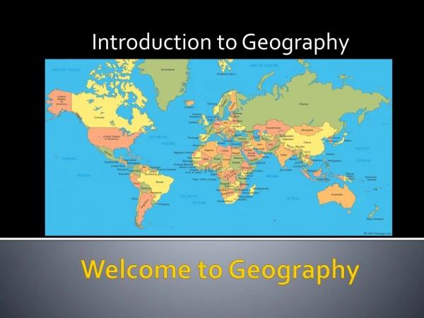
Maps and More Maps • Types of maps and projections • Physical maps • Cultural maps • Political maps • Population maps • And more.. • Why do geographers use each type map?
The Grid System • Latitude: Lines of latitude run horizontal around the globe or a map. They are designated as either North or South of the Equator. • Longitude: Lines of longitude run vertically around the globe or map. They are designated as either West or East of the Prime Meridian.