Download
1 / 19
190 likes | 304 Vues
Draft Methodology Report: For the Clear and Foster Creek Fish Passage Assessment and Prioritization Project. Presenters Jenny Walsh, Upstream Connection George Robison, Watersheds Northwest. Presentation Outline. Determining fish bearing streams and potential crossings

E N D
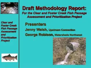
Draft Methodology Report:For the Clear and Foster Creek Fish Passage Assessment and Prioritization Project Presenters Jenny Walsh, Upstream Connection George Robison, Watersheds Northwest
Presentation Outline • Determining fish bearing streams and potential crossings • Landowner permission process for field measurements • Field measurement methods • Hydraulic and cost analysis • Prioritization • Timeline and outreach
Finding Crossings for the Assessment • Upward extent of fish use not well known • Created new maps that have best available information on fish use • Each crossing is uniquely numbered to key all information to the GIS database • Non crossing issues such as small dams and ponds also considered
Landowner Permission Process • Goals • Gaining trust • Education • Involvement
Landowner Permission Process • Objectives • Establish contact and introduce the project • Gain permission to examine potential fish passage barriers on the ownership • Educate and exchange information • Communicate results
Landowner Permission Process • Objectives • Establish contact and introduce the project • Gain permission to examine potential fish passage barriers on the ownership • Educate and exchange information • Communicate results
Tools for Outreach • Mailings • Flyers • Press releases • CRBC Newsletter • CRBC Website • Public meetings – CRBC meetings, small community outreach meetings, open house, final report presentation.
Field Protocol Issues • Field measurements must be tied to specific objectives and needs for cost analysis and prioritization. They include: • Fish use status at crossing (from updated ODF maps with interim classification for unknown streams along with field verification of presence used for crossing status and habitat use above blockage) • Stream slope/profile (critical in determining which design options are viable for cost information) • Presence of bedrock or shallow fill to bedrock (critical in determining design options) • Degree of drop at outlet or inlet of culvert (essential in determining fish passage status)
Field Protocol Issues • Field measurements continued: • Length and slope of culvert (essential in determining fish passage status) • Size of existing culvert (useful in pointing to inlet drop at higher flows or in determining risk of catastrophic failure in relation to streamflow) • Height of fill and width of road (critical to know in determining needed replacement culvert length for cost information) • Stream width (necessary to size replacement culvert options and in determining replacement bridge span for cost estimates)
Design Elements for Simple Design • Stake (BM) • Invert Elevation • 200 foot profile* (*needed profile varies in length) • Fill cover • Valley fill/Substrate Condition
Hydraulic Analysis • Fish Passage Status based on slopes and drops • Capacity of Culvert • Needed size and design type of new crossing
Cost Analysis • Field measures will be reduced and used to determine a preferred approach (Approach decision tree with criteria in Draft Methodology report) • Each approach will be given a cost based on factors like length, span, fill height and other factors (criteria is given in Draft Methodology Report)
Stream width greater than 20 feet? No Yes Stream width between 15-20 feet? No Yes Yes Stream gradient between 0-8% Steep dynamic stream (>4% gradient) with high scour potential? Yes Bedrock within three feet of stream surface or within expected elevation of culvert invert? Yes No No Yes No Bedrock close to (within two feet) of surface and uniform bedding expected? No Yes Open metal Arch with footings Streambed Simulation CBS Long-span bridge Slab bridge Or open box
2 Prioritization 4 • Combines cost info, length of habitat, severity of fish passage problem and other factors like failure risk into analysis. • With updated GIS coverage can also look at connectivity to culvert and take basin position into account 3 1
Assessment Uses • Fish passage is being assessed comprehensively in the Clear and Foster Creek basin. This assessment should: • Provide information for cooperative grant funding by identifying the most critical crossings needing action • Become a model and a pilot for an assessment for the entire Clackamas basin • Become an additional outreach platform to help gain understanding, acceptance and support from basin landowners concerned about improving watershed conditions
Timeline to Completion • Major Milestones • Draft Methodology Report (Submitted) • Field measurements (June-Early July) • Hydraulic Analysis and Prioritization July-August • Draft of final report submitted (September) • Final Report (October)